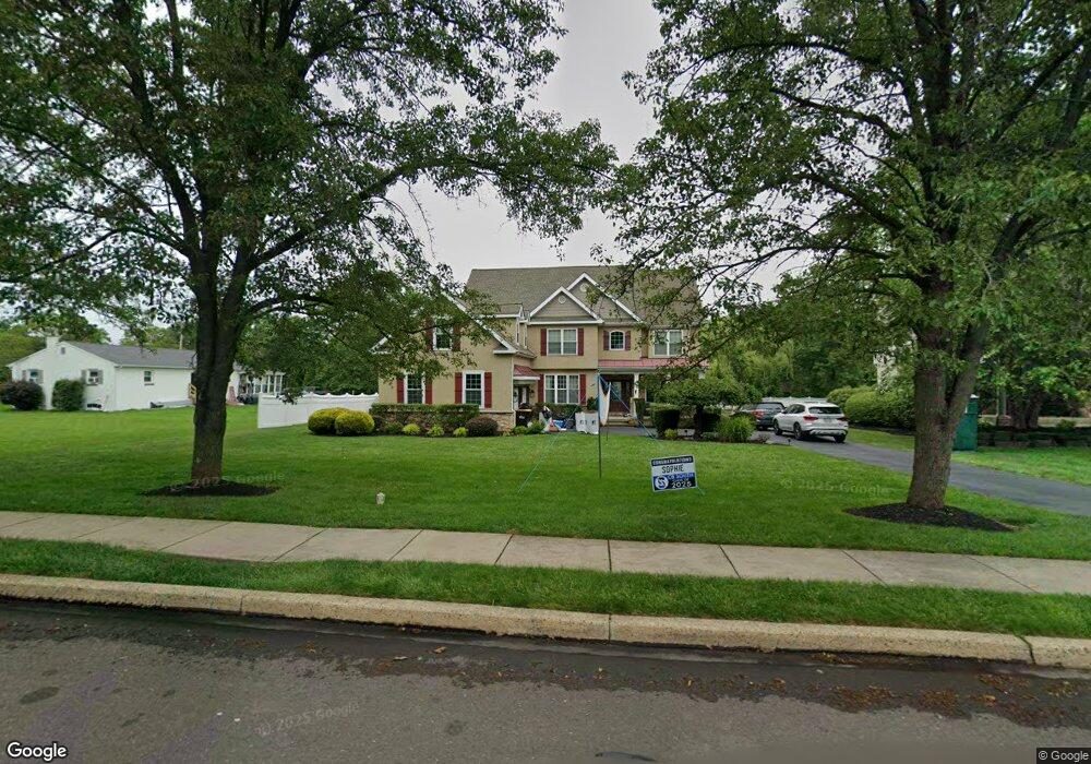
2026 Cedar Dr Warrington, PA 18976
Estimated Value: $876,813 - $1,025,000
4
Beds
4
Baths
3,495
Sq Ft
$273/Sq Ft
Est. Value
About This Home
This home is located at 2026 Cedar Dr, Warrington, PA 18976 and is currently estimated at $953,203, approximately $272 per square foot. 2026 Cedar Dr is a home located in Bucks County with nearby schools including Barclay Elementary School, Tamanend Middle School, and Central Bucks High School - South.
Ownership History
Date
Name
Owned For
Owner Type
Purchase Details
Closed on
Aug 7, 2009
Sold by
Schreiber Brian and Schreiber Mary Kate
Bought by
Moran James A and Moran Eileen M
Current Estimated Value
Home Financials for this Owner
Home Financials are based on the most recent Mortgage that was taken out on this home.
Original Mortgage
$110,000
Outstanding Balance
$71,647
Interest Rate
5.19%
Mortgage Type
Credit Line Revolving
Estimated Equity
$881,556
Purchase Details
Closed on
Nov 30, 2007
Sold by
Bass Walter C and Bass Heather
Bought by
Schreiber Brian and Schreiber Mary Kate
Home Financials for this Owner
Home Financials are based on the most recent Mortgage that was taken out on this home.
Original Mortgage
$94,345
Interest Rate
6.27%
Mortgage Type
Credit Line Revolving
Create a Home Valuation Report for This Property
The Home Valuation Report is an in-depth analysis detailing your home's value as well as a comparison with similar homes in the area
Home Values in the Area
Average Home Value in this Area
Purchase History
| Date | Buyer | Sale Price | Title Company |
|---|---|---|---|
| Moran James A | $600,000 | None Available | |
| Schreiber Brian | $629,400 | None Available |
Source: Public Records
Mortgage History
| Date | Status | Borrower | Loan Amount |
|---|---|---|---|
| Open | Moran James A | $110,000 | |
| Open | Moran James A | $370,000 | |
| Previous Owner | Schreiber Brian | $94,345 | |
| Previous Owner | Schreiber Brian | $503,520 |
Source: Public Records
Tax History
| Year | Tax Paid | Tax Assessment Tax Assessment Total Assessment is a certain percentage of the fair market value that is determined by local assessors to be the total taxable value of land and additions on the property. | Land | Improvement |
|---|---|---|---|---|
| 2025 | $10,456 | $60,070 | $6,320 | $53,750 |
| 2024 | $10,456 | $60,070 | $6,320 | $53,750 |
| 2023 | $10,124 | $60,070 | $6,320 | $53,750 |
| 2022 | $10,011 | $60,070 | $6,320 | $53,750 |
| 2021 | $9,900 | $60,070 | $6,320 | $53,750 |
| 2020 | $9,900 | $60,070 | $6,320 | $53,750 |
| 2019 | $9,839 | $60,070 | $6,320 | $53,750 |
| 2018 | $9,839 | $60,070 | $6,320 | $53,750 |
| 2017 | $9,764 | $60,070 | $6,320 | $53,750 |
| 2016 | -- | $60,070 | $6,320 | $53,750 |
| 2015 | -- | $60,070 | $6,320 | $53,750 |
| 2014 | -- | $60,070 | $6,320 | $53,750 |
Source: Public Records
Map
Nearby Homes
- 1267 Holly Rd
- 1281 Lisa Dr
- 1258 Lisa Dr
- 1402 Valley View
- 2249 Pileggi Rd
- 1868 Sunrise Way
- 412 Feldspar Ct Unit 69
- 1026 Surrey Ln
- 1477 Stony Rd Unit RUTLEDGE
- 1477 Stony Rd
- 1501 Stony Rd
- 1917 Palomino Dr
- 1525 Stony Rd Unit RAINTREE
- 0 W Bristol Rd
- 0 Stony Rd Unit ROLLINS
- 0 Stony Rd Unit KINGSWOOD
- 0 Stony Rd Unit CLOVERFIELD
- 0 Stony Rd Unit MAYWEATHER
- 2010 Canterbury Ln
- 1997 Brook Ln
- 2024 Cedar Dr
- 1521 Guinea Ln
- 1539 Guinea Ln
- 2022 Cedar Dr
- 1501 Guinea Ln
- 2040 Apple Ct
- 2027 Cedar Dr
- 2025 Cedar Dr
- 2020 Cedar Dr
- 2044 Apple Ct
- 1400 Marielle Dr
- 2034 Apple Ct
- 00 Cedar Dr
- Lot 2 Cedar Dr
- 731 Grand Blvd Unit 31
- 1044 Peach Tree Ln Unit 44
- 732 Grand Blvd Unit 32
- 1043 Peach Tree Ln Unit 43
- 2081 Mulberry Ln
- 1402 Marielle Dr
Your Personal Tour Guide
Ask me questions while you tour the home.