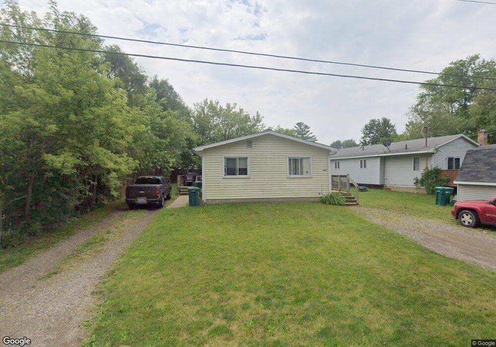
2026 James Ave Owosso, MI 48867
Estimated Value: $122,000 - $139,753
4
Beds
2
Baths
1,400
Sq Ft
$94/Sq Ft
Est. Value
About This Home
This home is located at 2026 James Ave, Owosso, MI 48867 and is currently estimated at $131,688, approximately $94 per square foot. 2026 James Ave is a home located in Shiawassee County with nearby schools including Corunna High School, St. Paul Catholic School, and St. Joseph School.
Ownership History
Date
Name
Owned For
Owner Type
Purchase Details
Closed on
Jun 24, 2009
Sold by
Miller Stephen J and Miller April L
Bought by
Miller April L
Current Estimated Value
Purchase Details
Closed on
Aug 4, 2005
Sold by
Garza Ricardo
Bought by
Garza Ricardo and Riley Andrew
Purchase Details
Closed on
Oct 25, 2004
Sold by
Carlson Lonnie J
Bought by
Garza Ricardo
Home Financials for this Owner
Home Financials are based on the most recent Mortgage that was taken out on this home.
Original Mortgage
$78,567
Interest Rate
5.85%
Mortgage Type
FHA
Purchase Details
Closed on
Oct 21, 2004
Sold by
Carlson Dena D and Brooks Dena D
Bought by
Carlson Lonnie J
Home Financials for this Owner
Home Financials are based on the most recent Mortgage that was taken out on this home.
Original Mortgage
$78,567
Interest Rate
5.85%
Mortgage Type
FHA
Create a Home Valuation Report for This Property
The Home Valuation Report is an in-depth analysis detailing your home's value as well as a comparison with similar homes in the area
Home Values in the Area
Average Home Value in this Area
Purchase History
| Date | Buyer | Sale Price | Title Company |
|---|---|---|---|
| Miller April L | -- | -- | |
| Garza Ricardo | -- | -- | |
| Garza Ricardo | $79,800 | -- | |
| Carlson Lonnie J | -- | -- |
Source: Public Records
Mortgage History
| Date | Status | Borrower | Loan Amount |
|---|---|---|---|
| Previous Owner | Garza Ricardo | $78,567 |
Source: Public Records
Tax History Compared to Growth
Tax History
| Year | Tax Paid | Tax Assessment Tax Assessment Total Assessment is a certain percentage of the fair market value that is determined by local assessors to be the total taxable value of land and additions on the property. | Land | Improvement |
|---|---|---|---|---|
| 2025 | $1,372 | $53,100 | $0 | $0 |
| 2024 | $1,372 | $48,000 | $0 | $0 |
| 2023 | $332 | $43,500 | $0 | $0 |
| 2022 | $942 | $36,800 | $0 | $0 |
| 2021 | $1,223 | $33,900 | $0 | $0 |
| 2020 | $898 | $30,700 | $0 | $0 |
| 2019 | $1,041 | $25,800 | $0 | $0 |
| 2018 | $1,169 | $27,000 | $0 | $0 |
| 2017 | $1,130 | $25,100 | $0 | $0 |
| 2016 | -- | $25,100 | $0 | $0 |
| 2015 | -- | $25,400 | $0 | $0 |
| 2014 | -- | $23,900 | $0 | $0 |
Source: Public Records
Map
Nearby Homes
- 1856 Owosso Ave
- 1833 Owosso Ave
- 628 Aiken St
- 1605 Corunna Ave
- 611 Beck Ave
- Parcel A Aiken Rd
- V/L Short St
- V/L E Main St
- 644 Hillside Dr
- 808 Corunna Ave
- 715 Glenwood Ave
- 915 Corunna Ave
- 702 Glenwood Ave
- 755 Woodlawn Ave
- 432 Oakwood Ave
- 304 W Corunna Ave
- 637 Woodvalley Dr
- 619 Huron St
- 1701 Copas Rd
- 609 Broadway Ave
- 2030 James Ave
- 2030 James Ave
- 715 Division Rd
- 2003 Kilbourn Ave
- 2034 James Ave
- 1945 Kilbourn Ave
- 2015 James Ave
- 2038 James Ave
- 2009 Kilbourn Ave
- 1946 James Ave
- 2025 James Ave
- 2029 James Ave
- 2040 James Ave
- 1943 Kilbourn Ave
- 2013 Kilbourn Ave
- 689 Division Rd
- 2002 Kilbourn Ave
- 1944 Kilbourn Ave
- 814 Division Rd
- 2045 James Ave