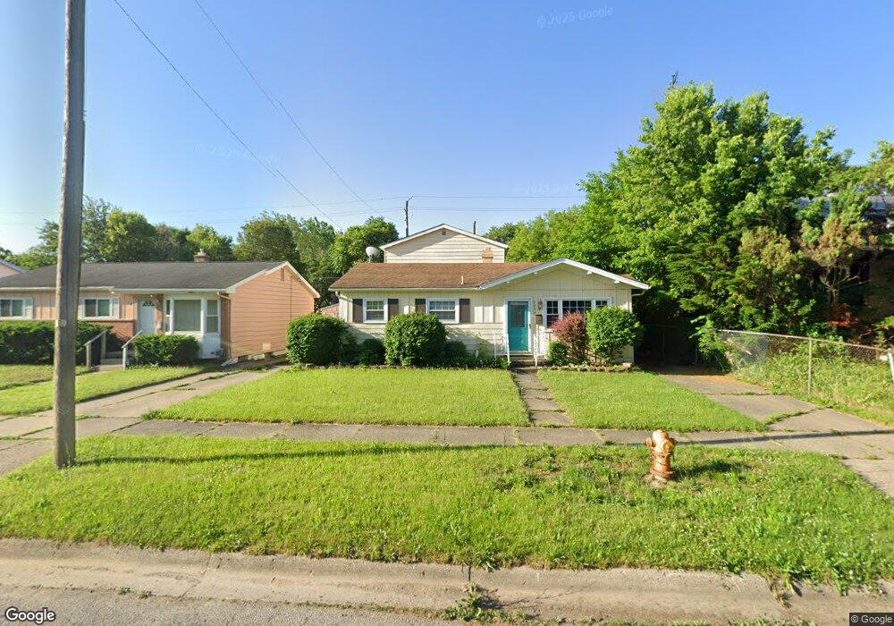
2026 Robert T Longway Blvd Flint, MI 48503
College Cultural Neighborhood NeighborhoodEstimated Value: $110,000 - $114,000
4
Beds
2
Baths
1,672
Sq Ft
$67/Sq Ft
Est. Value
About This Home
This home is located at 2026 Robert T Longway Blvd, Flint, MI 48503 and is currently estimated at $111,700, approximately $66 per square foot. 2026 Robert T Longway Blvd is a home located in Genesee County with nearby schools including Pierce Elementary School, Flint Cultural Center Academy, and WAY Academy of Flint.
Ownership History
Date
Name
Owned For
Owner Type
Purchase Details
Closed on
Jan 10, 2005
Sold by
Morgan Timothy M and Kreger Kenneth C
Bought by
Cruckshank Orin
Current Estimated Value
Home Financials for this Owner
Home Financials are based on the most recent Mortgage that was taken out on this home.
Original Mortgage
$36,000
Outstanding Balance
$21,615
Interest Rate
8.74%
Mortgage Type
Purchase Money Mortgage
Estimated Equity
$90,085
Purchase Details
Closed on
Mar 19, 1999
Sold by
Donlan Frances Barbara and Donlan Michael W
Bought by
Morgan Timothy M and Kreger Kenneth C
Create a Home Valuation Report for This Property
The Home Valuation Report is an in-depth analysis detailing your home's value as well as a comparison with similar homes in the area
Home Values in the Area
Average Home Value in this Area
Purchase History
| Date | Buyer | Sale Price | Title Company |
|---|---|---|---|
| Cruckshank Orin | $56,000 | Lawyers Title | |
| Morgan Timothy M | $47,000 | -- |
Source: Public Records
Mortgage History
| Date | Status | Borrower | Loan Amount |
|---|---|---|---|
| Open | Cruckshank Orin | $36,000 |
Source: Public Records
Tax History Compared to Growth
Tax History
| Year | Tax Paid | Tax Assessment Tax Assessment Total Assessment is a certain percentage of the fair market value that is determined by local assessors to be the total taxable value of land and additions on the property. | Land | Improvement |
|---|---|---|---|---|
| 2025 | $1,110 | $44,600 | $0 | $0 |
| 2024 | $1,029 | $39,200 | $0 | $0 |
| 2023 | $1,006 | $32,500 | $0 | $0 |
| 2022 | $0 | $26,500 | $0 | $0 |
| 2021 | $1,019 | $24,300 | $0 | $0 |
| 2020 | $752 | $21,900 | $0 | $0 |
| 2019 | $735 | $18,700 | $0 | $0 |
| 2018 | $728 | $18,000 | $0 | $0 |
| 2017 | $709 | $0 | $0 | $0 |
| 2016 | $704 | $0 | $0 | $0 |
| 2015 | -- | $0 | $0 | $0 |
| 2014 | -- | $0 | $0 | $0 |
| 2012 | -- | $13,000 | $0 | $0 |
Source: Public Records
Map
Nearby Homes
- 301 Chandler St
- 406 S Lynch St
- 2301 Missouri Ave
- 1318 Cronk Ave
- 2605 Nebraska Ave
- 524 S Lynch St
- 1501 Arlington Ave
- 2131 Windemere Ave
- 605 S Lynch St
- 1510 N Vernon Ave
- 1644 Pennsylvania Ave
- 2202 Windemere Ave
- 2610 Pennsylvania Ave
- 2208 Windemere Ave
- 1622 Arlington Ave
- 622 Chalmers St
- 1623 Montclair Ave
- 2013 E Court St
- 618 S Meade St
- 2122 Pierce St
- 2030 Robert T Longway Blvd
- 2022 Robert T Longway Blvd
- 2020 Robert T Longway Blvd
- 2034 Robert T Longway Blvd
- 2021 Tuscola St
- 2029 Tuscola St
- 2017 Tuscola St
- 2033 Tuscola St
- 2038 Robert T Longway Blvd
- 2013 Tuscola St
- 2037 Tuscola St
- 2009 Tuscola St
- 2101 Tuscola St
- 2106 Robert T Longway Blvd
- 2102 Robert T Longway Blvd
- 202 Hastings St
- 2005 Tuscola St
- 2105 Tuscola St
- 226 Hastings St
- 2016 Tuscola St