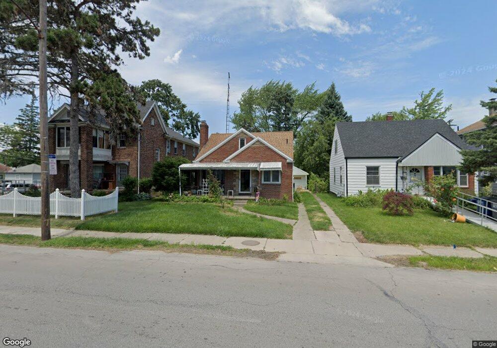
2026 South Ave Toledo, OH 43609
Southside NeighborhoodEstimated Value: $80,000 - $99,000
3
Beds
1
Bath
1,320
Sq Ft
$69/Sq Ft
Est. Value
About This Home
This home is located at 2026 South Ave, Toledo, OH 43609 and is currently estimated at $91,337, approximately $69 per square foot. 2026 South Ave is a home located in Lucas County with nearby schools including Burroughs Elementary School, Bowsher High School, and Explorers Academy of Science and Technology.
Ownership History
Date
Name
Owned For
Owner Type
Purchase Details
Closed on
May 11, 2023
Sold by
Mcgraw Frank C
Bought by
Mcgraw Jane A
Current Estimated Value
Purchase Details
Closed on
Mar 22, 2019
Sold by
Mcgraw Jane A
Bought by
Mcgraw Frank C
Purchase Details
Closed on
Sep 6, 2012
Sold by
Mcgraw Jane A and Caro Manuel
Bought by
Mcgraw Jane A and Mcgraw Frank C
Purchase Details
Closed on
Nov 12, 2004
Sold by
Mcgraw Jane A and Mcgraw Rebecca A
Bought by
Mcgraw Jane A and Mcgraw Rebecca A
Purchase Details
Closed on
Apr 11, 2001
Sold by
Mcgraw Katherine E
Bought by
Mcgraw Jayn A and Mcgraw Rebeckah A
Create a Home Valuation Report for This Property
The Home Valuation Report is an in-depth analysis detailing your home's value as well as a comparison with similar homes in the area
Home Values in the Area
Average Home Value in this Area
Purchase History
| Date | Buyer | Sale Price | Title Company |
|---|---|---|---|
| Mcgraw Jane A | -- | None Listed On Document | |
| Mcgraw Frank C | $300 | None Available | |
| Mcgraw Jane A | -- | None Available | |
| Mcgraw Jane A | -- | None Available | |
| Mcgraw Jane A | -- | -- | |
| Mcgraw Jayn A | $50,000 | -- |
Source: Public Records
Tax History Compared to Growth
Tax History
| Year | Tax Paid | Tax Assessment Tax Assessment Total Assessment is a certain percentage of the fair market value that is determined by local assessors to be the total taxable value of land and additions on the property. | Land | Improvement |
|---|---|---|---|---|
| 2024 | $668 | $21,280 | $5,810 | $15,470 |
| 2023 | $1,392 | $21,455 | $3,920 | $17,535 |
| 2022 | $1,397 | $21,455 | $3,920 | $17,535 |
| 2021 | $1,431 | $21,455 | $3,920 | $17,535 |
| 2020 | $1,500 | $19,950 | $3,640 | $16,310 |
| 2019 | $1,491 | $19,950 | $3,640 | $16,310 |
| 2018 | $1,493 | $19,950 | $3,640 | $16,310 |
| 2017 | $1,535 | $19,495 | $3,570 | $15,925 |
| 2016 | $1,501 | $55,700 | $10,200 | $45,500 |
| 2015 | $1,488 | $55,700 | $10,200 | $45,500 |
| 2014 | $1,226 | $19,500 | $3,570 | $15,930 |
| 2013 | $1,226 | $19,500 | $3,570 | $15,930 |
Source: Public Records
Map
Nearby Homes
- 440 Somerset St
- 2126 Airport Hwy
- 531 Shasta Dr
- 321 Mayberry St
- 304 Mayberry St
- 512 Woodsdale Ave
- 226 Somerset St
- 221 Somerset St
- 224 S Fearing Blvd
- 1777 South Ave
- 649 Wright Ave
- 705 Wright Ave
- 142 S Detroit Ave
- 556 Apple Ave
- 1754 Finch St
- 140 Whiting Ave
- 713 Geneva Ave
- 731 Geneva Ave
- 859 Wright Ave
- 885 National Ave
- 2032 South Ave
- 2022 South Ave
- 2016 South Ave
- 2018 South Ave
- 455 Decatur St
- 2042 South Ave
- 2010 South Ave
- 2023 South Ave
- 2019 South Ave
- 451 Decatur St
- 2025 South Ave
- 2017 South Ave
- 2033 South Ave
- 2044 South Ave
- 448 Somerset St
- 2035 South Ave
- 2039 South Ave
- 2048 South Ave
- 2004 South Ave
- 447 Decatur St Unit 43609