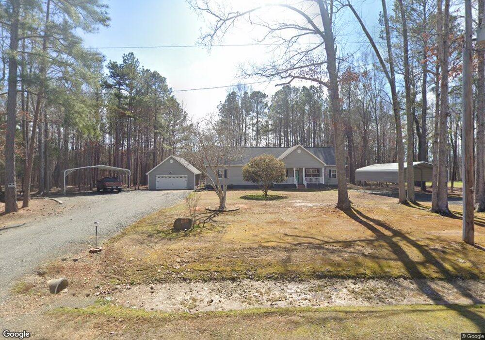
2026 Thad Carey Rd Oxford, NC 27565
Estimated Value: $265,000 - $421,000
--
Bed
2
Baths
2,128
Sq Ft
$165/Sq Ft
Est. Value
About This Home
This home is located at 2026 Thad Carey Rd, Oxford, NC 27565 and is currently estimated at $351,721, approximately $165 per square foot. 2026 Thad Carey Rd is a home located in Granville County with nearby schools including West Oxford Elementary School, Butner-Stem Middle School, and Granville Central High School.
Ownership History
Date
Name
Owned For
Owner Type
Purchase Details
Closed on
Aug 22, 2022
Sold by
Holt Michael C
Bought by
Holt Michael C and Harris Katrina
Current Estimated Value
Home Financials for this Owner
Home Financials are based on the most recent Mortgage that was taken out on this home.
Original Mortgage
$65,000
Outstanding Balance
$62,158
Interest Rate
5.54%
Mortgage Type
Credit Line Revolving
Estimated Equity
$289,563
Purchase Details
Closed on
Feb 12, 2015
Bought by
Holt Michael and Holt Katrina Harris
Purchase Details
Closed on
Apr 8, 2009
Sold by
Autry Cynthia W and Autry Franklin D
Bought by
Holt Michael C
Create a Home Valuation Report for This Property
The Home Valuation Report is an in-depth analysis detailing your home's value as well as a comparison with similar homes in the area
Home Values in the Area
Average Home Value in this Area
Purchase History
| Date | Buyer | Sale Price | Title Company |
|---|---|---|---|
| Holt Michael C | -- | Hicks & Koinis Pllc | |
| Holt Michael | -- | -- | |
| Holt Michael C | -- | -- |
Source: Public Records
Mortgage History
| Date | Status | Borrower | Loan Amount |
|---|---|---|---|
| Open | Holt Michael C | $65,000 |
Source: Public Records
Tax History Compared to Growth
Tax History
| Year | Tax Paid | Tax Assessment Tax Assessment Total Assessment is a certain percentage of the fair market value that is determined by local assessors to be the total taxable value of land and additions on the property. | Land | Improvement |
|---|---|---|---|---|
| 2025 | $2,156 | $297,296 | $42,345 | $254,951 |
| 2024 | $2,156 | $297,296 | $42,345 | $254,951 |
| 2023 | $2,152 | $219,211 | $29,594 | $189,617 |
| 2022 | $2,072 | $219,211 | $29,594 | $189,617 |
| 2021 | $1,935 | $219,211 | $29,594 | $189,617 |
| 2020 | $1,935 | $219,211 | $29,594 | $189,617 |
| 2019 | $1,935 | $219,211 | $29,594 | $189,617 |
| 2018 | $1,935 | $219,211 | $29,594 | $189,617 |
| 2016 | $1,884 | $203,367 | $29,682 | $173,685 |
| 2015 | $1,777 | $203,367 | $29,682 | $173,685 |
| 2014 | $1,777 | $203,367 | $29,682 | $173,685 |
| 2013 | -- | $203,367 | $29,682 | $173,685 |
Source: Public Records
Map
Nearby Homes
- 2071 Thad Carey Rd
- 2080 Thad Carey Rd
- 4148 Forest Ct
- 1658 Garrett Farm Rd
- 1664 Garrett Farm Rd
- 2164 Smith Rd
- 4034 Tyler Dr
- Tract 2b Watkins Rd
- 311 Coachmans Trail
- 309 Coachmans Trail
- 4285 Belltown Rd
- 116 E Tally Ho Rd
- 106 Lyon St
- 4457 Poppy Mallow Ln
- 125 Ross Dr
- 3653 Range Rd
- 4512 Belltown Rd
- 3566 U S 15
- 415 Angus Place
- 317 Wick Rd
- 2022 Thad Carey Rd
- 2025 Thad Carey Rd
- 2019 Thad Carey Rd
- 2041 Thad Carey Rd
- 4125 Brinkley Rd
- 4120 Brinkley Rd
- 4120 Brinkley Rd
- LOT 6 Thad Carey Rd
- 2053 Thad Carey Rd
- Lot 9 Thad Carey Rd
- 2067 Thad Carey Rd
- 4129 Doe Ct
- 4131 Doe Ct
- 413 Doe Ct
- 4133 Doe Ct
- 4135 Doe Ct
- 4126 Doe Ct
- 4137 Doe Ct
- 2072 Thad Carey Rd
- 4137 Deer Run Rd