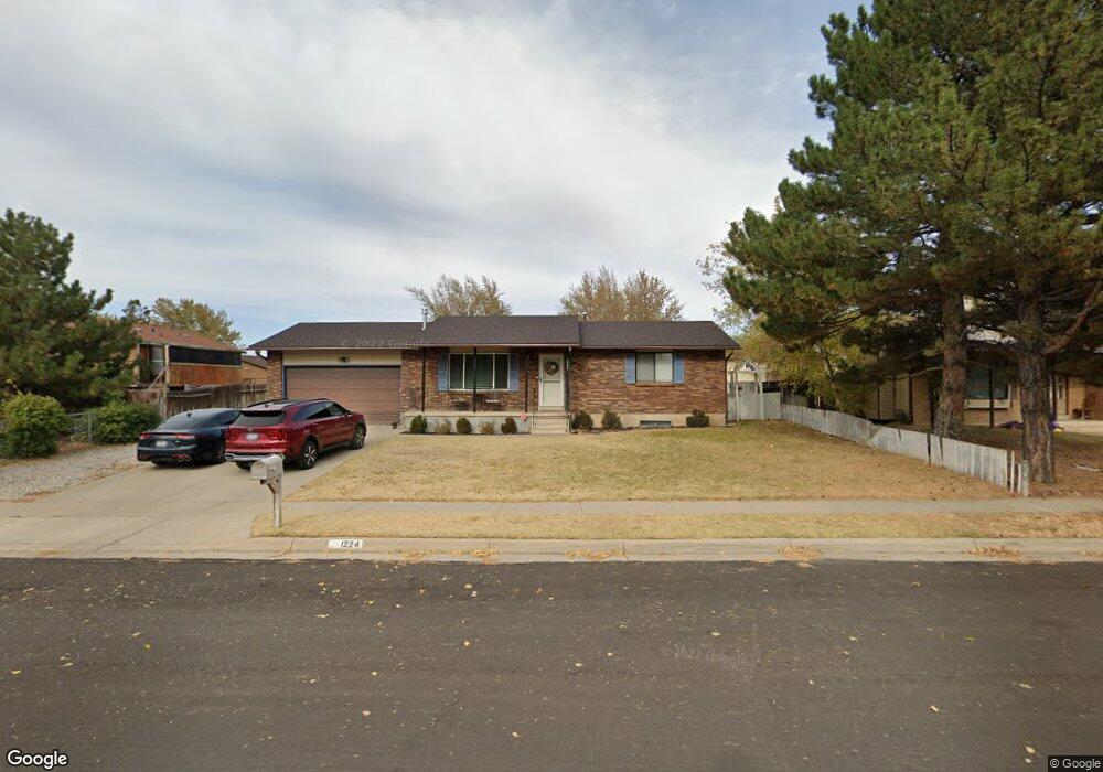
2026 W 550 N Clearfield, UT 84015
Estimated Value: $572,000 - $626,778
6
Beds
4
Baths
3,315
Sq Ft
$179/Sq Ft
Est. Value
About This Home
This home is located at 2026 W 550 N, Clearfield, UT 84015 and is currently estimated at $594,445, approximately $179 per square foot. 2026 W 550 N is a home located in Davis County with nearby schools including Lakeside School, West Point Junior High School, and Syracuse High School.
Ownership History
Date
Name
Owned For
Owner Type
Purchase Details
Closed on
Nov 26, 2024
Sold by
Kerby Aaron and Palmer Nichole
Bought by
Arce Andrez and Arce Maria Delos
Current Estimated Value
Home Financials for this Owner
Home Financials are based on the most recent Mortgage that was taken out on this home.
Original Mortgage
$545,568
Outstanding Balance
$540,338
Interest Rate
6.32%
Mortgage Type
FHA
Estimated Equity
$54,107
Purchase Details
Closed on
Nov 21, 2024
Sold by
Kerby Aaron and Palmer Nichole
Bought by
Arce Andrez and Arce Maria Delos
Home Financials for this Owner
Home Financials are based on the most recent Mortgage that was taken out on this home.
Original Mortgage
$545,568
Outstanding Balance
$540,338
Interest Rate
6.32%
Mortgage Type
FHA
Estimated Equity
$54,107
Purchase Details
Closed on
Jun 16, 2022
Sold by
Sfr Acquisitions 6 Llc
Bought by
Kerby Aaron and Palmer Nichole
Home Financials for this Owner
Home Financials are based on the most recent Mortgage that was taken out on this home.
Original Mortgage
$619,780
Interest Rate
5.3%
Mortgage Type
New Conventional
Purchase Details
Closed on
Mar 23, 2022
Sold by
Sfr Borrower 2022-1 Llc
Bought by
Sfr Acquisitions 6 Llc
Purchase Details
Closed on
Sep 30, 2021
Sold by
Coffeen Eric Allen and Coffeen Heather Marie
Bought by
Hp Utah I Llc
Purchase Details
Closed on
Apr 13, 2021
Sold by
Coffeen Erie Allen and Coffeen Heather Marie
Bought by
Hp Utah 1 Llc
Purchase Details
Closed on
Jun 1, 2012
Sold by
Swanstrom Christian J
Bought by
Swanstrom Christian J and Swanstrom Mary
Purchase Details
Closed on
Sep 26, 2008
Sold by
Shaw James J
Bought by
Swanstrom Christian J and Swanstrom Mary K
Home Financials for this Owner
Home Financials are based on the most recent Mortgage that was taken out on this home.
Original Mortgage
$245,000
Interest Rate
6.39%
Mortgage Type
VA
Purchase Details
Closed on
Mar 25, 2008
Sold by
Shaw James L
Bought by
Shaw James J and Estate Of Isabel Shaw
Create a Home Valuation Report for This Property
The Home Valuation Report is an in-depth analysis detailing your home's value as well as a comparison with similar homes in the area
Home Values in the Area
Average Home Value in this Area
Purchase History
| Date | Buyer | Sale Price | Title Company |
|---|---|---|---|
| Arce Andrez | -- | Stewart Title | |
| Arce Andrez | -- | Stewart Title | |
| Arce Andrez | -- | Stewart Title | |
| Kerby Aaron | -- | Metro National Title | |
| Sfr Acquisitions 6 Llc | -- | Metro National Title | |
| Sfr Acquisitions 6 Llc | -- | Realtech Title | |
| Hp Utah I Llc | -- | Metro National Title | |
| Hp Utah 1 Llc | -- | Metro National Tit | |
| Coffeen Eric Allen | -- | None Available | |
| Swanstrom Christian J | -- | None Available | |
| Swanstrom Christian J | -- | None Available | |
| Swanstrom Christian J | -- | Western States Title Company | |
| Shaw James J | -- | None Available |
Source: Public Records
Mortgage History
| Date | Status | Borrower | Loan Amount |
|---|---|---|---|
| Open | Arce Andrez | $545,568 | |
| Closed | Arce Andrez | $545,568 | |
| Previous Owner | Kerby Aaron | $619,780 | |
| Previous Owner | Swanstrom Christian J | $245,000 |
Source: Public Records
Tax History Compared to Growth
Tax History
| Year | Tax Paid | Tax Assessment Tax Assessment Total Assessment is a certain percentage of the fair market value that is determined by local assessors to be the total taxable value of land and additions on the property. | Land | Improvement |
|---|---|---|---|---|
| 2025 | $3,604 | $337,700 | $112,204 | $225,496 |
| 2024 | $3,447 | $324,499 | $100,990 | $223,509 |
| 2023 | $3,188 | $552,000 | $127,445 | $424,555 |
| 2022 | $3,464 | $597,000 | $121,331 | $475,669 |
| 2021 | $2,913 | $413,000 | $107,969 | $305,031 |
| 2020 | $2,566 | $359,000 | $91,027 | $267,973 |
| 2019 | $2,501 | $345,000 | $83,807 | $261,193 |
| 2018 | $2,324 | $316,000 | $83,136 | $232,864 |
| 2016 | $1,905 | $136,345 | $32,196 | $104,149 |
| 2015 | $1,863 | $126,335 | $32,196 | $94,139 |
| 2014 | $28 | $138,843 | $32,196 | $106,647 |
| 2013 | -- | $93,342 | $27,983 | $65,359 |
Source: Public Records
Map
Nearby Homes
- 607 N 2000 W
- 2132 W 800 N
- 1805 W 675 N
- 1832 W 725 N
- 1654 W 600 N
- 1681 W 350 N
- 2535 W 550 N
- 12 N 2000 W Unit 1
- 47 N 1750 W
- 587 N 2625 W
- 575 N 1350 W Unit 137
- 1350 W 300 N Unit 49
- 1350 W 300 N Unit 38
- 1350 W 300 N Unit 29
- 563 N 1350 W Unit 139
- 563 N 2700 W
- 1828 W 75 S
- 1337 W 550 N Unit 195
- 96 S 1600 W
- 3648 W 900 N Unit 207