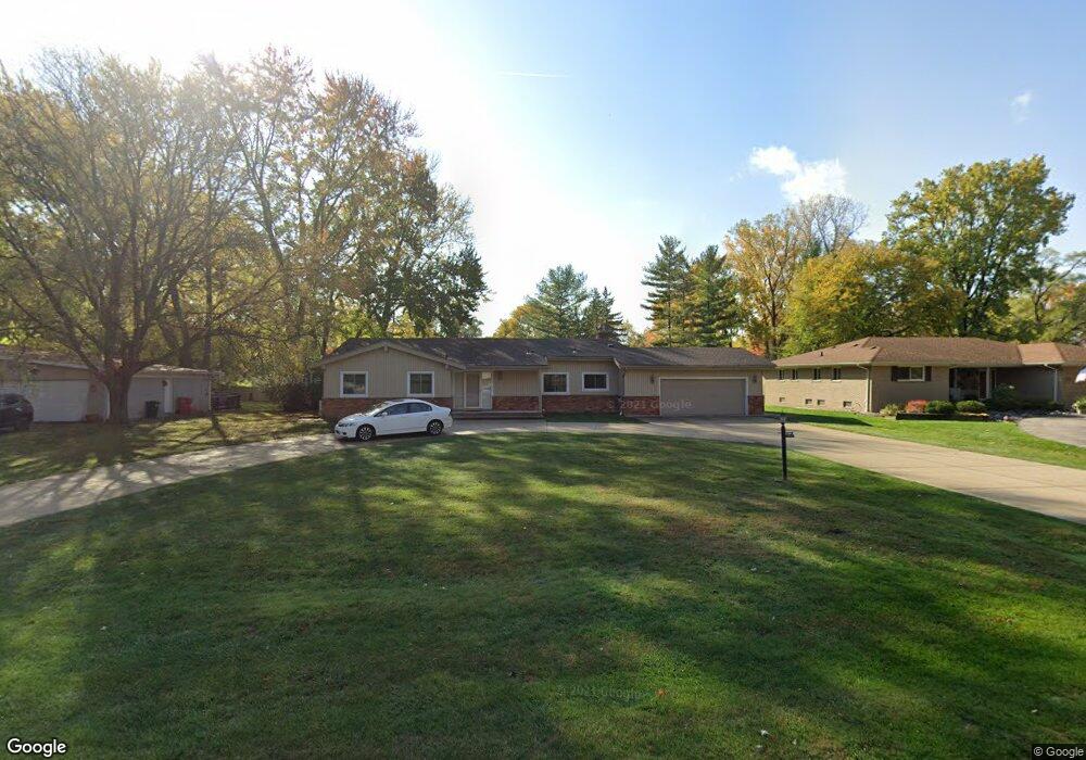
20265 N Greenway St Southfield, MI 48076
Estimated Value: $332,000 - $397,000
--
Bed
3
Baths
2,269
Sq Ft
$164/Sq Ft
Est. Value
About This Home
This home is located at 20265 N Greenway St, Southfield, MI 48076 and is currently estimated at $372,809, approximately $164 per square foot. 20265 N Greenway St is a home located in Oakland County with nearby schools including Wylie E. Groves High School, Bingham Farms Elementary School, and Berkshire Middle School.
Ownership History
Date
Name
Owned For
Owner Type
Purchase Details
Closed on
Oct 18, 2023
Sold by
Meade Ronald E
Bought by
Kantarian Cally and Kantarian Steven
Current Estimated Value
Purchase Details
Closed on
May 23, 2002
Sold by
Sawyer Ronnie
Bought by
Meade Ronald E
Home Financials for this Owner
Home Financials are based on the most recent Mortgage that was taken out on this home.
Original Mortgage
$229,500
Interest Rate
6.41%
Mortgage Type
Purchase Money Mortgage
Purchase Details
Closed on
Feb 21, 2001
Sold by
Sawyer Paula
Bought by
Sawyer Ronnie L
Purchase Details
Closed on
Feb 18, 2000
Sold by
Mildred M Beber Tr
Bought by
Sawyer Ronnie
Create a Home Valuation Report for This Property
The Home Valuation Report is an in-depth analysis detailing your home's value as well as a comparison with similar homes in the area
Home Values in the Area
Average Home Value in this Area
Purchase History
| Date | Buyer | Sale Price | Title Company |
|---|---|---|---|
| Kantarian Cally | $295,000 | None Listed On Document | |
| Kantarian Cally | $295,000 | None Listed On Document | |
| Meade Ronald E | -- | -- | |
| Sawyer Ronnie L | $204,000 | -- | |
| Sawyer Ronnie | $196,000 | -- |
Source: Public Records
Mortgage History
| Date | Status | Borrower | Loan Amount |
|---|---|---|---|
| Previous Owner | Meade Ronald E | $229,500 |
Source: Public Records
Tax History Compared to Growth
Tax History
| Year | Tax Paid | Tax Assessment Tax Assessment Total Assessment is a certain percentage of the fair market value that is determined by local assessors to be the total taxable value of land and additions on the property. | Land | Improvement |
|---|---|---|---|---|
| 2022 | $7,209 | $156,000 | $26,230 | $129,770 |
| 2021 | $160 | $147,980 | $26,230 | $121,750 |
| 2020 | $160 | $149,650 | $26,230 | $123,420 |
| 2018 | $0 | $0 | $0 | $0 |
| 2015 | -- | $0 | $0 | $0 |
| 2014 | -- | $71,920 | $0 | $0 |
| 2011 | -- | $75,310 | $0 | $0 |
Source: Public Records
Map
Nearby Homes
- 29662 Westbrook Pkwy
- 29585 Woodhaven Ln
- 30130 Woodgate Dr
- 19601 W 12 Mile Rd Unit 102
- 20351 Lacrosse Ave
- 20141 Lacrosse Ave
- 19245 Eldridge Ln
- 28450 Tapert Dr
- 29743 Chelmsford Rd
- 19710 W 13 Mile Rd Unit 201
- 19710 W 13 Mile Rd Unit 108
- 19710 W 13 Mile Rd Unit 202
- 20120 Covington Pkwy
- 29807 Spring Hill Dr
- 31462 Waltham Rd
- 0000 Farmbrook Rd
- 29484 Spring Hill Dr
- 31018 Pickwick Ln
- 29140 Candlewood Ln
- 29214 Candlewood Ln
- 20265 N Greenway St
- 20235 N Greenway St
- 20305 N Greenway St
- 20230 S Greenway St
- 20205 N Greenway St
- 20205 N Greenway St
- 20330 S Greenway St
- 20260 N Greenway St
- 20260 N Greenway St
- 20165 N Greenway St
- 20165 N Greenway St
- 20230 N Greenway St
- 20230 N Greenway St
- 20300 N Greenway St
- 20300 N Greenway St
- 20200 N Greenway St
- 20200 N Greenway St
- 20320 N Greenway St
- 20160 S Greenway St
- 20135 N Greenway St