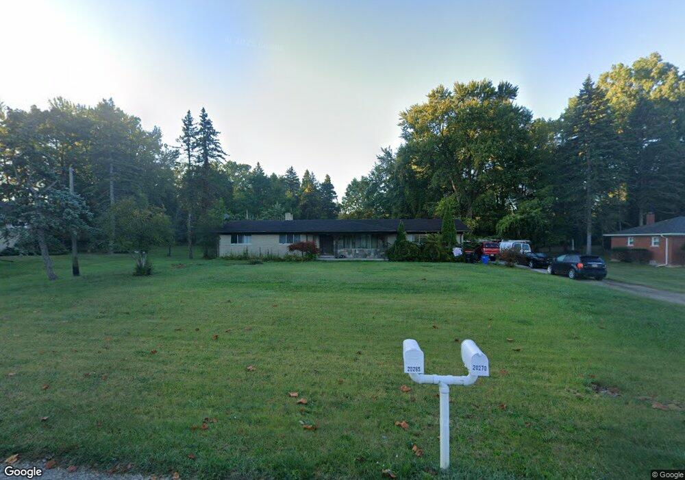
20265 Norwood Dr S Southfield, MI 48075
Estimated Value: $505,000 - $556,034
4
Beds
5
Baths
4,705
Sq Ft
$114/Sq Ft
Est. Value
About This Home
This home is located at 20265 Norwood Dr S, Southfield, MI 48075 and is currently estimated at $535,259, approximately $113 per square foot. 20265 Norwood Dr S is a home located in Oakland County with nearby schools including Morris Adler Elementary School, Glenn W. Levey Middle School, and Dr. Joseph F. Pollack Academic Center Of Excellence.
Ownership History
Date
Name
Owned For
Owner Type
Purchase Details
Closed on
Mar 9, 2016
Sold by
Martin John B and Martin Barbara J
Bought by
Martin John B and Revocab Barbara
Current Estimated Value
Purchase Details
Closed on
Oct 29, 2004
Sold by
Olof H Nilson Trust
Bought by
Martin John B and Martin Barbara J
Home Financials for this Owner
Home Financials are based on the most recent Mortgage that was taken out on this home.
Original Mortgage
$25,000
Interest Rate
5.8%
Mortgage Type
Credit Line Revolving
Purchase Details
Closed on
Sep 1, 1993
Sold by
Nilson Olof H
Bought by
Olof H Nilson Tr
Create a Home Valuation Report for This Property
The Home Valuation Report is an in-depth analysis detailing your home's value as well as a comparison with similar homes in the area
Home Values in the Area
Average Home Value in this Area
Purchase History
| Date | Buyer | Sale Price | Title Company |
|---|---|---|---|
| Martin John B | -- | Attorney | |
| Martin John B | $325,000 | Title America | |
| Olof H Nilson Tr | -- | -- |
Source: Public Records
Mortgage History
| Date | Status | Borrower | Loan Amount |
|---|---|---|---|
| Open | Martin John B | $225,000 | |
| Previous Owner | Martin John B | $25,000 |
Source: Public Records
Tax History Compared to Growth
Tax History
| Year | Tax Paid | Tax Assessment Tax Assessment Total Assessment is a certain percentage of the fair market value that is determined by local assessors to be the total taxable value of land and additions on the property. | Land | Improvement |
|---|---|---|---|---|
| 2022 | $6,452 | $218,090 | $31,800 | $186,290 |
| 2021 | $6,738 | $206,580 | $31,800 | $174,780 |
| 2020 | $5,849 | $182,980 | $31,800 | $151,180 |
| 2018 | $6,930 | $154,420 | $31,800 | $122,620 |
| 2015 | -- | $125,680 | $0 | $0 |
| 2014 | -- | $100,050 | $0 | $0 |
| 2011 | -- | $114,240 | $0 | $0 |
Source: Public Records
Map
Nearby Homes
- 24153 Evergreen Rd Unit 30
- 24393 Evergreen Rd
- 24139 Philip Dr
- VL Russell St
- 19680 Hilton Dr
- 19780 Mahon St
- 19620 Jeanette St
- 19633 Mahon St
- 21763 Hidden Rivers Dr N Unit M68
- 19910 Albany Ave
- 19171 Hilton Dr
- 24713 Lois Ln
- 25476 Saint James
- 25493 Saint James Unit 271
- 20082 Rodeo Ct Unit 8
- 20023 Boardwalk Blvd Unit 281
- 20217 Boardwalk Blvd
- 19490 Goldwin St
- 21812 Duns Scotus St Unit 7
- 19880 Hazelhurst St
- 20551 Norwood Dr S
- 20440 Norwood Dr S
- 20362 Norwood Dr S
- 24260 Norwood Dr W
- 24101 Norwood Dr W
- 20220 Norwood Dr S
- 000 S Norwood Dr
- Norwood W Norwood Dr
- 24259 Norwood Dr W
- 24310 Norwood Dr W
- 20190 Norwood Dr S
- 24271 Norwood Dr W
- 20365 Norwood Dr N
- 24275 Norwood Dr W
- 20191 Norwood Dr S
- 20295 Norwood Dr N
- 20439 Norwood Dr N Unit Bldg-Unit
- 20439 Norwood Dr N
- 24147 Evergreen Rd
- 20265 Norwood Dr N