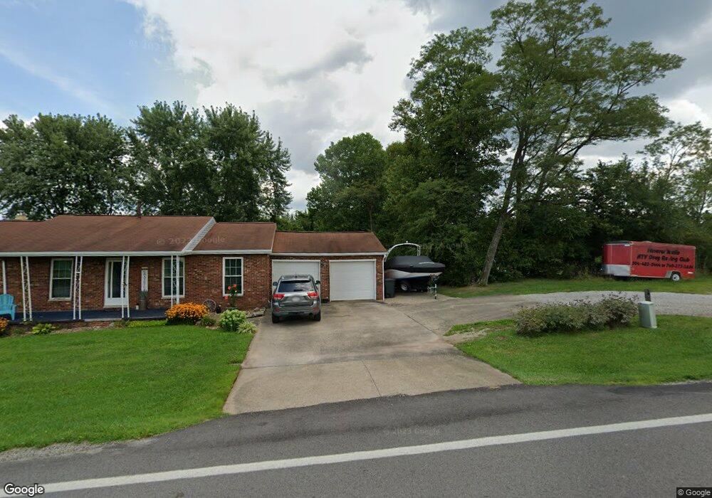
20265 State Route 676 Marietta, OH 45750
Estimated Value: $226,000 - $275,000
3
Beds
3
Baths
1,980
Sq Ft
$124/Sq Ft
Est. Value
About This Home
This home is located at 20265 State Route 676, Marietta, OH 45750 and is currently estimated at $246,443, approximately $124 per square foot. 20265 State Route 676 is a home located in Washington County with nearby schools including Warren High School, St. John Central Grade School, and Veritas Classical Academy.
Ownership History
Date
Name
Owned For
Owner Type
Purchase Details
Closed on
Jul 9, 2008
Sold by
Wilson Melvin A
Bought by
Bailey Michael R and Bailey Kristin L
Current Estimated Value
Home Financials for this Owner
Home Financials are based on the most recent Mortgage that was taken out on this home.
Original Mortgage
$114,408
Outstanding Balance
$73,920
Interest Rate
6.1%
Mortgage Type
Commercial
Estimated Equity
$172,523
Purchase Details
Closed on
Jun 11, 2004
Bought by
Wilson Melvin A and Wilson Joanne
Purchase Details
Closed on
Nov 4, 2003
Bought by
Williams Flora J
Purchase Details
Closed on
Sep 1, 1987
Bought by
Williams James E and Williams Flora
Create a Home Valuation Report for This Property
The Home Valuation Report is an in-depth analysis detailing your home's value as well as a comparison with similar homes in the area
Home Values in the Area
Average Home Value in this Area
Purchase History
| Date | Buyer | Sale Price | Title Company |
|---|---|---|---|
| Bailey Michael R | $112,000 | Title First Marietta | |
| Wilson Melvin A | $102,000 | -- | |
| Williams Flora J | -- | -- | |
| Williams James E | $50,000 | -- |
Source: Public Records
Mortgage History
| Date | Status | Borrower | Loan Amount |
|---|---|---|---|
| Open | Bailey Michael R | $114,408 |
Source: Public Records
Tax History Compared to Growth
Tax History
| Year | Tax Paid | Tax Assessment Tax Assessment Total Assessment is a certain percentage of the fair market value that is determined by local assessors to be the total taxable value of land and additions on the property. | Land | Improvement |
|---|---|---|---|---|
| 2024 | $2,222 | $68,560 | $10,030 | $58,530 |
| 2023 | $2,222 | $68,560 | $10,030 | $58,530 |
| 2022 | $2,256 | $68,560 | $10,030 | $58,530 |
| 2021 | $1,714 | $52,150 | $6,970 | $45,180 |
| 2020 | $1,707 | $52,150 | $6,970 | $45,180 |
| 2019 | $1,688 | $52,150 | $6,970 | $45,180 |
| 2018 | $1,540 | $47,130 | $6,060 | $41,070 |
| 2017 | $1,532 | $47,130 | $6,060 | $41,070 |
| 2016 | $1,337 | $47,130 | $6,060 | $41,070 |
| 2015 | $1,155 | $40,920 | $5,810 | $35,110 |
| 2014 | $2,106 | $40,920 | $5,810 | $35,110 |
| 2013 | $1,102 | $40,920 | $5,810 | $35,110 |
Source: Public Records
Map
Nearby Homes
- 20645 Ohio 676
- 565 Lang Farm Rd
- 100 Pineview Dr
- 116 Pineview Dr
- 305 Flintwood Dr
- 65 High Point Dr
- 132 Mound Dr
- 111 Hanson Dr
- 102 Woodrow St
- 117 Clark St
- 211 Beaver St
- 107 Strecker Hill
- 203 Marion St
- 101 Laramie Rd
- 208 Marshall Rd
- 315 Muskingum Dr
- 977 Gilman Ave
- 101 W Montgomery St
- 109 Ohio Blvd
- 4 Julie Ln
- 20223 State Route 676
- 20226 State Route 676
- 20226 State Route 676
- 20285 State Route 676
- 20226 Rt 676
- 20200 State Route 676
- 20205 State Route 676
- 20325 State Route 676
- 20140 State Route 676
- 20315 State Route 676
- 20355 State Route 676
- 20375 State Route 676
- 20370 State Route 676
- . St Rt 676 Watertown Rd
- 75 Lang Farm Rd
- 20290 State Route 676
- 20319 State Route 676
- 20050 State Route 676
- 20045 State Route 676
- 20030 State Route 676