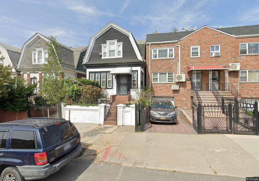
2027 Haviland Ave Bronx, NY 10472
Unionport NeighborhoodEstimated Value: $626,343 - $854,000
--
Bed
--
Bath
1,586
Sq Ft
$478/Sq Ft
Est. Value
About This Home
This home is located at 2027 Haviland Ave, Bronx, NY 10472 and is currently estimated at $757,336, approximately $477 per square foot. 2027 Haviland Ave is a home located in Bronx County with nearby schools including The Dr Emmett W. Bassett School, St Helena School, and St. Helena Commercial High School.
Ownership History
Date
Name
Owned For
Owner Type
Purchase Details
Closed on
May 6, 2002
Sold by
Perez Eduardo E
Bought by
Gonzalez Moises
Current Estimated Value
Home Financials for this Owner
Home Financials are based on the most recent Mortgage that was taken out on this home.
Original Mortgage
$195,700
Outstanding Balance
$83,044
Interest Rate
7%
Estimated Equity
$674,292
Purchase Details
Closed on
Apr 14, 1997
Sold by
Perez Carmen
Bought by
Perez Eduardo E
Home Financials for this Owner
Home Financials are based on the most recent Mortgage that was taken out on this home.
Original Mortgage
$90,000
Interest Rate
7.97%
Mortgage Type
Balloon
Create a Home Valuation Report for This Property
The Home Valuation Report is an in-depth analysis detailing your home's value as well as a comparison with similar homes in the area
Home Values in the Area
Average Home Value in this Area
Purchase History
| Date | Buyer | Sale Price | Title Company |
|---|---|---|---|
| Gonzalez Moises | -- | -- | |
| Gonzalez Moises | -- | -- | |
| Perez Eduardo E | -- | American Title Insurance Co | |
| Perez Eduardo E | -- | American Title Insurance Co |
Source: Public Records
Mortgage History
| Date | Status | Borrower | Loan Amount |
|---|---|---|---|
| Open | Gonzalez Moises | $195,700 | |
| Closed | Gonzalez Moises | $195,700 | |
| Previous Owner | Perez Eduardo E | $90,000 |
Source: Public Records
Tax History Compared to Growth
Tax History
| Year | Tax Paid | Tax Assessment Tax Assessment Total Assessment is a certain percentage of the fair market value that is determined by local assessors to be the total taxable value of land and additions on the property. | Land | Improvement |
|---|---|---|---|---|
| 2025 | $5,098 | $27,475 | $4,420 | $23,055 |
| 2024 | $5,098 | $26,784 | $4,722 | $22,062 |
| 2023 | $4,885 | $25,724 | $5,096 | $20,628 |
| 2022 | $4,319 | $37,920 | $7,500 | $30,420 |
| 2021 | $4,515 | $32,580 | $7,500 | $25,080 |
| 2020 | $4,550 | $28,200 | $7,500 | $20,700 |
| 2019 | $4,376 | $22,740 | $7,500 | $15,240 |
| 2018 | $4,072 | $21,437 | $7,165 | $14,272 |
| 2017 | $3,823 | $20,224 | $7,101 | $13,123 |
| 2016 | $3,504 | $19,080 | $7,500 | $11,580 |
| 2015 | $2,353 | $19,716 | $7,720 | $11,996 |
| 2014 | $2,353 | $18,600 | $8,340 | $10,260 |
Source: Public Records
Map
Nearby Homes
- 2016 Haviland Ave
- 1068 Pugsley Ave
- 2027 Chatterton Ave
- 2164 Cross Bronx Expy
- 1042 Virginia Ave
- 1934 Chatterton Ave
- 1966 Newbold Ave Unit 108
- 1966 Newbold Ave Unit 1510
- 1966 Newbold Ave Unit 405
- 1966 Newbold Ave Unit 308
- 2131 Bruckner Blvd
- 2131 Newbold Ave
- 1055 Virginia Ave
- 1210 White Plains Rd
- 2209 Ellis Ave
- 1886 Gleason Ave
- 2121 Quimby Ave
- 1315 Purdy St
- 2139 Quimby Ave
- 1870 Gleason Ave
- 2029 Haviland Ave
- 2025 Haviland Ave
- 2031 Haviland Ave
- 2023 Haviland Ave
- 2033 Haviland Ave
- 2021 Haviland Ave
- 2035 Haviland Ave
- 2028 Powell Ave
- 2037 Haviland Ave
- 2026 Powell Ave
- 2030 Powell Ave
- 2032 Powell Ave
- 2022 Powell Ave
- 2019 Haviland Ave
- 2020 Powell Ave
- 2034 Powell Ave
- 2041 Haviland Ave
- 2013 Haviland Ave
- 2040 Powell Ave
- 2043 Haviland Ave