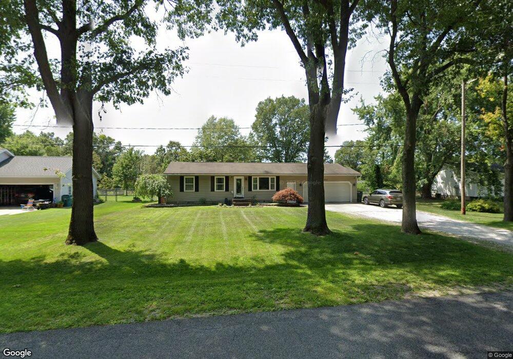
2027 N Sheridan Rd Muskegon, MI 49445
Estimated Value: $242,000 - $292,000
3
Beds
2
Baths
1,002
Sq Ft
$264/Sq Ft
Est. Value
About This Home
This home is located at 2027 N Sheridan Rd, Muskegon, MI 49445 and is currently estimated at $264,935, approximately $264 per square foot. 2027 N Sheridan Rd is a home located in Muskegon County with nearby schools including Reeths-Puffer High School.
Ownership History
Date
Name
Owned For
Owner Type
Purchase Details
Closed on
Oct 2, 2020
Sold by
Colbom Michael C and Santo Megan A
Bought by
Colborn Michael C and Colborn Megan A
Current Estimated Value
Home Financials for this Owner
Home Financials are based on the most recent Mortgage that was taken out on this home.
Original Mortgage
$126,600
Outstanding Balance
$112,399
Interest Rate
2.8%
Mortgage Type
New Conventional
Estimated Equity
$152,536
Purchase Details
Closed on
Dec 28, 2016
Sold by
Bamberg Matthew Dennis and Bamberg Matthew D
Bought by
Colborn Michael C and Santo Megan A
Home Financials for this Owner
Home Financials are based on the most recent Mortgage that was taken out on this home.
Original Mortgage
$130,591
Interest Rate
4.03%
Mortgage Type
FHA
Purchase Details
Closed on
May 8, 2014
Sold by
Bamberg Leanne M
Bought by
Bamberg Matthew Dennis
Create a Home Valuation Report for This Property
The Home Valuation Report is an in-depth analysis detailing your home's value as well as a comparison with similar homes in the area
Home Values in the Area
Average Home Value in this Area
Purchase History
| Date | Buyer | Sale Price | Title Company |
|---|---|---|---|
| Colborn Michael C | -- | None Available | |
| Colborn Michael C | $133,000 | Safe Title | |
| Bamberg Matthew Dennis | -- | None Available |
Source: Public Records
Mortgage History
| Date | Status | Borrower | Loan Amount |
|---|---|---|---|
| Open | Colborn Michael C | $126,600 | |
| Closed | Colborn Michael C | $130,591 |
Source: Public Records
Tax History Compared to Growth
Tax History
| Year | Tax Paid | Tax Assessment Tax Assessment Total Assessment is a certain percentage of the fair market value that is determined by local assessors to be the total taxable value of land and additions on the property. | Land | Improvement |
|---|---|---|---|---|
| 2025 | $2,655 | $99,800 | $0 | $0 |
| 2024 | $795 | $91,900 | $0 | $0 |
| 2023 | $760 | $82,100 | $0 | $0 |
| 2022 | $2,425 | $71,800 | $0 | $0 |
| 2021 | $2,361 | $66,800 | $0 | $0 |
| 2020 | $2,338 | $63,400 | $0 | $0 |
| 2019 | $2,304 | $57,900 | $0 | $0 |
| 2018 | $2,261 | $57,300 | $0 | $0 |
| 2017 | $2,251 | $55,300 | $0 | $0 |
| 2016 | $524 | $49,400 | $0 | $0 |
| 2015 | -- | $46,000 | $0 | $0 |
| 2014 | -- | $46,200 | $0 | $0 |
| 2013 | -- | $43,600 | $0 | $0 |
Source: Public Records
Map
Nearby Homes
- 2551 Hiawatha Trail
- 2635 E River Rd
- 2026 N Port Blvd
- 1925 Shady Oak Dr
- 1960 Nielwood Dr
- 2337 Northwind Dr
- 0 Holton Vl Rd Unit 20027438
- V/L Holton Rd
- 2624 Holton Rd
- 2021 Queens Ct
- 2960 Holton Rd
- 0 E Mcmillan Rd
- 2060 N Roberts Rd
- 3501 Cedar Rd
- 3450 Spruce St
- 3480 Hickory Rd
- 3475 Spruce St
- 2340 Beech Ln
- 2434 Elm Rd
- 3502 Beech Ln
- 2015 N Sheridan Rd
- 2039 N Sheridan Rd
- 2014 N Sheridan Rd
- 2051 N Sheridan Rd
- 2005 N Sheridan Rd
- 2061 N Sheridan Rd
- 1991 N Sheridan Rd
- 2024 N Sheridan Rd
- 2073 N Sheridan Rd
- 2085 N Sheridan Rd
- 1976 N Sheridan Rd
- 1969 N Sheridan Rd
- 2097 N Sheridan Rd
- 1957 N Sheridan Rd
- 2107 N Sheridan Rd
- 2080 N Sheridan Rd
- 1954 N Sheridan Rd
- 1945 N Sheridan Rd
- 2119 N Sheridan Rd
- 2116 N Sheridan Rd