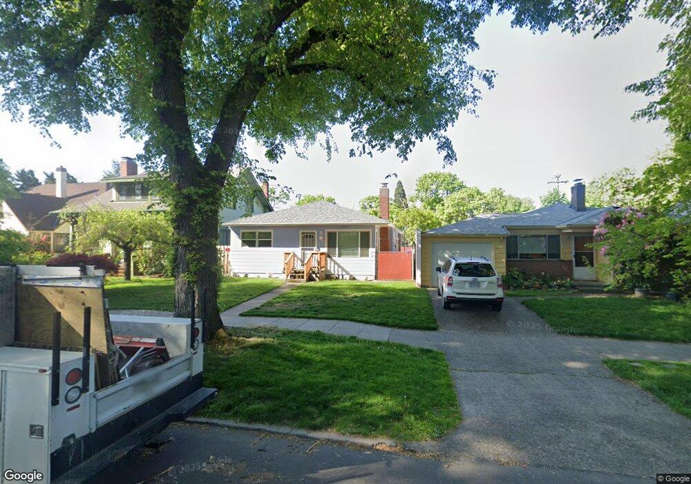
2027 SE Ladd Ave Portland, OR 97214
Hosford-Abernethy NeighborhoodEstimated Value: $565,689 - $734,000
4
Beds
1
Bath
1,000
Sq Ft
$652/Sq Ft
Est. Value
About This Home
This home is located at 2027 SE Ladd Ave, Portland, OR 97214 and is currently estimated at $651,922, approximately $651 per square foot. 2027 SE Ladd Ave is a home located in Multnomah County with nearby schools including Abernethy Elementary School, Hosford Middle School, and Cleveland High School.
Ownership History
Date
Name
Owned For
Owner Type
Purchase Details
Closed on
Jun 25, 2024
Sold by
Yee Karlan T and Yee Karen
Bought by
Yee Family Trust and Yee
Current Estimated Value
Purchase Details
Closed on
Nov 27, 2001
Sold by
Yee Karlan T
Bought by
Yee Karlan T and Yee Karen
Home Financials for this Owner
Home Financials are based on the most recent Mortgage that was taken out on this home.
Original Mortgage
$98,500
Interest Rate
6.63%
Mortgage Type
Purchase Money Mortgage
Create a Home Valuation Report for This Property
The Home Valuation Report is an in-depth analysis detailing your home's value as well as a comparison with similar homes in the area
Home Values in the Area
Average Home Value in this Area
Purchase History
| Date | Buyer | Sale Price | Title Company |
|---|---|---|---|
| Yee Family Trust | -- | None Listed On Document | |
| Yee Karlan T | -- | Ticor Title |
Source: Public Records
Mortgage History
| Date | Status | Borrower | Loan Amount |
|---|---|---|---|
| Previous Owner | Yee Karlan T | $98,500 |
Source: Public Records
Tax History Compared to Growth
Tax History
| Year | Tax Paid | Tax Assessment Tax Assessment Total Assessment is a certain percentage of the fair market value that is determined by local assessors to be the total taxable value of land and additions on the property. | Land | Improvement |
|---|---|---|---|---|
| 2024 | $6,772 | $253,110 | -- | -- |
| 2023 | $6,512 | $245,740 | $0 | $0 |
| 2022 | $6,371 | $238,590 | $0 | $0 |
| 2021 | $6,263 | $231,650 | $0 | $0 |
| 2020 | $5,746 | $224,910 | $0 | $0 |
| 2019 | $5,535 | $218,360 | $0 | $0 |
| 2018 | $5,372 | $212,000 | $0 | $0 |
| 2017 | $5,148 | $205,830 | $0 | $0 |
| 2016 | $4,712 | $199,840 | $0 | $0 |
| 2015 | $4,588 | $194,020 | $0 | $0 |
| 2014 | $4,519 | $188,370 | $0 | $0 |
Source: Public Records
Map
Nearby Homes
- 2112 SE Elliott Ave
- 2036 SE Larch Ave
- 1844 SE 12th Ave
- 2025 SE Caruthers St Unit 24
- 2135 SE 12th Ave
- 1116 SE Stephens St
- 2222 SE 22nd Ave
- 1606 SE Clinton St
- 1529 SE Hawthorne Blvd Unit 101
- 1312 SE Hawthorne Blvd
- 2301 SE Caruthers St Unit 10
- 1804 SE Madison St Unit 1806
- 1946 SE 23rd Ave
- 2806 SE 15th Ave Unit 5
- 2264 SE Division St
- 2268 SE Division St
- 1114 SE Clay St
- 1805 SE Madison St Unit 303
- 1805 SE Madison St Unit 304
- 1310 SE 14th Ave Unit 3
- 2031 SE Ladd Ave
- 2021 SE Ladd Ave
- 2041 SE Ladd Ave
- 1991 SE Ladd Ave
- 2050 SE 16th Ave
- 2047 SE Ladd Ave
- 2015 SE 16th Ave
- 2104 SE Tamarack Ave
- 2063 SE Ladd Ave
- 2028 SE Ladd Ave
- 2018 SE Elliott Ave
- 2032 SE Ladd Ave
- 2018 SE Ladd Ave
- 2043 SE 16th Ave Unit 2055
- 2110 SE Tamarack Ave
- 2010 SE Ladd Ave
- 2042 SE Ladd Ave
- 2026 SE Elliott Ave
- 2107 SE Ladd Ave
- 2118 SE Tamarack Ave