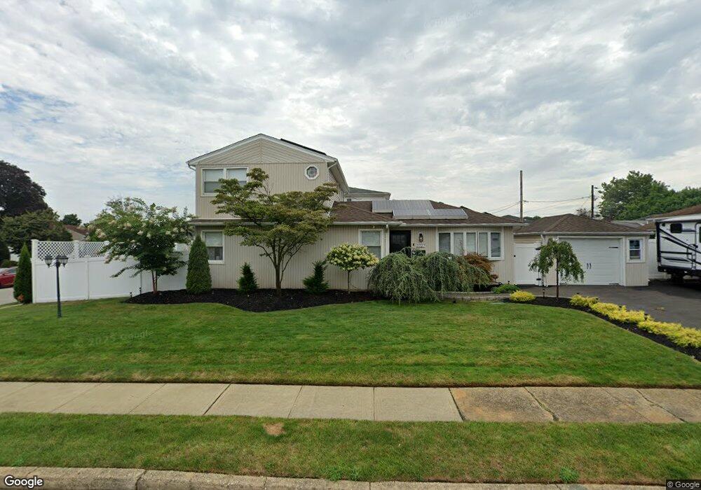
2027 Stirrup Path Seaford, NY 11783
Estimated Value: $752,587 - $878,000
4
Beds
3
Baths
1,554
Sq Ft
$525/Sq Ft
Est. Value
About This Home
This home is located at 2027 Stirrup Path, Seaford, NY 11783 and is currently estimated at $815,294, approximately $524 per square foot. 2027 Stirrup Path is a home located in Nassau County with nearby schools including Seaford Middle School, Seaford Senior High School, and St. William the Abbot School.
Ownership History
Date
Name
Owned For
Owner Type
Purchase Details
Closed on
Jan 23, 2015
Sold by
Moor Donna M
Bought by
Monforte Frank and Zimny Kristen
Current Estimated Value
Home Financials for this Owner
Home Financials are based on the most recent Mortgage that was taken out on this home.
Original Mortgage
$361,000
Outstanding Balance
$273,774
Interest Rate
3.81%
Mortgage Type
New Conventional
Estimated Equity
$541,520
Purchase Details
Closed on
Mar 29, 2011
Sold by
Moor Michael M and Moor Donna M
Bought by
Moor Donna M
Home Financials for this Owner
Home Financials are based on the most recent Mortgage that was taken out on this home.
Original Mortgage
$378,325
Interest Rate
4.75%
Mortgage Type
FHA
Purchase Details
Closed on
May 22, 2000
Sold by
Belgiorno Victor C
Bought by
Moor Michael M
Create a Home Valuation Report for This Property
The Home Valuation Report is an in-depth analysis detailing your home's value as well as a comparison with similar homes in the area
Home Values in the Area
Average Home Value in this Area
Purchase History
| Date | Buyer | Sale Price | Title Company |
|---|---|---|---|
| Monforte Frank | $380,000 | None Available | |
| Moor Donna M | -- | -- | |
| Moor Michael M | $260,000 | Bernard H Cohen |
Source: Public Records
Mortgage History
| Date | Status | Borrower | Loan Amount |
|---|---|---|---|
| Open | Monforte Frank | $361,000 | |
| Previous Owner | Moor Donna M | $378,325 |
Source: Public Records
Tax History
| Year | Tax Paid | Tax Assessment Tax Assessment Total Assessment is a certain percentage of the fair market value that is determined by local assessors to be the total taxable value of land and additions on the property. | Land | Improvement |
|---|---|---|---|---|
| 2025 | $13,379 | $455 | $180 | $275 |
| 2024 | $3,360 | $486 | $192 | $294 |
| 2023 | $12,531 | $494 | $195 | $299 |
| 2022 | $12,531 | $494 | $195 | $299 |
| 2021 | $16,020 | $535 | $211 | $324 |
| 2020 | $12,451 | $609 | $608 | $1 |
| 2019 | $11,014 | $653 | $634 | $19 |
| 2018 | $11,266 | $696 | $0 | $0 |
| 2017 | $9,888 | $887 | $676 | $211 |
| 2016 | $13,811 | $887 | $676 | $211 |
| 2015 | $3,660 | $887 | $676 | $211 |
| 2014 | $3,660 | $887 | $676 | $211 |
| 2013 | $3,390 | $887 | $676 | $211 |
Source: Public Records
Map
Nearby Homes
- 3610 Locust Ave
- 3532 Waverly Ave
- 3589 Naomi Place
- 3861 Wilburne Ave
- 2175 Spruce St
- 1769 Jane St
- 2331 Neptune Ave
- 2089 Beech St
- 3860 Hudson Ave
- 3969 Marlow Ct
- 3268 Jackson Ave
- 1691 Lehigh Rd
- 1732 Princeton Dr W
- 2327 Mattituck Ave
- 2181 Hortense Ave
- 2393 Maple Ave
- 2359 Spruce St
- 2202 Beech St
- 2094 Wantagh Ave
- 3862 Clark St
- 3636 Woodward Ave
- 2039 Stirrup Path
- 2026 Stirrup Path
- 2034 Guildford Park Dr
- 2046 Guildford Park Dr
- 2045 Stirrup Path
- 3633 Woodward Ave
- 3627 Woodward Ave
- 2038 Stirrup Path
- 3643 Woodward Ave
- 2052 Guildford Park Dr
- 3621 Woodward Ave
- 3612 Woodward Ave
- 29 Guildford Park Dr Unit Upper
- 29 Guildford Park Dr
- 2051 Stirrup Path
- 2044 Stirrup Path
- 3615 Woodward Ave
- 2016 Guildford Park Dr
- 2058 Guildford Park Dr