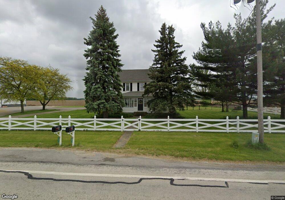
20272 State Route 697 Delphos, OH 45833
Estimated Value: $233,000 - $292,000
3
Beds
2
Baths
1,728
Sq Ft
$156/Sq Ft
Est. Value
About This Home
This home is located at 20272 State Route 697, Delphos, OH 45833 and is currently estimated at $269,514, approximately $155 per square foot. 20272 State Route 697 is a home located in Van Wert County with nearby schools including Lincolnview Elementary School and Lincolnview Junior/Senior High School.
Ownership History
Date
Name
Owned For
Owner Type
Purchase Details
Closed on
Feb 14, 2018
Sold by
Wofenbarger Shelva J
Bought by
Bok Dillon F and Bok Rachael E
Current Estimated Value
Home Financials for this Owner
Home Financials are based on the most recent Mortgage that was taken out on this home.
Original Mortgage
$199,750
Outstanding Balance
$168,215
Interest Rate
3.95%
Mortgage Type
New Conventional
Estimated Equity
$101,299
Purchase Details
Closed on
May 26, 2017
Sold by
Elwer Travis M and Elwer Karmen
Bought by
Wolfenbarger Paul S and Wolfenbarger Shelva J
Home Financials for this Owner
Home Financials are based on the most recent Mortgage that was taken out on this home.
Original Mortgage
$110,000
Interest Rate
3.97%
Mortgage Type
New Conventional
Purchase Details
Closed on
Apr 1, 2004
Bought by
Black Kevin B and Black Casey J
Create a Home Valuation Report for This Property
The Home Valuation Report is an in-depth analysis detailing your home's value as well as a comparison with similar homes in the area
Home Values in the Area
Average Home Value in this Area
Purchase History
| Date | Buyer | Sale Price | Title Company |
|---|---|---|---|
| Bok Dillon F | $212,500 | Terra Title | |
| Wolfenbarger Paul S | $200,000 | Hallmark Title | |
| Black Kevin B | $126,000 | -- | |
| Black Kevin B | $126,000 | -- |
Source: Public Records
Mortgage History
| Date | Status | Borrower | Loan Amount |
|---|---|---|---|
| Open | Bok Dillon F | $199,750 | |
| Previous Owner | Wolfenbarger Paul S | $110,000 |
Source: Public Records
Tax History Compared to Growth
Tax History
| Year | Tax Paid | Tax Assessment Tax Assessment Total Assessment is a certain percentage of the fair market value that is determined by local assessors to be the total taxable value of land and additions on the property. | Land | Improvement |
|---|---|---|---|---|
| 2024 | $2,825 | $89,780 | $7,250 | $82,530 |
| 2023 | $2,825 | $89,780 | $7,250 | $82,530 |
| 2022 | $2,605 | $60,800 | $6,300 | $54,500 |
| 2021 | $2,622 | $60,800 | $6,300 | $54,500 |
| 2020 | $2,614 | $60,800 | $6,300 | $54,500 |
| 2019 | $2,028 | $51,900 | $5,320 | $46,580 |
| 2018 | $2,006 | $51,900 | $5,320 | $46,580 |
| 2017 | $2,001 | $51,900 | $5,320 | $46,580 |
| 2016 | $1,108 | $32,280 | $5,320 | $26,960 |
| 2015 | $1,092 | $32,280 | $5,320 | $26,960 |
| 2014 | $1,108 | $31,580 | $5,320 | $26,260 |
| 2013 | $1,334 | $31,580 | $5,320 | $26,260 |
Source: Public Records
Map
Nearby Homes
- 104 W Railroad St
- 104 W South St
- 112 W Railroad St
- TBD Dog Creek Rd
- 11630 Clearview Dr
- 19083 Venedocia Eastern Rd
- 15044 Main St
- 18906 Bebb St
- 19059 Wittington St
- 8951 Brickner Rd
- 616 W 5th St
- 409 N Bredeick St
- 604 W 6th St
- 606 S Cass St
- 503 W 6th St
- 634 S Clay St
- 424 S Canal St
- 221 S Main St
- 516 S Main St
- 827 S Washington St
- 20381 State Route 697
- 20381 State Route 697
- 20135 State Route 697
- 20559 Ohio 697
- 20559 State Route 697
- 20592 State Route 697
- 20594 State Route 697
- 11843 Middlepoint Wetzel Rd
- 20701 State Route 697
- 19840 State Route 697
- 19813 State Route 697
- 11972 Middlepoint Wetzel Rd
- 11068 Middlepoint Wetzel Rd
- 11972 Middle Point Wetzel Rd
- 20796 State Route 697
- 12075 Middlepoint Wetzel Rd
- 19669 State Route 697
- 20881 State Route 697
- 19634 State Route 697
- 12118 Middlepoint Wetzel Rd