Estimated Value: $313,000 - $373,000
--
Bed
--
Bath
2,049
Sq Ft
$169/Sq Ft
Est. Value
About This Home
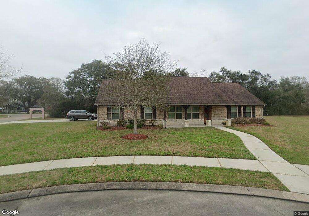
This home is located at 2028 Brentwood Dr, Alvin, TX 77511 and is currently estimated at $346,376, approximately $169 per square foot. 2028 Brentwood Dr is a home with nearby schools including Melba Passmore Elementary School, Fairview Junior High School, and Alvin High School.
Ownership History
Date
Name
Owned For
Owner Type
Purchase Details
Closed on
Jan 24, 2025
Sold by
Parker Jo N
Bought by
Alps Shirley Ann
Current Estimated Value
Purchase Details
Closed on
Apr 24, 2013
Sold by
Mishara Builders Inc
Bought by
Parker Jo N
Home Financials for this Owner
Home Financials are based on the most recent Mortgage that was taken out on this home.
Original Mortgage
$128,800
Interest Rate
3.67%
Mortgage Type
New Conventional
Purchase Details
Closed on
Apr 6, 2012
Sold by
Falling Leaf Development Lp
Bought by
Mishra Builders Inc
Create a Home Valuation Report for This Property
The Home Valuation Report is an in-depth analysis detailing your home's value as well as a comparison with similar homes in the area
Home Values in the Area
Average Home Value in this Area
Purchase History
| Date | Buyer | Sale Price | Title Company |
|---|---|---|---|
| Alps Shirley Ann | -- | Alamo Title Company | |
| Parker Jo N | -- | Stewart Title | |
| Mishra Builders Inc | -- | None Available |
Source: Public Records
Mortgage History
| Date | Status | Borrower | Loan Amount |
|---|---|---|---|
| Previous Owner | Parker Jo N | $128,800 |
Source: Public Records
Tax History Compared to Growth
Tax History
| Year | Tax Paid | Tax Assessment Tax Assessment Total Assessment is a certain percentage of the fair market value that is determined by local assessors to be the total taxable value of land and additions on the property. | Land | Improvement |
|---|---|---|---|---|
| 2025 | $4,195 | $398,180 | $40,140 | $358,040 |
| 2023 | $4,195 | $362,290 | $42,650 | $319,640 |
| 2022 | $9,165 | $334,140 | $42,650 | $291,490 |
| 2021 | $8,859 | $308,440 | $44,360 | $264,080 |
| 2020 | $8,164 | $278,950 | $39,240 | $239,710 |
| 2019 | $8,072 | $268,740 | $32,700 | $236,040 |
| 2018 | $7,820 | $259,900 | $34,120 | $225,780 |
| 2017 | $7,207 | $268,440 | $34,120 | $234,320 |
| 2016 | $7,975 | $262,220 | $34,120 | $228,100 |
| 2014 | $6,579 | $211,660 | $31,280 | $180,380 |
Source: Public Records
Map
Nearby Homes
- 256 Davis Bend Rd
- 252 Davis Bend Rd
- 1503 Fairview Dr
- 1655 Kost Rd
- 2693 Fairview Dr
- 1109 Hampton Cir
- 0 Kost Rd
- 1312 W Adoue St
- 1302 W Adoue St
- 2386 Mamie Ford Rd
- 2195 W Lang St
- 405 W Lang St
- 218 W Blum St
- 1314 W Willis St
- 1316 W Willis St
- 3293 County Road 181
- 2306 Westfield St
- 503 N 5th St
- 1600 Rosharon Rd Unit 19
- 2016 W Davis Bend St
- 2026 Brentwood
- 2017 Brentwood
- 2024 Brentwood Dr
- 2020 Brentwood Dr
- 2022 Brentwood Dr
- 2018 Brentwood
- 2015 Brentwood Dr
- 1992 Brentwood Dr
- 1994 Brentwood Dr
- 1990 Brentwood Dr
- 2130 W Coombs St
- 800 Callaway Dr
- 1996 Brentwood Dr
- 2117 W House St
- 2011 Brentwood Dr
- 1922 Brentwood Dr
- 2009 Brentwood Dr
- 2150 W Coombs St
- 2130 W Dumble St
- 2013 Brentwood Dr