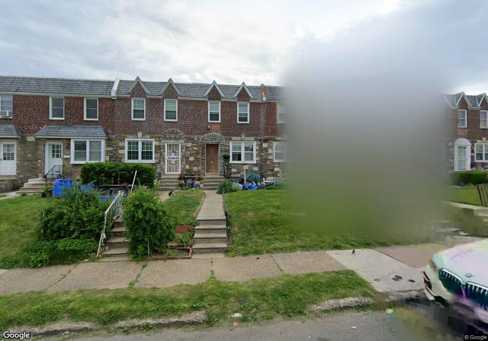
2028 Disston St Philadelphia, PA 19149
Castor Gardens NeighborhoodEstimated Value: $214,479 - $280,000
3
Beds
1
Bath
1,126
Sq Ft
$213/Sq Ft
Est. Value
About This Home
This home is located at 2028 Disston St, Philadelphia, PA 19149 and is currently estimated at $239,620, approximately $212 per square foot. 2028 Disston St is a home located in Philadelphia County with nearby schools including Solomon Solis-Cohen School, Castor Gardens Middle School, and Northeast High School.
Ownership History
Date
Name
Owned For
Owner Type
Purchase Details
Closed on
May 4, 2018
Sold by
Mattison Shawn R and Kagan Laurence
Bought by
Cocozza Michael and Mattison Shaw R
Current Estimated Value
Purchase Details
Closed on
Apr 30, 2014
Sold by
Kagan Laurence and Mattison Shawn R
Bought by
Kagan Laurence and Mattison Shawn R
Purchase Details
Closed on
Jun 29, 2008
Sold by
Mattison Robert D and Mattison Robert
Bought by
Bernick Adam S and Mattison Shawn R
Purchase Details
Closed on
Oct 26, 2001
Sold by
Rosenblum Samuel and Rosenblum Rosalind
Bought by
Mattison Robert
Home Financials for this Owner
Home Financials are based on the most recent Mortgage that was taken out on this home.
Original Mortgage
$61,950
Interest Rate
6.85%
Create a Home Valuation Report for This Property
The Home Valuation Report is an in-depth analysis detailing your home's value as well as a comparison with similar homes in the area
Home Values in the Area
Average Home Value in this Area
Purchase History
| Date | Buyer | Sale Price | Title Company |
|---|---|---|---|
| Cocozza Michael | -- | None Available | |
| Kagan Laurence | -- | None Available | |
| Bernick Adam S | -- | None Available | |
| Mattison Robert | $63,900 | -- |
Source: Public Records
Mortgage History
| Date | Status | Borrower | Loan Amount |
|---|---|---|---|
| Previous Owner | Mattison Robert | $61,950 |
Source: Public Records
Tax History Compared to Growth
Tax History
| Year | Tax Paid | Tax Assessment Tax Assessment Total Assessment is a certain percentage of the fair market value that is determined by local assessors to be the total taxable value of land and additions on the property. | Land | Improvement |
|---|---|---|---|---|
| 2025 | $2,444 | $215,800 | $43,160 | $172,640 |
| 2024 | $2,444 | $215,800 | $43,160 | $172,640 |
| 2023 | $2,444 | $174,600 | $34,920 | $139,680 |
| 2022 | $1,806 | $174,600 | $34,920 | $139,680 |
| 2021 | $1,806 | $0 | $0 | $0 |
| 2020 | $1,806 | $0 | $0 | $0 |
| 2019 | $1,733 | $0 | $0 | $0 |
| 2018 | $1,645 | $0 | $0 | $0 |
| 2017 | $1,645 | $0 | $0 | $0 |
| 2016 | $1,645 | $0 | $0 | $0 |
| 2015 | $1,575 | $0 | $0 | $0 |
| 2014 | -- | $117,500 | $21,810 | $95,690 |
| 2012 | -- | $15,968 | $1,427 | $14,541 |
Source: Public Records
Map
Nearby Homes
- 2011 Longshore Ave
- 6900 Eastwood St
- 2110 Longshore Ave
- 2119 Glenview St
- 6826 Sylvester St
- 2171 Disston St
- 7028 Horrocks St
- 2140 Princeton Ave
- 2162 Princeton Ave
- 7034 Souder St
- 6725 Eastwood St
- 2105 Friendship St
- 2169 Knorr St
- 6946 Kindred St
- 6829 Horrocks St
- 7153 Saul St
- 7039 Kindred St
- 7155 Saul St
- 2206 Princeton Ave
- 7123 Souder St
- 2030 Disston St
- 2026 Disston St
- 2032 Disston St
- 2024 Disston St
- 2022 Disston St
- 2036 Disston St
- 2020 Disston St
- 2038 Disston St
- 2018 Disston St
- 2040 Disston St
- 2027 Longshore Ave
- 2025 Longshore Ave
- 2023 Longshore Ave
- 2014 Disston St
- 2021 Longshore Ave
- 2031 Longshore Ave
- 2019 Longshore Ave
- 2012 Disston St
- 2033 Longshore Ave
- 2017 Longshore Ave