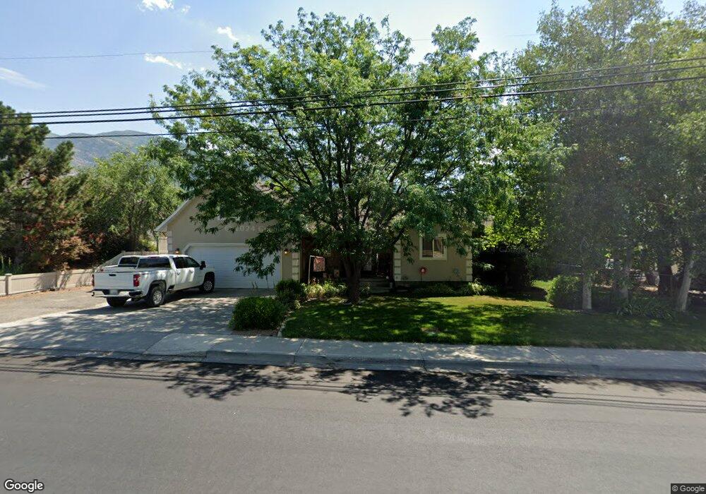
2028 N 1300 W Unit 13 Pleasant Grove, UT 84062
Estimated Value: $713,000 - $922,000
4
Beds
3
Baths
2,410
Sq Ft
$332/Sq Ft
Est. Value
About This Home
This home is located at 2028 N 1300 W Unit 13, Pleasant Grove, UT 84062 and is currently estimated at $798,975, approximately $331 per square foot. 2028 N 1300 W Unit 13 is a home located in Utah County with nearby schools including Manila Elementary School, Pleasant Grove Junior High School, and Pleasant Grove High School.
Ownership History
Date
Name
Owned For
Owner Type
Purchase Details
Closed on
Oct 16, 2013
Sold by
Durrant Michael J and Durrant Maria Elena Serrano
Bought by
Peterson Brandon L and Peterson Andrea E
Current Estimated Value
Home Financials for this Owner
Home Financials are based on the most recent Mortgage that was taken out on this home.
Original Mortgage
$274,829
Outstanding Balance
$204,491
Interest Rate
4.25%
Mortgage Type
FHA
Estimated Equity
$594,484
Purchase Details
Closed on
Nov 29, 2012
Sold by
Durrant Michael J
Bought by
Durrant Michael J and Serrano Durrant Maria Elena
Home Financials for this Owner
Home Financials are based on the most recent Mortgage that was taken out on this home.
Original Mortgage
$228,000
Interest Rate
3.33%
Mortgage Type
New Conventional
Purchase Details
Closed on
Apr 29, 1999
Sold by
Hall Mack R and Hall Leslie B
Bought by
Durrant Michael J
Home Financials for this Owner
Home Financials are based on the most recent Mortgage that was taken out on this home.
Original Mortgage
$46,000
Interest Rate
6.96%
Create a Home Valuation Report for This Property
The Home Valuation Report is an in-depth analysis detailing your home's value as well as a comparison with similar homes in the area
Home Values in the Area
Average Home Value in this Area
Purchase History
| Date | Buyer | Sale Price | Title Company |
|---|---|---|---|
| Peterson Brandon L | -- | Magellan Title | |
| Durrant Michael J | -- | Provo Land Title Co | |
| Durrant Michael J | -- | Provo Land Title Co | |
| Durrant Michael J | -- | Signature Title |
Source: Public Records
Mortgage History
| Date | Status | Borrower | Loan Amount |
|---|---|---|---|
| Open | Peterson Brandon L | $274,829 | |
| Previous Owner | Durrant Michael J | $228,000 | |
| Previous Owner | Durrant Michael J | $46,000 |
Source: Public Records
Tax History Compared to Growth
Tax History
| Year | Tax Paid | Tax Assessment Tax Assessment Total Assessment is a certain percentage of the fair market value that is determined by local assessors to be the total taxable value of land and additions on the property. | Land | Improvement |
|---|---|---|---|---|
| 2025 | $3,016 | $373,560 | $347,600 | $331,600 |
| 2024 | $3,016 | $359,865 | $0 | $0 |
| 2023 | $2,911 | $355,630 | $0 | $0 |
| 2022 | $2,865 | $348,260 | $0 | $0 |
| 2021 | $2,343 | $433,700 | $204,100 | $229,600 |
| 2020 | $2,224 | $403,600 | $189,000 | $214,600 |
| 2019 | $2,082 | $390,700 | $176,100 | $214,600 |
| 2018 | $2,178 | $386,400 | $171,800 | $214,600 |
| 2017 | $2,175 | $205,425 | $0 | $0 |
| 2016 | $2,252 | $205,425 | $0 | $0 |
| 2015 | $2,379 | $205,425 | $0 | $0 |
| 2014 | $2,264 | $193,655 | $0 | $0 |
Source: Public Records
Map
Nearby Homes
- 980 W 1800 N
- 1897 N 900 W
- 2254 N 1560 W
- 598 N 1280 E
- 636 N 1280 E
- 649 N 1280 E
- 1320 W 1340 N
- 674 W 1590 N Unit 11
- Konlee Plan at Makin Dreams
- Alexa Plan at Makin Dreams
- Callahan Plan at Makin Dreams
- Hailey Plan at Makin Dreams
- Alydia Plan at Makin Dreams
- Addison Plan at Makin Dreams
- Julia Plan at Makin Dreams
- 1531 N 750 W Unit 4
- Aaron Plan at Makin Dreams
- Amie Plan at Makin Dreams
- Nora Plan at Makin Dreams
- Emmet Plan at Makin Dreams
- 2028 N 1300 W
- 2046 N 1300 W
- 1990 N 1300 W
- 2029 N 1210 W
- 2049 N 1210 W
- 2049 N 1210 W Unit 10
- 2096 N 1300 W
- 1977 N 1300 W
- 1226 W 1960 N
- 2001 N 1210 W
- 2001 N 1210 W Unit 8
- 2009 N 1300 W
- 2009 N 1300 W Unit 1
- 2035 N 1300 W
- 1936 N 1300 W
- 2073 N 1210 W
- 1335 W 2100 N
- 1335 W 2100 N Unit 15
- 2071 N 1300 St W
- 2100 N 1300 W