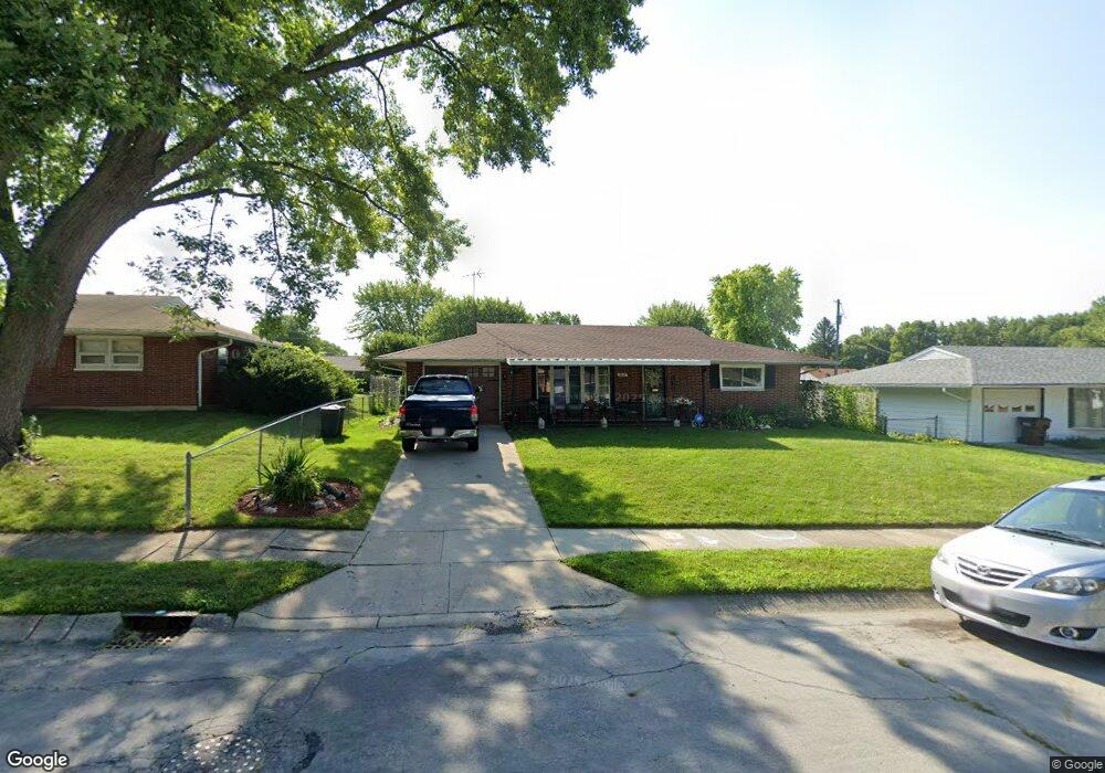
2028 Portage Path Springfield, OH 45506
Estimated Value: $138,000 - $167,000
3
Beds
1
Bath
1,169
Sq Ft
$130/Sq Ft
Est. Value
About This Home
This home is located at 2028 Portage Path, Springfield, OH 45506 and is currently estimated at $151,568, approximately $129 per square foot. 2028 Portage Path is a home located in Clark County with nearby schools including Perrin Woods Elementary School, Hayward Middle School, and Springfield High School.
Ownership History
Date
Name
Owned For
Owner Type
Purchase Details
Closed on
Jun 27, 2002
Sold by
Sagraves Ray M and Sagraves Beverly J
Bought by
Givens Hugh and Givens Sharon
Current Estimated Value
Home Financials for this Owner
Home Financials are based on the most recent Mortgage that was taken out on this home.
Original Mortgage
$77,350
Outstanding Balance
$32,015
Interest Rate
6.93%
Mortgage Type
FHA
Estimated Equity
$119,553
Purchase Details
Closed on
Mar 1, 1984
Create a Home Valuation Report for This Property
The Home Valuation Report is an in-depth analysis detailing your home's value as well as a comparison with similar homes in the area
Home Values in the Area
Average Home Value in this Area
Purchase History
| Date | Buyer | Sale Price | Title Company |
|---|---|---|---|
| Givens Hugh | $78,000 | -- | |
| -- | $9,000 | -- |
Source: Public Records
Mortgage History
| Date | Status | Borrower | Loan Amount |
|---|---|---|---|
| Open | Givens Hugh | $77,350 |
Source: Public Records
Tax History
| Year | Tax Paid | Tax Assessment Tax Assessment Total Assessment is a certain percentage of the fair market value that is determined by local assessors to be the total taxable value of land and additions on the property. | Land | Improvement |
|---|---|---|---|---|
| 2025 | $1,628 | $37,310 | $5,330 | $31,980 |
| 2024 | $1,587 | $32,130 | $4,800 | $27,330 |
| 2023 | $1,587 | $32,130 | $4,800 | $27,330 |
| 2022 | $1,626 | $32,130 | $4,800 | $27,330 |
| 2021 | $1,382 | $25,150 | $3,430 | $21,720 |
| 2020 | $1,385 | $25,150 | $3,430 | $21,720 |
| 2019 | $1,389 | $25,150 | $3,430 | $21,720 |
| 2018 | $1,155 | $20,080 | $2,840 | $17,240 |
| 2017 | $1,154 | $19,866 | $2,835 | $17,031 |
| 2016 | $1,156 | $19,866 | $2,835 | $17,031 |
| 2015 | $1,194 | $19,866 | $2,835 | $17,031 |
| 2014 | $1,189 | $19,866 | $2,835 | $17,031 |
| 2013 | $1,176 | $19,866 | $2,835 | $17,031 |
Source: Public Records
Map
Nearby Homes
- 2000 Springmont Ave
- 2140 Shawnee Ave
- 1920 Russell Ave
- 00 Russell Ave
- 518 Hazelbrook Ave
- 1730 Damascus Ave
- 550 W Parkwood Ave
- 2301 Duquesne Dr
- 1619 S Center Blvd
- 405 W Southern Ave
- 506 W Southern Ave
- 802 Innisfallen Ave
- 1002 S Yellow Springs St
- 929 S Western Ave
- 1754 S Fountain Ave
- 311 W Grand Ave
- 326 W Grand Ave
- 1109 Montgomery Ave
- 1355 S Fountain Ave
- 2642 Springfield Xenia Rd
- 2036 Portage Path
- 2027 Elmsford St
- 2037 Elmsford St
- 2014 Portage Path
- 2019 Elmsford St
- 2027 Portage Path
- 2042 Portage Path
- 754 Knickerbocker Ave
- 2013 Elmsford St
- 2035 Portage Path
- 2041 Elmsford St
- 2019 Portage Path
- 2006 Portage Path
- 2041 Portage Path
- 2013 Portage Path
- 2005 Elmsford St
- 2047 Portage Path
- 2028 Elmsford St
- 2005 Portage Path
- 730 Knickerbocker Ave
Your Personal Tour Guide
Ask me questions while you tour the home.