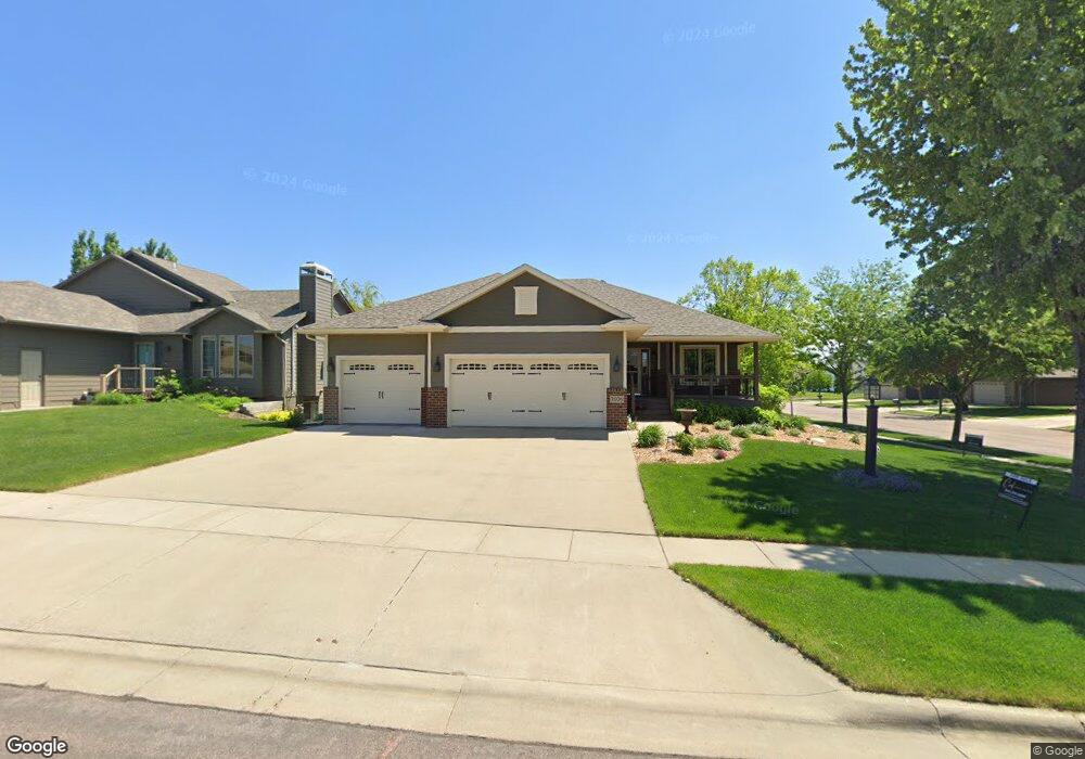
2028 S Shaw Ave Sioux Falls, SD 57106
Northwest Sioux Falls NeighborhoodEstimated Value: $478,000 - $568,000
6
Beds
3
Baths
2,856
Sq Ft
$177/Sq Ft
Est. Value
About This Home
This home is located at 2028 S Shaw Ave, Sioux Falls, SD 57106 and is currently estimated at $506,879, approximately $177 per square foot. 2028 S Shaw Ave is a home located in Minnehaha County with nearby schools including Hayward Elementary School, George McGovern Middle School, and Jefferson High School - 67.
Ownership History
Date
Name
Owned For
Owner Type
Purchase Details
Closed on
Sep 17, 2024
Sold by
Johnson Daniel E and Johnson Deborah K
Bought by
West Kara and West Alexander
Current Estimated Value
Home Financials for this Owner
Home Financials are based on the most recent Mortgage that was taken out on this home.
Original Mortgage
$175,000
Outstanding Balance
$173,029
Interest Rate
6.46%
Estimated Equity
$333,850
Create a Home Valuation Report for This Property
The Home Valuation Report is an in-depth analysis detailing your home's value as well as a comparison with similar homes in the area
Home Values in the Area
Average Home Value in this Area
Purchase History
| Date | Buyer | Sale Price | Title Company |
|---|---|---|---|
| West Kara | $465,000 | Stewart Title Co | |
| West Kara | $465,000 | Stewart Title Co |
Source: Public Records
Mortgage History
| Date | Status | Borrower | Loan Amount |
|---|---|---|---|
| Open | West Kara | $175,000 | |
| Closed | West Kara | $175,000 |
Source: Public Records
Tax History Compared to Growth
Tax History
| Year | Tax Paid | Tax Assessment Tax Assessment Total Assessment is a certain percentage of the fair market value that is determined by local assessors to be the total taxable value of land and additions on the property. | Land | Improvement |
|---|---|---|---|---|
| 2024 | $7,092 | $527,000 | $56,600 | $470,400 |
| 2023 | $7,179 | $514,000 | $38,600 | $475,400 |
| 2022 | $6,695 | $451,700 | $38,600 | $413,100 |
| 2021 | $5,556 | $360,500 | $0 | $0 |
| 2020 | $5,556 | $358,700 | $0 | $0 |
| 2019 | $5,045 | $319,104 | $0 | $0 |
| 2018 | $4,803 | $312,237 | $0 | $0 |
| 2017 | $4,559 | $305,369 | $42,111 | $263,258 |
| 2016 | $4,559 | $289,720 | $40,197 | $249,523 |
| 2015 | $4,481 | $273,694 | $40,196 | $233,498 |
| 2014 | $4,325 | $266,827 | $40,196 | $226,631 |
Source: Public Records
Map
Nearby Homes
- 8708 W Norma Trail
- 8812 W Norma Trail
- 8901 W 32nd St Unit 6
- 0 S Ellis Rd
- 2317 S Katie Ave
- 2028 S Sonoma Place
- 9232 W Norma Trail Unit 2
- 2033 S Sonoma Place
- 2031 S Sonoma Place
- 2027 S Sonoma Place
- 2025 S Sonoma Place
- 9308 W 32nd St Unit 7
- 9308 W 32nd St Unit 10
- 9308 W 32nd St Unit 4
- 9308 W 32nd St Unit 6
- 9308 W 32nd St Unit 9
- 9308 W 32nd St Unit 8
- 9308 W 32nd St Unit 5
- 9308 W 32nd St Unit 2
- 9402 W Broek Dr
- 2024 S Shaw Ave
- 0 S Shaw Ave
- 0 S Shaw Ave
- 2020 S Shaw Ave
- 8700 W Laverne Wipf St
- 2025 S Mary Beth Ave
- 2029 S Shaw Ave
- 8713 W Lavern Wipf St
- 8709 W Lavern Wipf St
- 8717 W Lavern Wipf St
- 2025 S Shaw Ave
- 8705 W Laverne Wipf St St
- 2016 S Shaw Ave
- 8801 W Lavern Wipf St
- 8801 W Laverne Wipf St
- 8705 W Lavern Wipf St
- 8705 W Lavern Wipf St St
- 2021 S Shaw Ave
- 2017 S Mary Beth Ave
- 8701 W Laverne Wipf St