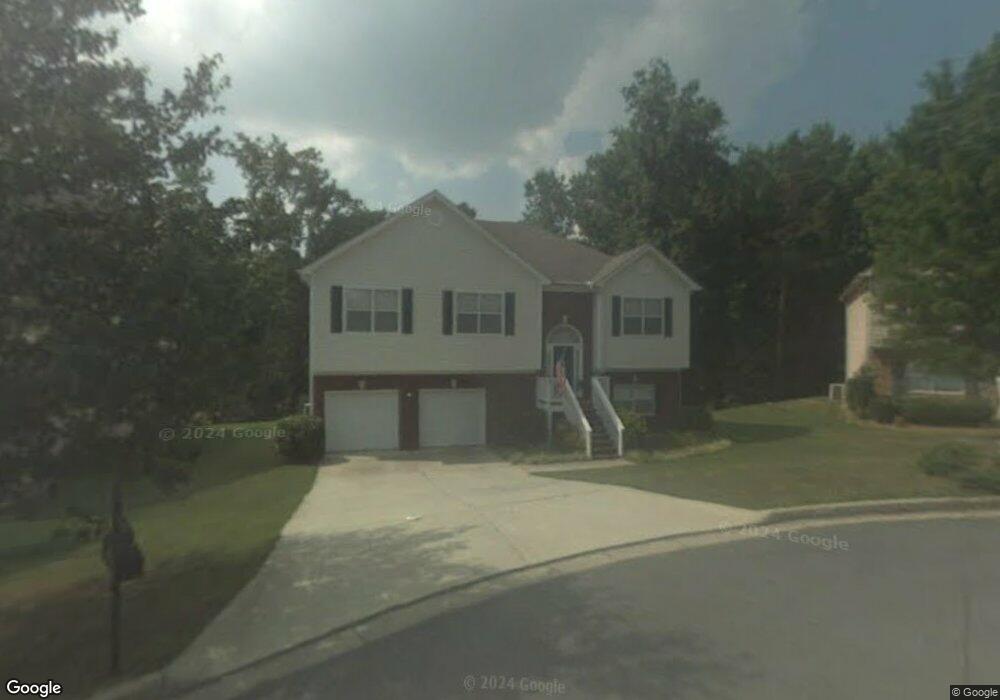
2028 Under Ct Unit 7 Sugar Hill, GA 30518
Estimated Value: $427,000 - $435,000
4
Beds
3
Baths
1,712
Sq Ft
$252/Sq Ft
Est. Value
About This Home
This home is located at 2028 Under Ct Unit 7, Sugar Hill, GA 30518 and is currently estimated at $431,110, approximately $251 per square foot. 2028 Under Ct Unit 7 is a home located in Gwinnett County with nearby schools including Sugar Hill Elementary School, Lanier Middle School, and Lanier High School.
Ownership History
Date
Name
Owned For
Owner Type
Purchase Details
Closed on
Mar 26, 2024
Sold by
Bancroft Ladd William
Bought by
Mann Bancroft Denise and Mann William Bancroft
Current Estimated Value
Purchase Details
Closed on
Jul 13, 1999
Sold by
Our Generations Inc
Bought by
Bancroft Ladd W and Bancroft Denise M
Home Financials for this Owner
Home Financials are based on the most recent Mortgage that was taken out on this home.
Original Mortgage
$137,500
Interest Rate
7.51%
Mortgage Type
VA
Create a Home Valuation Report for This Property
The Home Valuation Report is an in-depth analysis detailing your home's value as well as a comparison with similar homes in the area
Home Values in the Area
Average Home Value in this Area
Purchase History
| Date | Buyer | Sale Price | Title Company |
|---|---|---|---|
| Mann Bancroft Denise | -- | -- | |
| Bancroft Ladd W | $133,500 | -- |
Source: Public Records
Mortgage History
| Date | Status | Borrower | Loan Amount |
|---|---|---|---|
| Previous Owner | Bancroft Ladd W | $137,500 |
Source: Public Records
Tax History Compared to Growth
Tax History
| Year | Tax Paid | Tax Assessment Tax Assessment Total Assessment is a certain percentage of the fair market value that is determined by local assessors to be the total taxable value of land and additions on the property. | Land | Improvement |
|---|---|---|---|---|
| 2025 | $638 | $176,920 | $34,000 | $142,920 |
| 2024 | $4,303 | $180,280 | $32,000 | $148,280 |
| 2023 | $4,303 | $179,920 | $28,000 | $151,920 |
| 2022 | $3,708 | $150,600 | $24,000 | $126,600 |
| 2021 | $3,117 | $118,080 | $18,400 | $99,680 |
| 2020 | $3,359 | $107,680 | $18,400 | $89,280 |
| 2019 | $3,046 | $97,920 | $16,000 | $81,920 |
| 2018 | $2,821 | $88,560 | $12,800 | $75,760 |
| 2016 | $2,602 | $79,840 | $12,800 | $67,040 |
| 2015 | $2,432 | $72,320 | $10,000 | $62,320 |
| 2014 | $2,410 | $71,040 | $10,000 | $61,040 |
Source: Public Records
Map
Nearby Homes
- 384 Sunset Hollow St Unit 2
- 384 Sunset Hollow St
- 5166 Thorin Oak Cir Unit 7
- 965 Under Ct
- 5229 Pine Branch Ct
- 1135 Chastain Dr
- 5152 Park Vale Dr
- The Ellison II Plan at Ellison Square
- The Norwood II Plan at Ellison Square
- The Maddux II Plan at Ellison Square
- 1181 Chastain Dr
- 5059 Hidden Branch Dr
- 5248 Arbor View Ln
- 850 Long Branch Cir
- 4950 Rolling Rock Dr
- 870 Long Branch Cir
- 965 Garner Spring Ln
- 4812 Moonview Ln Unit 4
- 5330 Sycamore Rd
- 345 Sugarview Rd
- 2018 Under Ct
- 2038 Under Ct
- 2008 Under Ct
- 2048 Under Ct Unit 7
- 1098 Under Ct
- 2015 Under Ct Unit 7
- 2058 Under Ct
- 1095 Under Ct
- 5155 Thorin Oak Cir Unit 7
- 5145 Thorin Oak Cir Unit 7
- 5165 Thorin Oak Cir
- 2068 Under Ct
- 1085 Under Ct
- 2065 Under Ct Unit 7
- 2078 Under Ct Unit 7
- 2075 Under Ct
- 5135 Thorin Oak Cir
- 5175 Thorin Oak Cir
- 5125 Thorin Oak Cir Unit 7
- 0 Thorin Oak Cir Unit 7050675