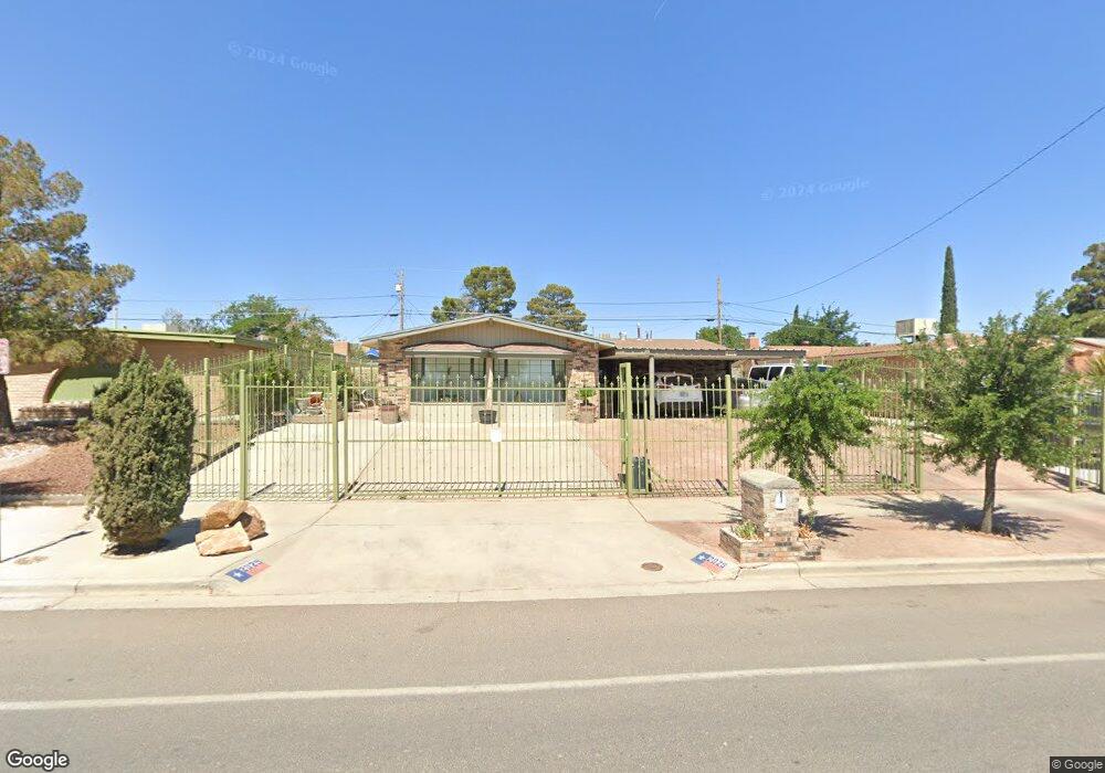
2029 Anise Dr El Paso, TX 79935
Pico Norte NeighborhoodEstimated Value: $234,000 - $259,000
3
Beds
2
Baths
1,992
Sq Ft
$125/Sq Ft
Est. Value
About This Home
This home is located at 2029 Anise Dr, El Paso, TX 79935 and is currently estimated at $248,768, approximately $124 per square foot. 2029 Anise Dr is a home located in El Paso County with nearby schools including Vista Hills Elementary School, J M Hanks High School, and St. Raphael School.
Ownership History
Date
Name
Owned For
Owner Type
Purchase Details
Closed on
Jun 30, 2022
Sold by
Bustamante Pablo E
Bought by
Bustamante Alejandro and Bustamante Lizeth
Current Estimated Value
Purchase Details
Closed on
Dec 10, 1999
Sold by
Bustamante Alejandro and Bustamante Juan M
Bought by
Bustamante Pablo E
Home Financials for this Owner
Home Financials are based on the most recent Mortgage that was taken out on this home.
Original Mortgage
$50,000
Interest Rate
11%
Mortgage Type
Credit Line Revolving
Create a Home Valuation Report for This Property
The Home Valuation Report is an in-depth analysis detailing your home's value as well as a comparison with similar homes in the area
Home Values in the Area
Average Home Value in this Area
Purchase History
| Date | Buyer | Sale Price | Title Company |
|---|---|---|---|
| Bustamante Alejandro | -- | None Listed On Document | |
| Bustamante Pablo E | -- | -- |
Source: Public Records
Mortgage History
| Date | Status | Borrower | Loan Amount |
|---|---|---|---|
| Previous Owner | Bustamante Pablo E | $50,000 |
Source: Public Records
Tax History Compared to Growth
Tax History
| Year | Tax Paid | Tax Assessment Tax Assessment Total Assessment is a certain percentage of the fair market value that is determined by local assessors to be the total taxable value of land and additions on the property. | Land | Improvement |
|---|---|---|---|---|
| 2025 | $6,095 | $248,639 | $36,104 | $212,535 |
| 2024 | $6,095 | $221,930 | $20,154 | $201,776 |
| 2023 | $6,935 | $238,277 | $20,154 | $218,123 |
| 2022 | $5,394 | $173,700 | $0 | $0 |
| 2021 | $5,133 | $157,909 | $20,154 | $137,755 |
| 2020 | $4,688 | $148,411 | $18,294 | $130,117 |
| 2018 | $4,751 | $152,765 | $18,294 | $134,471 |
| 2017 | $4,258 | $139,289 | $18,294 | $120,995 |
| 2016 | $4,258 | $139,289 | $18,294 | $120,995 |
| 2015 | $3,474 | $139,289 | $18,294 | $120,995 |
| 2014 | $3,474 | $144,254 | $18,294 | $125,960 |
Source: Public Records
Map
Nearby Homes
- 2000 Solano Dr
- 1844 Jack Nicklaus Dr Unit 1846
- 2313 Frank Beard Dr
- 2153 Trawood Dr
- 2201 Trawood Dr
- 2109 Febrero Dr
- 2001 Bobby Jones Dr Unit A
- 2009 Bobby Jones Dr Unit B
- 1901 Bobby Jones Dr
- 2105 Pacheco Dr
- 2325 Ken Venturi Ln
- 11012 Bob Stone Dr
- 11016 Bob Stone Dr
- 11013 Bob Stone Dr
- 1730 Bara Dr
- 1817 Hugh Royer Place
- 11008 Johnny Miller Dr
- 10916 Miller Barber Dr
- 2224 Escarpa Dr
- 1644 Lomaland Dr Unit 169