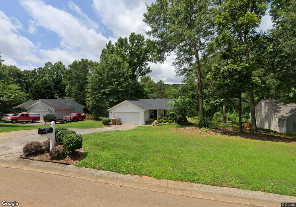
2029 Emerald Pointe Dr Winder, GA 30680
Estimated Value: $314,000 - $326,000
3
Beds
2
Baths
1,295
Sq Ft
$247/Sq Ft
Est. Value
About This Home
This home is located at 2029 Emerald Pointe Dr, Winder, GA 30680 and is currently estimated at $319,257, approximately $246 per square foot. 2029 Emerald Pointe Dr is a home located in Barrow County with nearby schools including Statham Elementary School, Bear Creek Middle School, and Winder-Barrow High School.
Ownership History
Date
Name
Owned For
Owner Type
Purchase Details
Closed on
Jul 31, 2013
Sold by
Bingham Timothy Neil
Bought by
Bingham Timothy Neil and Bingham Beverly Lea
Current Estimated Value
Purchase Details
Closed on
Apr 9, 2004
Sold by
Southfork Hms Inc
Bought by
Bingham Timothy N
Home Financials for this Owner
Home Financials are based on the most recent Mortgage that was taken out on this home.
Original Mortgage
$113,096
Interest Rate
5.35%
Mortgage Type
New Conventional
Purchase Details
Closed on
Mar 5, 2004
Sold by
Sierra Development Inc
Bought by
Southfork Homes Inc
Home Financials for this Owner
Home Financials are based on the most recent Mortgage that was taken out on this home.
Original Mortgage
$113,096
Interest Rate
5.35%
Mortgage Type
New Conventional
Purchase Details
Closed on
Jun 18, 2002
Sold by
Davis George H
Bought by
Sierra Development Inc
Create a Home Valuation Report for This Property
The Home Valuation Report is an in-depth analysis detailing your home's value as well as a comparison with similar homes in the area
Home Values in the Area
Average Home Value in this Area
Purchase History
| Date | Buyer | Sale Price | Title Company |
|---|---|---|---|
| Bingham Timothy Neil | -- | -- | |
| Bingham Timothy N | $111,400 | -- | |
| Southfork Homes Inc | $30,000 | -- | |
| Sierra Development Inc | $419,200 | -- |
Source: Public Records
Mortgage History
| Date | Status | Borrower | Loan Amount |
|---|---|---|---|
| Previous Owner | Bingham Timothy N | $113,096 |
Source: Public Records
Tax History
| Year | Tax Paid | Tax Assessment Tax Assessment Total Assessment is a certain percentage of the fair market value that is determined by local assessors to be the total taxable value of land and additions on the property. | Land | Improvement |
|---|---|---|---|---|
| 2025 | $2,273 | $97,654 | $18,400 | $79,254 |
| 2024 | $2,364 | $95,344 | $18,400 | $76,944 |
| 2023 | $1,965 | $95,944 | $18,400 | $77,544 |
| 2022 | $2,075 | $72,667 | $18,400 | $54,267 |
| 2021 | $1,900 | $63,112 | $16,000 | $47,112 |
| 2020 | $1,900 | $63,112 | $16,000 | $47,112 |
| 2019 | $1,660 | $54,183 | $16,000 | $38,183 |
| 2018 | $1,461 | $48,383 | $10,200 | $38,183 |
| 2017 | $1,080 | $37,108 | $10,200 | $26,908 |
| 2016 | $1,092 | $37,404 | $10,200 | $27,204 |
| 2015 | $1,106 | $37,700 | $10,200 | $27,500 |
| 2014 | $986 | $33,675 | $5,880 | $27,795 |
| 2013 | -- | $32,321 | $5,880 | $26,441 |
Source: Public Records
Map
Nearby Homes
- 1006 English Oak Ln
- 1303 Post Oak Ct
- 1740 Highway 211 NE
- 1453 Solomon Dr
- 1948 Hearthstone Ct
- 311 Anchors Way
- 16 Fox Dr
- 416 Corbin Ct
- 1295 Double Bridges Rd
- 2028 Highway 211 NE
- 41 Meagan St
- 1308 Georgia 82
- 1264 Highway 211 NE
- 113 Platte St
- 1703 Bismarck Cir
- 1415 Blanding Way
- 16 Ga Hwy 211
- 1281 Wentworth Cove Ct
- 207 Cedar Grove Church Rd
- 917 Justin Dr Unit 3
- 2031 Emerald Pointe Dr
- 2027 Emerald Pointe Dr
- 2031 Emerald Pointe Dr Lot16a
- 2033 Emerald Pointe Dr
- 2030 Emerald Pointe Dr
- 2028 Emerald Pointe Dr
- 2032 Emerald Pointe Dr
- 2034 Emerald Pointe Dr
- 1601 White Oak Dr
- 2026 Emerald Pointe Dr
- 2024 Emerald Pointe Dr
- 1600 White Oak Dr
- 2023 Emerald Pointe Dr
- 1603 White Oak Dr
- 1581 Brush Creek Dr
- 1579 Brush Creek Dr
- 1583 Brush Creek Dr Lot31
- 2021 Emerald Pointe Dr
- 1583 Brush Creek Dr
- 1577 Brush Creek Dr
Your Personal Tour Guide
Ask me questions while you tour the home.