Estimated Value: $398,000 - $455,000
3
Beds
3
Baths
2,049
Sq Ft
$206/Sq Ft
Est. Value
About This Home
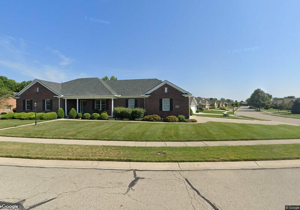
This home is located at 2029 Kitty Hawk Dr, Xenia, OH 45385 and is currently estimated at $421,613, approximately $205 per square foot. 2029 Kitty Hawk Dr is a home located in Greene County with nearby schools including Xenia High School, Summit Academy Community School for Alternative Learners - Xenia, and Legacy Christian Academy.
Ownership History
Date
Name
Owned For
Owner Type
Purchase Details
Closed on
Jun 22, 2017
Bought by
Grimes Catherine A
Current Estimated Value
Purchase Details
Closed on
May 25, 2007
Sold by
P F D Development P L L
Bought by
Grimes Dennis H and Grimes Catherine A
Create a Home Valuation Report for This Property
The Home Valuation Report is an in-depth analysis detailing your home's value as well as a comparison with similar homes in the area
Home Values in the Area
Average Home Value in this Area
Purchase History
| Date | Buyer | Sale Price | Title Company |
|---|---|---|---|
| Grimes Catherine A | -- | -- | |
| Grimes Dennis H | $42,500 | Attorney |
Source: Public Records
Tax History Compared to Growth
Tax History
| Year | Tax Paid | Tax Assessment Tax Assessment Total Assessment is a certain percentage of the fair market value that is determined by local assessors to be the total taxable value of land and additions on the property. | Land | Improvement |
|---|---|---|---|---|
| 2024 | $4,980 | $129,250 | $22,180 | $107,070 |
| 2023 | $4,980 | $129,250 | $22,180 | $107,070 |
| 2022 | $4,358 | $97,860 | $14,790 | $83,070 |
| 2021 | $4,417 | $97,860 | $14,790 | $83,070 |
| 2020 | $4,227 | $97,860 | $14,790 | $83,070 |
| 2019 | $3,941 | $86,950 | $14,630 | $72,320 |
| 2018 | $3,956 | $86,950 | $14,630 | $72,320 |
| 2017 | $3,714 | $86,950 | $14,630 | $72,320 |
| 2016 | $3,715 | $80,840 | $14,630 | $66,210 |
| 2015 | $3,694 | $80,240 | $14,630 | $65,610 |
| 2014 | $3,534 | $80,240 | $14,630 | $65,610 |
Source: Public Records
Map
Nearby Homes
- 2144 Tandem Dr
- 2223 Tandem Dr
- 2096 High Wheel Dr
- 2540 Cornwall Dr
- 2540 Jenny Marie Dr
- 0 Berkshire Dr Unit 942854
- 2499 Jenny Marie Dr
- 2421 Louisiana Dr
- 1255 Colorado Dr
- 1881 Commonwealth Dr
- 2187 Minnesota Dr
- 2265 Minnesota Dr
- 2852 Raxit Ct
- 1908 Whitt St
- 2189 Mississippi Dr
- 2685 Childers Dr
- 1068 Hedges Rd
- 2705 Tennessee Dr
- 1248 Prem Place
- 1766 Gayhart Dr
- 1978 Lakeview Dr
- 1989 Kitty Hawk Dr
- 1968 Lakeview Dr
- 2030 Kitty Hawk Dr
- 2040 Kitty Hawk Dr
- 2020 Kitty Hawk Dr
- 1989 Lakeview Dr
- 1969 Lakeview Dr
- 1958 Lakeview Dr
- 1999 Lakeview Dr
- 2010 Kitty Hawk Dr
- 1959 Lakeview Dr
- 1959 Kitty Hawk Dr
- 2010 Lakeview Dr
- 2007 Lakeview Dr
- Lot # 165 Lakeview Dr
- lot # 203 Lakeview Dr
- lot #201 Lakeview Dr
- lot #193 Lakeview Dr
- lot # 192 Lakeview Dr