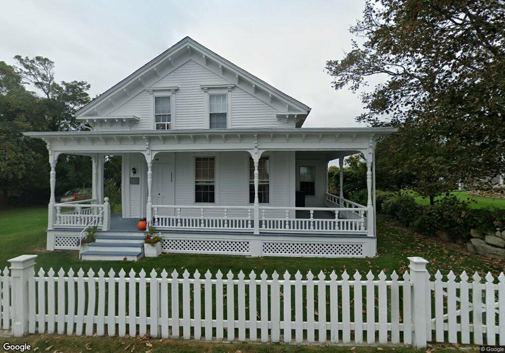
2029 Main Rd Westport Point, MA 02791
Westport Point NeighborhoodEstimated Value: $1,237,000 - $1,950,549
4
Beds
--
Bath
2,289
Sq Ft
$696/Sq Ft
Est. Value
About This Home
This home is located at 2029 Main Rd, Westport Point, MA 02791 and is currently estimated at $1,593,775, approximately $696 per square foot. 2029 Main Rd is a home with nearby schools including Alice A. Macomber Primary School, Westport Elementary School, and Westport Middle-High School.
Ownership History
Date
Name
Owned For
Owner Type
Purchase Details
Closed on
Sep 14, 2012
Sold by
Kulger Robert A
Bought by
Grinnell Rock Nt and Kugler
Current Estimated Value
Purchase Details
Closed on
Apr 2, 2004
Sold by
Bush Louise K
Bought by
Kugler Robert Alexande
Home Financials for this Owner
Home Financials are based on the most recent Mortgage that was taken out on this home.
Original Mortgage
$75,000
Interest Rate
5.56%
Mortgage Type
Purchase Money Mortgage
Purchase Details
Closed on
Jun 30, 1995
Sold by
Kugler Richard Cory
Bought by
Kugler Robert A
Home Financials for this Owner
Home Financials are based on the most recent Mortgage that was taken out on this home.
Original Mortgage
$100,000
Interest Rate
7.8%
Mortgage Type
Purchase Money Mortgage
Create a Home Valuation Report for This Property
The Home Valuation Report is an in-depth analysis detailing your home's value as well as a comparison with similar homes in the area
Home Values in the Area
Average Home Value in this Area
Purchase History
| Date | Buyer | Sale Price | Title Company |
|---|---|---|---|
| Grinnell Rock Nt | -- | -- | |
| Grinnell Rock Nt | -- | -- | |
| Grinnell Rock Nt | -- | -- | |
| Kugler Robert Alexande | $200,000 | -- | |
| Kugler Robert A | $120,000 | -- | |
| Kugler Robert A | $120,000 | -- | |
| Grinnell Rock Nt | -- | -- | |
| Kugler Robert Alexande | $200,000 | -- | |
| Kugler Robert A | $120,000 | -- |
Source: Public Records
Mortgage History
| Date | Status | Borrower | Loan Amount |
|---|---|---|---|
| Previous Owner | Kugler Robert A | $75,000 | |
| Previous Owner | Kugler Robert A | $100,000 |
Source: Public Records
Tax History Compared to Growth
Tax History
| Year | Tax Paid | Tax Assessment Tax Assessment Total Assessment is a certain percentage of the fair market value that is determined by local assessors to be the total taxable value of land and additions on the property. | Land | Improvement |
|---|---|---|---|---|
| 2025 | $14,157 | $1,900,300 | $1,454,900 | $445,400 |
| 2024 | $11,521 | $1,490,400 | $1,051,400 | $439,000 |
| 2023 | $11,292 | $1,383,800 | $1,001,300 | $382,500 |
| 2022 | $10,262 | $1,210,100 | $872,900 | $337,200 |
| 2021 | $8,378 | $971,900 | $758,600 | $213,300 |
| 2020 | $4,433 | $941,500 | $728,200 | $213,300 |
| 2019 | $7,703 | $931,400 | $728,200 | $203,200 |
| 2018 | $4,103 | $1,067,000 | $870,100 | $196,900 |
| 2017 | $8,463 | $1,061,800 | $870,100 | $191,700 |
| 2016 | $8,247 | $1,042,600 | $858,100 | $184,500 |
| 2015 | $8,033 | $1,013,000 | $858,100 | $154,900 |
Source: Public Records
Map
Nearby Homes
- 0 Reed Rd (Ss)
- 1881 Main Rd
- 1702J Drift Rd
- 1702 Drift Rd
- 1580 Main Rd
- 19 Seabury Ln
- 238-242 E Beach Rd
- 99 Sylvia Ln
- 1346 Main Rd Unit B
- 189 Brayton Point Rd
- 304 Brayton Point Rd
- Lot 2 Horseneck Rd
- 255 John Dyer Rd
- 245 John Dyer Rd
- 225 Hixbridge Rd
- 17 Quail Trail
- 920 Drift Rd
- Lot 2E Horseneck Rd
- 101 Adamsville Rd
- 18 Old Barn Rd