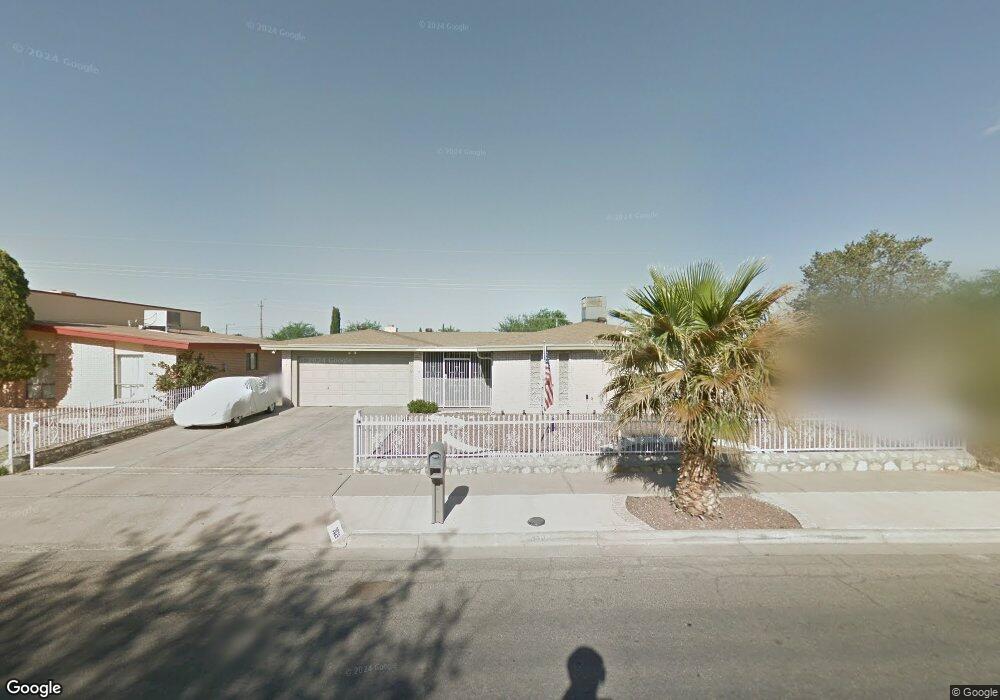
2029 Mermaid Dr El Paso, TX 79936
Glen Cove NeighborhoodEstimated Value: $264,000 - $343,777
3
Beds
2
Baths
1,936
Sq Ft
$153/Sq Ft
Est. Value
About This Home
This home is located at 2029 Mermaid Dr, El Paso, TX 79936 and is currently estimated at $296,694, approximately $153 per square foot. 2029 Mermaid Dr is a home located in El Paso County with nearby schools including Tierra Del Sol Elementary School, J M Hanks High School, and EL PASO LEADERSHIP ACADEMY - MIDDLE EAST.
Ownership History
Date
Name
Owned For
Owner Type
Purchase Details
Closed on
Sep 4, 2002
Sold by
Keegan Richard E and Keegan Therese
Bought by
Aponte Charles E and Aponte Laura E
Current Estimated Value
Home Financials for this Owner
Home Financials are based on the most recent Mortgage that was taken out on this home.
Original Mortgage
$95,880
Interest Rate
5.71%
Mortgage Type
VA
Purchase Details
Closed on
Aug 9, 1996
Sold by
Vasquez Arnold and Vasquez Margaret
Bought by
Keegan Richard E and Keegan Therese
Home Financials for this Owner
Home Financials are based on the most recent Mortgage that was taken out on this home.
Original Mortgage
$86,900
Interest Rate
8.32%
Create a Home Valuation Report for This Property
The Home Valuation Report is an in-depth analysis detailing your home's value as well as a comparison with similar homes in the area
Home Values in the Area
Average Home Value in this Area
Purchase History
| Date | Buyer | Sale Price | Title Company |
|---|---|---|---|
| Aponte Charles E | -- | -- | |
| Keegan Richard E | -- | -- |
Source: Public Records
Mortgage History
| Date | Status | Borrower | Loan Amount |
|---|---|---|---|
| Previous Owner | Aponte Charles E | $95,880 | |
| Previous Owner | Keegan Richard E | $86,900 |
Source: Public Records
Tax History Compared to Growth
Tax History
| Year | Tax Paid | Tax Assessment Tax Assessment Total Assessment is a certain percentage of the fair market value that is determined by local assessors to be the total taxable value of land and additions on the property. | Land | Improvement |
|---|---|---|---|---|
| 2025 | -- | $305,810 | $38,693 | $267,117 |
| 2024 | -- | $291,999 | $24,882 | $267,117 |
| 2023 | $21 | $214,716 | $0 | $0 |
| 2022 | $6,062 | $195,196 | $0 | $0 |
| 2021 | $5,768 | $177,451 | $24,882 | $152,569 |
| 2020 | $5,558 | $175,979 | $21,437 | $154,542 |
| 2018 | $5,483 | $176,331 | $21,437 | $154,894 |
| 2017 | $4,953 | $162,042 | $21,437 | $140,605 |
| 2016 | $4,562 | $149,260 | $21,437 | $127,823 |
| 2015 | $3,335 | $149,260 | $21,437 | $127,823 |
| 2014 | $3,335 | $149,959 | $21,437 | $128,522 |
Source: Public Records
Map
Nearby Homes
- 1913 Seagull Dr
- 1868 Tom Bolt Dr
- 2604 Anise Dr
- 11016 Bob Stone Dr
- 11013 Bob Stone Dr
- 11012 Bob Stone Dr
- 2009 Bobby Jones Dr Unit B
- 2001 Bobby Jones Dr Unit A
- 2308 Tom Watson Ct
- 1817 Hugh Royer Place
- 1901 Bobby Jones Dr
- 11008 Johnny Miller Dr
- 2348 Sea Side Dr
- 2101 E Glen Dr
- 2325 Ken Venturi Ln
- 11276 Skipper Dr
- 11132 Wharf Cove Dr
- 1804 Jerry Abbott St
- 1844 Jack Nicklaus Dr Unit 1846
- 11201 Skipper Dr
- 2033 Mermaid Dr
- 2025 Mermaid Dr
- 2021 Mermaid Dr
- 2101 Mermaid Dr
- 2100 Sea Palm Dr
- 2001 Sea Cove Dr
- 2024 Lee Elder Dr
- 2020 Lee Elder Dr
- 2028 Lee Elder Dr
- 2017 Mermaid Dr
- 2105 Mermaid Dr
- 2104 Sea Palm Dr
- 2101 Sea Palm Dr
- 2005 Sea Cove Dr
- 2016 Lee Elder Dr
- 2100 Lee Elder Dr
- 2105 Sea Palm Dr
- 2109 Mermaid Dr
- 2012 Lee Elder Dr
- 2013 Mermaid Dr