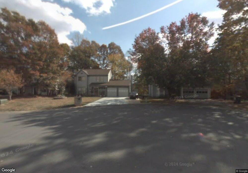
2029 Montgomery Trail Duluth, GA 30096
Estimated Value: $340,456 - $404,000
3
Beds
3
Baths
1,894
Sq Ft
$200/Sq Ft
Est. Value
About This Home
This home is located at 2029 Montgomery Trail, Duluth, GA 30096 and is currently estimated at $379,114, approximately $200 per square foot. 2029 Montgomery Trail is a home located in Gwinnett County with nearby schools including Beaver Ridge Elementary School, Summerour Middle School, and Norcross High School.
Ownership History
Date
Name
Owned For
Owner Type
Purchase Details
Closed on
May 21, 2024
Sold by
Swier Lori
Bought by
Htl Realty Llc
Current Estimated Value
Purchase Details
Closed on
Aug 28, 2009
Sold by
Swier Robert W
Bought by
Swier Craig A and Swier Lori
Home Financials for this Owner
Home Financials are based on the most recent Mortgage that was taken out on this home.
Original Mortgage
$101,590
Interest Rate
5.15%
Mortgage Type
Trade
Create a Home Valuation Report for This Property
The Home Valuation Report is an in-depth analysis detailing your home's value as well as a comparison with similar homes in the area
Home Values in the Area
Average Home Value in this Area
Purchase History
| Date | Buyer | Sale Price | Title Company |
|---|---|---|---|
| Htl Realty Llc | $275,000 | -- | |
| Swier Craig A | $100,000 | -- |
Source: Public Records
Mortgage History
| Date | Status | Borrower | Loan Amount |
|---|---|---|---|
| Previous Owner | Swier Craig A | $101,590 |
Source: Public Records
Tax History Compared to Growth
Tax History
| Year | Tax Paid | Tax Assessment Tax Assessment Total Assessment is a certain percentage of the fair market value that is determined by local assessors to be the total taxable value of land and additions on the property. | Land | Improvement |
|---|---|---|---|---|
| 2024 | $3,926 | $146,240 | $26,800 | $119,440 |
| 2023 | $3,926 | $146,240 | $26,800 | $119,440 |
| 2022 | $3,566 | $130,640 | $22,000 | $108,640 |
| 2021 | $2,852 | $93,800 | $16,080 | $77,720 |
| 2020 | $2,873 | $93,800 | $16,080 | $77,720 |
| 2019 | $2,226 | $83,080 | $12,800 | $70,280 |
| 2018 | $2,006 | $66,800 | $10,800 | $56,000 |
| 2016 | $1,704 | $46,600 | $7,200 | $39,400 |
| 2015 | $1,722 | $46,600 | $7,200 | $39,400 |
| 2014 | -- | $46,600 | $7,200 | $39,400 |
Source: Public Records
Map
Nearby Homes
- 4565 Satellite Blvd
- 2032 Hopkins Mill Rd
- 2082 Montgomery Trail
- 4375 Hopkins Run Dr
- 4781 Valley Ridge Dr
- 4409 Creek Ford Trace
- 4787 Greenway Rd
- 4880 Racquet Ct
- 4827 Royal Dr NW
- 2385 Muirfield Way
- 4916 High Forest Dr
- 5041 Rockborough Trail Unit 3
- 5055 Running Fox Trail
- 4767 Glenwhite Dr
- 4935 Rockborough Trail
- 4114 Berkeley Mill Close
- 4300 Wildridge Dr
- 2250 Berkeley Creek Ct Unit 2
- 5106 Rockborough Trail
- 3991 Centennial Trail
- 4559 Satellite Blvd
- 2035 Montgomery Trail
- 2041 Montgomery Trail
- 2024 Montgomery Trail
- 4571 Satellite Blvd
- 4560 Satellite Blvd Unit B101
- 2030 Montgomery Trail
- 2047 Montgomery Trail
- 2042 Montgomery Trail
- 2036 Montgomery Trail
- 2044 Hopkins Mill Rd
- 2038 Hopkins Mill Rd
- 2050 Hopkins Mill Rd
- 2053 Montgomery Trail
- 0 Montgomery Trail Unit 7214244
- 0 Montgomery Trail Unit 7093254
- 0 Montgomery Trail Unit 7061424
- 0 Montgomery Trail Unit 8561725
- 0 Montgomery Trail Unit 7552606
- 2056 Hopkins Mill Rd