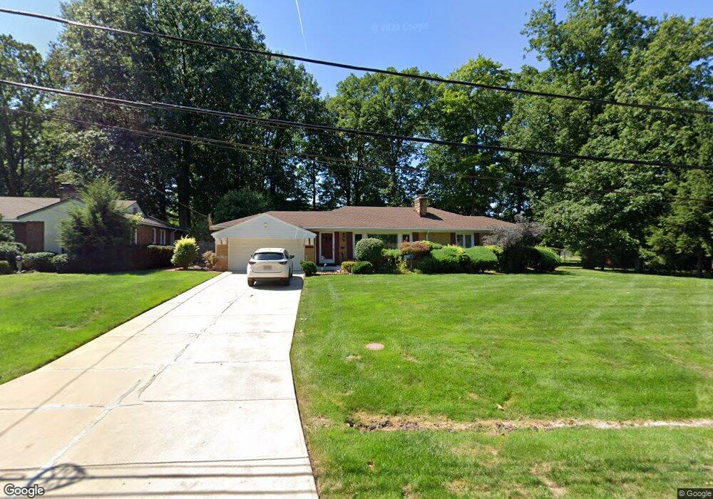
2029 Natona Rd Euclid, OH 44117
Estimated Value: $167,000 - $188,982
3
Beds
2
Baths
1,461
Sq Ft
$122/Sq Ft
Est. Value
About This Home
This home is located at 2029 Natona Rd, Euclid, OH 44117 and is currently estimated at $178,746, approximately $122 per square foot. 2029 Natona Rd is a home located in Cuyahoga County with nearby schools including Bluestone Elementary School, Euclid Middle School, and Euclid High School.
Ownership History
Date
Name
Owned For
Owner Type
Purchase Details
Closed on
Oct 28, 2002
Sold by
Booker Lee and Booker Jane
Bought by
Booker Lee and Booker Jane A
Current Estimated Value
Purchase Details
Closed on
Jun 26, 1987
Sold by
Thomas John F
Bought by
Booker Lee
Purchase Details
Closed on
Dec 30, 1985
Sold by
Keefe Joyce Ann Kemp
Bought by
Thomas John F
Purchase Details
Closed on
Mar 12, 1984
Sold by
Keefe Wilbur R
Bought by
Keefe Joyce Ann Kemp
Purchase Details
Closed on
Dec 30, 1977
Sold by
Wesolowski Stanley and Wesolowski Anna
Bought by
Keefe Wilbur R
Purchase Details
Closed on
Jan 1, 1975
Bought by
Wesolowski Stanley and Wesolowski Anna
Create a Home Valuation Report for This Property
The Home Valuation Report is an in-depth analysis detailing your home's value as well as a comparison with similar homes in the area
Home Values in the Area
Average Home Value in this Area
Purchase History
| Date | Buyer | Sale Price | Title Company |
|---|---|---|---|
| Booker Lee | -- | -- | |
| Booker Lee | $85,000 | -- | |
| Thomas John F | $53,000 | -- | |
| Keefe Joyce Ann Kemp | -- | -- | |
| Keefe Wilbur R | $74,000 | -- | |
| Wesolowski Stanley | -- | -- |
Source: Public Records
Tax History
| Year | Tax Paid | Tax Assessment Tax Assessment Total Assessment is a certain percentage of the fair market value that is determined by local assessors to be the total taxable value of land and additions on the property. | Land | Improvement |
|---|---|---|---|---|
| 2025 | $2,725 | $51,660 | $13,475 | $38,185 |
| 2024 | $2,918 | $51,660 | $13,475 | $38,185 |
| 2023 | $3,041 | $44,240 | $10,570 | $33,670 |
| 2022 | $3,005 | $44,240 | $10,570 | $33,670 |
| 2021 | $3,338 | $44,240 | $10,570 | $33,670 |
| 2020 | $2,600 | $33,530 | $8,020 | $25,520 |
| 2019 | $2,337 | $95,800 | $22,900 | $72,900 |
| 2018 | $2,198 | $33,530 | $8,020 | $25,520 |
| 2017 | $2,210 | $28,040 | $6,340 | $21,700 |
| 2016 | $2,215 | $28,040 | $6,340 | $21,700 |
| 2015 | $2,019 | $28,040 | $6,340 | $21,700 |
| 2014 | $2,019 | $28,040 | $6,340 | $21,700 |
Source: Public Records
Map
Nearby Homes
- 2017 Natona Rd
- 18079 Blandford Rd
- 18062 Blandford Rd
- 19871 Upper Valley Dr
- 19201 Shawnee Rd
- 19151 Genesee Rd
- 2460 Belvoir Blvd
- 19201 Genesee Rd
- 11 Trenton Square Unit T27
- 1566 E 195th St
- 1872 Torbenson Dr
- 1849 Torbenson Dr
- 3936 Lancaster Rd
- 1769 Burgess Rd
- 24 Washington Square Unit 15
- 1721 Grand Blvd
- 20021 Green Oak Dr
- 4002 Lancaster Rd
- 209 Greenbriar Ct
- 18120 Olympia Rd
Your Personal Tour Guide
Ask me questions while you tour the home.