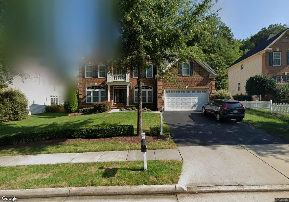
2029 Powells Landing Cir Woodbridge, VA 22191
Estimated Value: $846,109 - $957,000
4
Beds
5
Baths
3,974
Sq Ft
$223/Sq Ft
Est. Value
About This Home
This home is located at 2029 Powells Landing Cir, Woodbridge, VA 22191 and is currently estimated at $886,277, approximately $223 per square foot. 2029 Powells Landing Cir is a home located in Prince William County with nearby schools including Leesylvania Elementary School, Potomac Middle School, and Potomac High School.
Ownership History
Date
Name
Owned For
Owner Type
Purchase Details
Closed on
May 25, 2006
Sold by
Nvr Inc
Bought by
Point Coren C
Current Estimated Value
Home Financials for this Owner
Home Financials are based on the most recent Mortgage that was taken out on this home.
Original Mortgage
$767,600
Outstanding Balance
$447,858
Interest Rate
6.53%
Mortgage Type
New Conventional
Estimated Equity
$438,419
Create a Home Valuation Report for This Property
The Home Valuation Report is an in-depth analysis detailing your home's value as well as a comparison with similar homes in the area
Home Values in the Area
Average Home Value in this Area
Purchase History
| Date | Buyer | Sale Price | Title Company |
|---|---|---|---|
| Point Coren C | $959,523 | -- |
Source: Public Records
Mortgage History
| Date | Status | Borrower | Loan Amount |
|---|---|---|---|
| Open | Point Coren C | $767,600 |
Source: Public Records
Tax History Compared to Growth
Tax History
| Year | Tax Paid | Tax Assessment Tax Assessment Total Assessment is a certain percentage of the fair market value that is determined by local assessors to be the total taxable value of land and additions on the property. | Land | Improvement |
|---|---|---|---|---|
| 2025 | $7,771 | $810,100 | $240,400 | $569,700 |
| 2024 | $7,771 | $781,400 | $231,100 | $550,300 |
| 2023 | $7,774 | $747,100 | $220,100 | $527,000 |
| 2022 | $7,884 | $701,600 | $205,700 | $495,900 |
| 2021 | $7,674 | $631,700 | $185,300 | $446,400 |
| 2020 | $9,185 | $592,600 | $174,800 | $417,800 |
| 2019 | $9,405 | $606,800 | $169,800 | $437,000 |
| 2018 | $6,938 | $574,600 | $161,700 | $412,900 |
| 2017 | $7,065 | $576,400 | $160,100 | $416,300 |
| 2016 | $7,234 | $596,200 | $165,000 | $431,200 |
| 2015 | $7,284 | $603,300 | $166,700 | $436,600 |
| 2014 | $7,284 | $587,600 | $161,900 | $425,700 |
Source: Public Records
Map
Nearby Homes
- 16309 Sandy Ridge Ct
- 16830 Tidewater Ct
- 2114 Jellico Ct
- 16068 Hayes Ln
- 16660 Bolling Brook Ct
- 16363 Rusty Rudder Dr
- 16862 Reef Knot Way
- 2424 Five Fathom Cir
- 2620 Cast Off Loop
- 16559 Bramblewood Ln
- 16518 Bobster Ct
- 2679 Cast Off Loop
- 2610 Grayton Ln
- 17080 Belle Isle Dr
- 2606 Oak Valley Dr
- 2119 Callao Ct
- 2433 Battery Hill Cir
- 16249 Chase Eagle Ln
- 2728 Brier Pond Cir
- 16879 Sea Lawn Place
- 2025 Powells Landing Cir
- 2033 Powells Landing Cir
- 2021 Powells Landing Cir
- 2037 Powells Landing Cir
- 16301 Sandy Ridge Ct
- 16300 Sandy Ridge Ct
- 16305 Sandy Ridge Ct
- 2036 Powells Landing Cir
- 2041 Powells Landing Cir
- 2017 Powells Landing Cir
- 2042 Powells Landing Cir
- 2013 Powells Landing Cir
- 16304 Sandy Ridge Ct
- 2045 Powells Landing Cir
- 2051 Powells Landing Cir
- 2046 Powells Landing Cir
- 16308 Sandy Ridge Ct
- 2009 Powells Landing Cir
- 2047 Powells Landing Cir
- 2024 Port Potomac Ave