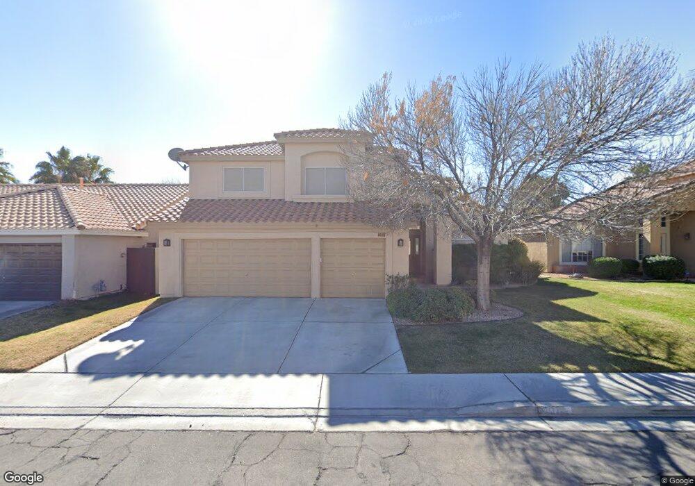
2029 Shadow Brook Way Henderson, NV 89074
Green Valley North NeighborhoodEstimated Value: $625,198 - $691,000
5
Beds
3
Baths
2,976
Sq Ft
$221/Sq Ft
Est. Value
About This Home
This home is located at 2029 Shadow Brook Way, Henderson, NV 89074 and is currently estimated at $657,300, approximately $220 per square foot. 2029 Shadow Brook Way is a home located in Clark County with nearby schools including James Gibson Elementary School, Barbara and Hank Greenspun Junior High School, and Green Valley High School.
Ownership History
Date
Name
Owned For
Owner Type
Purchase Details
Closed on
Nov 20, 1998
Sold by
Davis Andrew C and Davis Rita J
Bought by
Lane Thomas D and Lane Susan T
Current Estimated Value
Home Financials for this Owner
Home Financials are based on the most recent Mortgage that was taken out on this home.
Original Mortgage
$208,050
Outstanding Balance
$40,442
Interest Rate
6.42%
Estimated Equity
$616,858
Purchase Details
Closed on
Dec 29, 1993
Sold by
Davis Andrew C and Davis Rita J
Bought by
Davis Andrew Clarence and Davis Rita Jean
Home Financials for this Owner
Home Financials are based on the most recent Mortgage that was taken out on this home.
Original Mortgage
$150,000
Interest Rate
3.87%
Purchase Details
Closed on
Dec 20, 1993
Sold by
Davis Andrew C and Davis Rita J
Bought by
Davis Andrew C and Davis Rita J
Home Financials for this Owner
Home Financials are based on the most recent Mortgage that was taken out on this home.
Original Mortgage
$150,000
Interest Rate
3.87%
Create a Home Valuation Report for This Property
The Home Valuation Report is an in-depth analysis detailing your home's value as well as a comparison with similar homes in the area
Home Values in the Area
Average Home Value in this Area
Purchase History
| Date | Buyer | Sale Price | Title Company |
|---|---|---|---|
| Lane Thomas D | $219,000 | Ati Title | |
| Davis Andrew Clarence | -- | -- | |
| Davis Andrew C | -- | Nevada Title Company |
Source: Public Records
Mortgage History
| Date | Status | Borrower | Loan Amount |
|---|---|---|---|
| Open | Lane Thomas D | $208,050 | |
| Previous Owner | Davis Andrew C | $150,000 |
Source: Public Records
Tax History
| Year | Tax Paid | Tax Assessment Tax Assessment Total Assessment is a certain percentage of the fair market value that is determined by local assessors to be the total taxable value of land and additions on the property. | Land | Improvement |
|---|---|---|---|---|
| 2026 | $3,725 | $122,980 | $37,538 | $85,442 |
| 2025 | $3,460 | $125,715 | $37,538 | $88,177 |
| 2024 | $3,205 | $125,715 | $37,538 | $88,177 |
| 2023 | $3,205 | $122,082 | $37,538 | $84,544 |
| 2022 | $2,968 | $110,681 | $32,603 | $78,078 |
| 2021 | $2,748 | $102,290 | $27,563 | $74,727 |
| 2020 | $2,549 | $99,827 | $25,200 | $74,627 |
| 2019 | $2,389 | $97,989 | $23,888 | $74,101 |
| 2018 | $2,279 | $92,460 | $21,000 | $71,460 |
| 2017 | $2,725 | $94,006 | $21,000 | $73,006 |
| 2016 | $2,134 | $89,167 | $15,750 | $73,417 |
| 2015 | $2,129 | $83,111 | $10,763 | $72,348 |
| 2014 | $2,067 | $69,232 | $10,763 | $58,469 |
Source: Public Records
Map
Nearby Homes
- 2005 Pinion Springs Dr
- 222 Windsong Dr
- 227 Drysdale Cir
- 2104 Inverness Dr
- 2108 Inverness Dr
- 231 Windsong Dr
- 2052 Angel Falls Dr
- 272 Grand Teton Dr
- 246 Windsong Dr
- 197 Reed Ln
- 2087 Angel Falls Dr
- 2222 Versailles Ct
- 290 Grand Teton Dr
- 2108 Running River Rd
- 1910 Kransten Dr
- 2218 Armacost Dr
- 2239 Chatsworth Ct
- 2010 Catalina Marie Ave
- 2127 Tyler Dr
- 2244 Sisley Place
- 2031 Shadow Brook Way
- 2027 Shadow Brook Way
- 2033 Shadow Brook Way
- 2030 Shadow Brook Way
- 2025 Shadow Brook Way
- 2025 Shadow Brook Way
- 2028 Shadow Brook Way
- 2032 Shadow Brook Way
- 2026 Pinion Springs Dr
- 2024 Pinion Springs Dr
- 2026 Shadow Brook Way
- 2028 Pinion Springs Dr
- 2034 Shadow Brook Way
- 2022 Pinion Springs Dr
- 2035 Shadow Brook Way
- 2023 Shadow Brook Way
- 2023 Shadow Brook Way
- 2030 Pinion Springs Dr Unit 1
- 2024 Shadow Brook Way
- 2020 Pinion Springs Dr
Your Personal Tour Guide
Ask me questions while you tour the home.