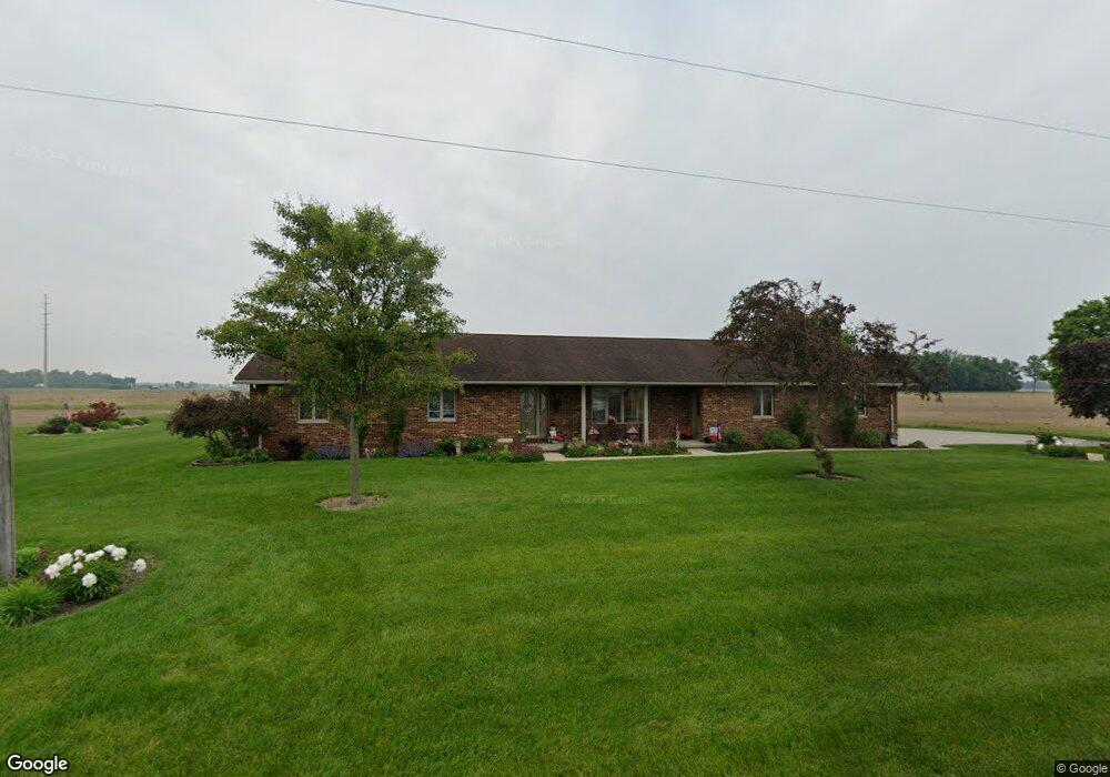
20293 Road 22 Fort Jennings, OH 45844
Estimated Value: $313,000 - $449,000
--
Bed
1
Bath
1,896
Sq Ft
$197/Sq Ft
Est. Value
About This Home
This home is located at 20293 Road 22, Fort Jennings, OH 45844 and is currently estimated at $372,857, approximately $196 per square foot. 20293 Road 22 is a home located in Putnam County with nearby schools including Fort Jennings Elementary School and Fort Jennings High School.
Ownership History
Date
Name
Owned For
Owner Type
Purchase Details
Closed on
Aug 27, 2021
Sold by
Berelsman Thomas A
Bought by
Tbmaj Llc
Current Estimated Value
Purchase Details
Closed on
Aug 29, 2006
Sold by
Murphy Craig D and Murphy Dawn M
Bought by
Berelsman Thomas A and Berelsman Beverly A
Home Financials for this Owner
Home Financials are based on the most recent Mortgage that was taken out on this home.
Original Mortgage
$100,900
Interest Rate
6.78%
Mortgage Type
Purchase Money Mortgage
Create a Home Valuation Report for This Property
The Home Valuation Report is an in-depth analysis detailing your home's value as well as a comparison with similar homes in the area
Home Values in the Area
Average Home Value in this Area
Purchase History
| Date | Buyer | Sale Price | Title Company |
|---|---|---|---|
| Tbmaj Llc | $325,000 | None Available | |
| Berelsman Thomas A | -- | None Available | |
| Berelsman Beverly Ann | -- | None Available | |
| Berelsman Thomas A | $115,500 | None Available |
Source: Public Records
Mortgage History
| Date | Status | Borrower | Loan Amount |
|---|---|---|---|
| Previous Owner | Berelsman Thomas A | $100,900 |
Source: Public Records
Tax History Compared to Growth
Tax History
| Year | Tax Paid | Tax Assessment Tax Assessment Total Assessment is a certain percentage of the fair market value that is determined by local assessors to be the total taxable value of land and additions on the property. | Land | Improvement |
|---|---|---|---|---|
| 2024 | $2,606 | $89,140 | $5,230 | $83,910 |
| 2023 | $2,699 | $71,470 | $4,100 | $67,370 |
| 2022 | $2,381 | $71,471 | $4,099 | $67,372 |
| 2021 | $2,394 | $71,470 | $4,100 | $67,370 |
| 2020 | $2,402 | $59,680 | $3,420 | $56,260 |
| 2019 | $2,050 | $61,620 | $4,100 | $57,520 |
| 2018 | $2,024 | $61,620 | $4,100 | $57,520 |
| 2017 | $2,081 | $61,620 | $4,100 | $57,520 |
| 2016 | $1,973 | $59,680 | $3,420 | $56,260 |
| 2015 | $2,166 | $59,680 | $3,420 | $56,260 |
| 2014 | $2,190 | $59,680 | $3,420 | $56,260 |
| 2013 | $2,234 | $59,680 | $3,420 | $56,260 |
Source: Public Records
Map
Nearby Homes
- 22345 Road T
- 804 N Moening St
- 650 E 6th St
- 914 E 3rd St
- 821 E 3rd St
- 7510 State Route 66
- 7110 Elida Rd
- 810 N Franklin St
- 628 N Pierce St
- 1035 N Main St
- 704 N Franklin St
- 633 E 2nd St
- 6585 Huffer Rd
- 405 N Franklin St
- 702 Jackson St
- 210 E 3rd St
- 0 Heritage Cir Unit 6112034
- 0 Heritage Cir Unit 303239
- 310 S Pierce St
- 404 W 5th St