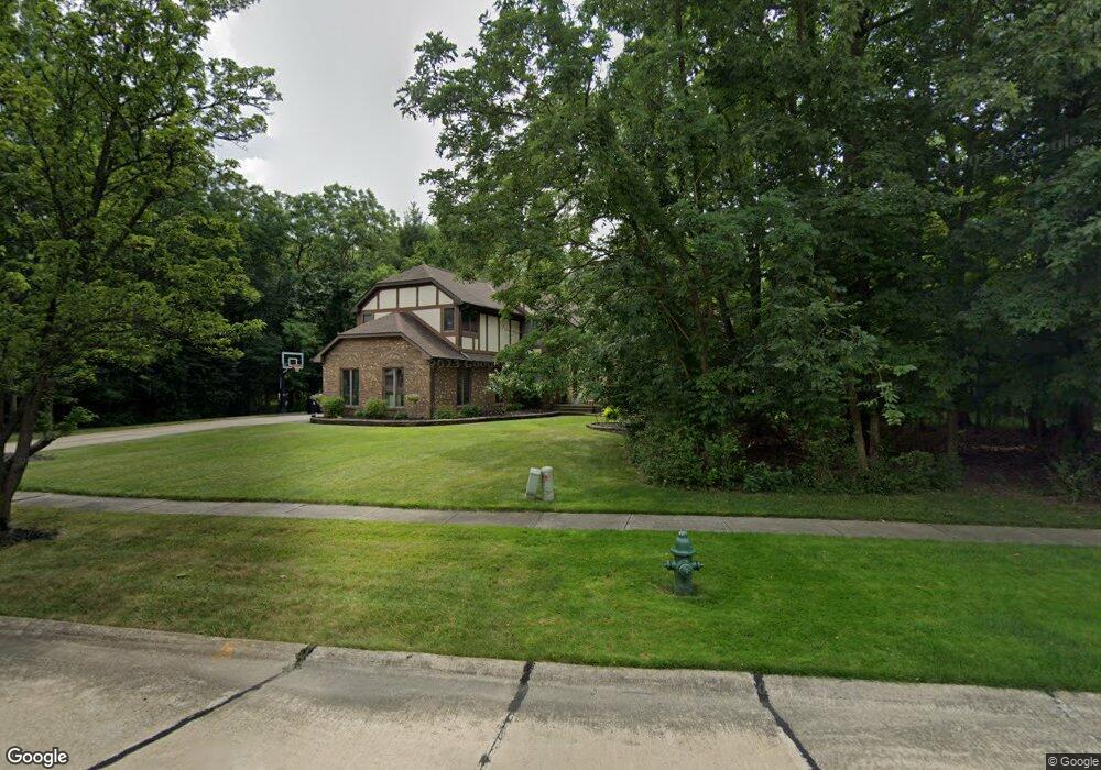
20297 Scott Dr Strongsville, OH 44149
Estimated Value: $516,187 - $549,000
4
Beds
3
Baths
3,274
Sq Ft
$163/Sq Ft
Est. Value
About This Home
This home is located at 20297 Scott Dr, Strongsville, OH 44149 and is currently estimated at $534,297, approximately $163 per square foot. 20297 Scott Dr is a home located in Cuyahoga County with nearby schools including Strongsville High School, Strongsville Academy, and Strongsville Montessori School.
Ownership History
Date
Name
Owned For
Owner Type
Purchase Details
Closed on
Nov 26, 2018
Sold by
Krenz Paul R and Krenz Lisa
Bought by
Krenz Paul R and Krenz Lisa
Current Estimated Value
Home Financials for this Owner
Home Financials are based on the most recent Mortgage that was taken out on this home.
Original Mortgage
$250,000
Outstanding Balance
$220,255
Interest Rate
4.8%
Mortgage Type
New Conventional
Estimated Equity
$314,042
Purchase Details
Closed on
May 2, 2000
Sold by
Alfred Krist
Bought by
Krenz Paul R
Home Financials for this Owner
Home Financials are based on the most recent Mortgage that was taken out on this home.
Original Mortgage
$225,000
Interest Rate
8.24%
Purchase Details
Closed on
Jan 1, 1990
Bought by
Krist Alfred and Krist T
Create a Home Valuation Report for This Property
The Home Valuation Report is an in-depth analysis detailing your home's value as well as a comparison with similar homes in the area
Home Values in the Area
Average Home Value in this Area
Purchase History
| Date | Buyer | Sale Price | Title Company |
|---|---|---|---|
| Krenz Paul R | -- | Hbi Title Services | |
| Krenz Paul R | $285,000 | Chicago Title | |
| Krist Alfred | -- | -- |
Source: Public Records
Mortgage History
| Date | Status | Borrower | Loan Amount |
|---|---|---|---|
| Open | Krenz Paul R | $250,000 | |
| Closed | Krenz Paul R | $225,000 |
Source: Public Records
Tax History Compared to Growth
Tax History
| Year | Tax Paid | Tax Assessment Tax Assessment Total Assessment is a certain percentage of the fair market value that is determined by local assessors to be the total taxable value of land and additions on the property. | Land | Improvement |
|---|---|---|---|---|
| 2024 | $7,531 | $160,405 | $33,215 | $127,190 |
| 2023 | $7,780 | $124,250 | $30,870 | $93,380 |
| 2022 | $7,723 | $355,000 | $88,200 | $266,800 |
| 2021 | $7,662 | $124,250 | $30,870 | $93,380 |
| 2020 | $8,171 | $117,220 | $29,120 | $88,100 |
| 2019 | $7,932 | $334,900 | $83,200 | $251,700 |
| 2018 | $7,168 | $117,220 | $29,120 | $88,100 |
| 2017 | $7,270 | $109,590 | $25,660 | $83,930 |
| 2016 | $7,211 | $109,590 | $25,660 | $83,930 |
| 2015 | $6,834 | $109,590 | $25,660 | $83,930 |
| 2014 | $6,834 | $102,420 | $23,980 | $78,440 |
Source: Public Records
Map
Nearby Homes
- 20078 Trapper Trail
- 15017 Regency Dr
- 14896 Britannia Ct
- 20678 Spruce Dr
- 19620 Porters Ln Unit 15F
- 14890 Prospect Rd
- 14400 Prospect Rd
- 15279 Walnut Creek Dr
- 19513 Lunn Rd
- 14112 Settlers Way
- VL Lunn Rd
- 15001 Scarlet Oak Trail
- 15447 Oak Hollow Ln
- 13236 Tomson Dr
- 15379 Old Oak Dr
- 19160 Wheelers Ln
- 19908 Stoughton Dr
- 13156 Olympus Way
- 13066 Olympus Way
- 12651 Alameda Dr
- 20341 Scott Dr
- 20266 Scott Dr
- 20284 Scott Dr
- 20328 Scott Dr
- 20302 Scott Dr
- 14802 Cortland Way
- 20373 Scott Dr
- 20354 Scott Dr
- 20248 Scott Dr
- 20380 Scott Dr
- 14836 Cortland Way
- 20230 Scott Dr
- 14870 Cortland Way
- 20406 Scott Dr
- 14571 Shireen Dr
- 14904 Cortland Way
- 14749 Cortland Way
- 20432 Scott Dr
- 14785 Cortland Way
- 14938 Cortland Way