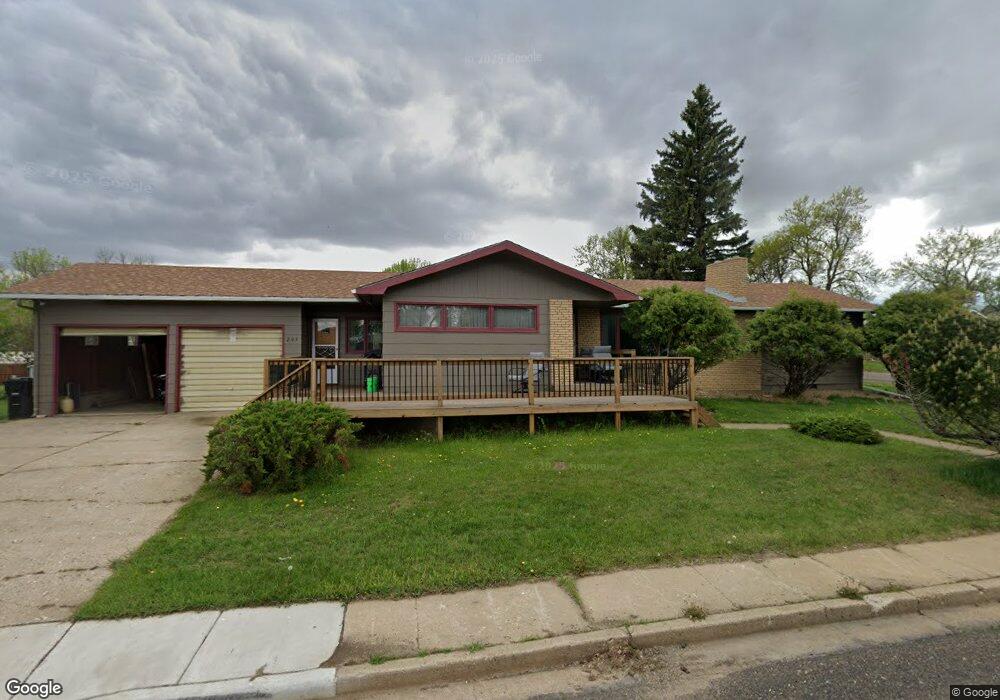
203 2nd Ave E Richardton, ND 58652
Estimated Value: $214,000 - $259,000
3
Beds
2
Baths
1,388
Sq Ft
$169/Sq Ft
Est. Value
About This Home
This home is located at 203 2nd Ave E, Richardton, ND 58652 and is currently estimated at $234,355, approximately $168 per square foot. 203 2nd Ave E is a home located in Stark County with nearby schools including Taylor-Richardton Elementary School and Richardton-Taylor High School.
Ownership History
Date
Name
Owned For
Owner Type
Purchase Details
Closed on
Nov 1, 2019
Sold by
Messer Anita L and Messer Revocable Livin Anita L
Bought by
Frederick Todd P
Current Estimated Value
Home Financials for this Owner
Home Financials are based on the most recent Mortgage that was taken out on this home.
Original Mortgage
$85,510
Outstanding Balance
$55,442
Interest Rate
3.65%
Estimated Equity
$178,913
Purchase Details
Closed on
Jun 19, 2008
Sold by
Messer Anita and Estate Of George Messer
Bought by
Messer Anita
Create a Home Valuation Report for This Property
The Home Valuation Report is an in-depth analysis detailing your home's value as well as a comparison with similar homes in the area
Purchase History
| Date | Buyer | Sale Price | Title Company |
|---|---|---|---|
| Frederick Todd P | $165,000 | None Available | |
| Messer Anita | -- | None Available |
Source: Public Records
Mortgage History
| Date | Status | Borrower | Loan Amount |
|---|---|---|---|
| Open | Frederick Todd P | $85,510 |
Source: Public Records
Tax History
| Year | Tax Paid | Tax Assessment Tax Assessment Total Assessment is a certain percentage of the fair market value that is determined by local assessors to be the total taxable value of land and additions on the property. | Land | Improvement |
|---|---|---|---|---|
| 2025 | $1,408 | $163,700 | $7,000 | $156,700 |
| 2024 | $2,441 | $152,800 | $7,000 | $145,800 |
| 2023 | $2,709 | $143,500 | $7,000 | $136,500 |
| 2022 | $2,004 | $143,500 | $7,000 | $136,500 |
| 2021 | $2,005 | $138,700 | $7,000 | $131,700 |
| 2020 | $2,022 | $140,600 | $7,000 | $133,600 |
| 2019 | $1,531 | $96,800 | $7,000 | $89,800 |
| 2018 | $1,537 | $98,200 | $7,000 | $91,200 |
| 2017 | $827 | $99,600 | $7,000 | $92,600 |
| 2015 | $827 | $95,200 | $7,000 | $88,200 |
| 2014 | $892 | $89,300 | $7,000 | $82,300 |
| 2013 | -- | $83,600 | $7,000 | $76,600 |
Source: Public Records
Map
Nearby Homes
- 215 5th St N
- 210 S B St
- 214 Ray Jay Cir
- 207 Ray Jay Cir
- 209 4th St W
- 3287 82w Ave SW
- 9977 36b St SW
- 9984 36b St SW
- 0 36e St SW
- 0 36b St SW
- 0 High St
- 0 Block 1 Lot 1 Unit 24-775
- 0 Cliff St
- 0 Main St
- Tbd Gallagher's Subdivision
- 520 Washington Ave
- 0 Lot 1 102p Ave SW Unit 25-169
- 904 Washington Ave
- 1001 North Ave
- 211 N Bismarck St
Your Personal Tour Guide
Ask me questions while you tour the home.