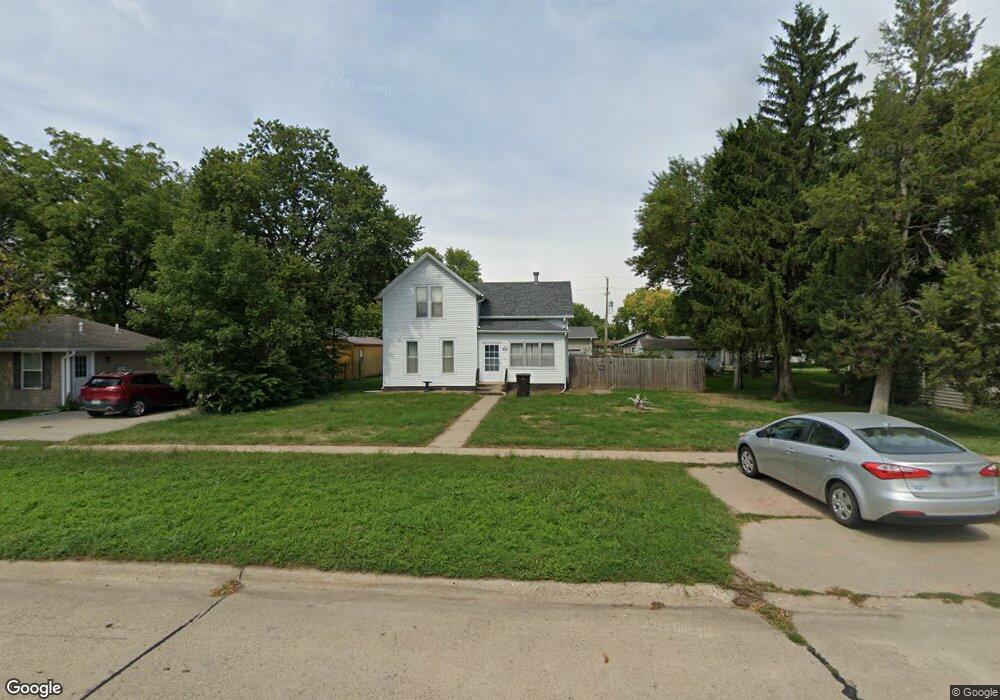
203 5th St Sergeant Bluff, IA 51054
Estimated Value: $158,000 - $307,000
3
Beds
1
Bath
1,486
Sq Ft
$151/Sq Ft
Est. Value
About This Home
This home is located at 203 5th St, Sergeant Bluff, IA 51054 and is currently estimated at $224,802, approximately $151 per square foot. 203 5th St is a home located in Woodbury County with nearby schools including Sergeant Bluff-Luton Primary School, Sergeant Bluff-Luton Elementary School, and Sergeant Bluff-Luton Middle School.
Ownership History
Date
Name
Owned For
Owner Type
Purchase Details
Closed on
Sep 25, 2013
Sold by
Peterson Steven A and Peterson Mary C
Bought by
Conyers Brandon R
Current Estimated Value
Home Financials for this Owner
Home Financials are based on the most recent Mortgage that was taken out on this home.
Original Mortgage
$84,452
Outstanding Balance
$62,996
Interest Rate
4.39%
Mortgage Type
FHA
Estimated Equity
$161,806
Create a Home Valuation Report for This Property
The Home Valuation Report is an in-depth analysis detailing your home's value as well as a comparison with similar homes in the area
Home Values in the Area
Average Home Value in this Area
Purchase History
| Date | Buyer | Sale Price | Title Company |
|---|---|---|---|
| Conyers Brandon R | $85,000 | None Available |
Source: Public Records
Mortgage History
| Date | Status | Borrower | Loan Amount |
|---|---|---|---|
| Open | Conyers Brandon R | $84,452 |
Source: Public Records
Tax History
| Year | Tax Paid | Tax Assessment Tax Assessment Total Assessment is a certain percentage of the fair market value that is determined by local assessors to be the total taxable value of land and additions on the property. | Land | Improvement |
|---|---|---|---|---|
| 2025 | $1,784 | $129,090 | $12,670 | $116,420 |
| 2024 | $17 | $125,900 | $11,310 | $114,590 |
| 2023 | $1,588 | $125,900 | $11,310 | $114,590 |
| 2022 | $1,542 | $99,260 | $11,310 | $87,950 |
| 2021 | $1,542 | $97,480 | $11,310 | $86,170 |
| 2020 | $1,466 | $91,370 | $12,100 | $79,270 |
| 2019 | $1,392 | $91,370 | $12,100 | $79,270 |
| 2018 | $1,356 | $85,830 | $12,100 | $73,730 |
| 2017 | $1,474 | $85,830 | $12,100 | $73,730 |
| 2016 | $1,498 | $85,830 | $0 | $0 |
| 2015 | $1,465 | $80,220 | $11,310 | $68,910 |
| 2014 | $1,292 | $73,330 | $11,310 | $62,020 |
Source: Public Records
Map
Nearby Homes
Your Personal Tour Guide
Ask me questions while you tour the home.