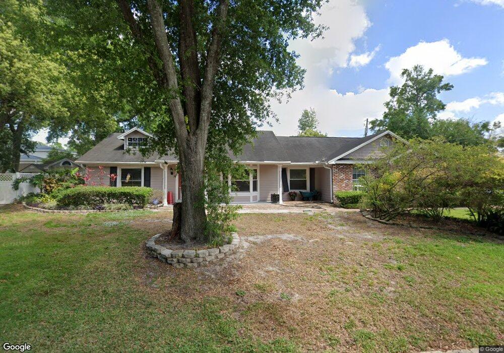
203 Adair Ave Longwood, FL 32750
Estimated Value: $515,673 - $554,000
4
Beds
4
Baths
2,204
Sq Ft
$241/Sq Ft
Est. Value
About This Home
This home is located at 203 Adair Ave, Longwood, FL 32750 and is currently estimated at $532,168, approximately $241 per square foot. 203 Adair Ave is a home located in Seminole County with nearby schools including Altamonte Elementary School, Lyman High School, and Milwee Middle School.
Ownership History
Date
Name
Owned For
Owner Type
Purchase Details
Closed on
Jul 22, 2021
Sold by
Payne Joy C and Viera Hector Miguel
Bought by
Payne Carol Joy and Viera Hector M
Current Estimated Value
Home Financials for this Owner
Home Financials are based on the most recent Mortgage that was taken out on this home.
Original Mortgage
$532,500
Outstanding Balance
$237,109
Interest Rate
7.8%
Mortgage Type
Reverse Mortgage Home Equity Conversion Mortgage
Estimated Equity
$295,059
Purchase Details
Closed on
Jul 17, 2018
Sold by
Payne Joy C
Bought by
Payne Joy C and Viera Hector Miguel
Home Financials for this Owner
Home Financials are based on the most recent Mortgage that was taken out on this home.
Original Mortgage
$80,000
Interest Rate
4.6%
Mortgage Type
New Conventional
Purchase Details
Closed on
Oct 27, 2005
Sold by
Sandland George W
Bought by
Payne Joy C
Purchase Details
Closed on
Jun 7, 2005
Sold by
Sandland George W and Henkhaus Barbara N
Bought by
Sandland George W
Home Financials for this Owner
Home Financials are based on the most recent Mortgage that was taken out on this home.
Original Mortgage
$232,000
Interest Rate
8.9%
Mortgage Type
New Conventional
Purchase Details
Closed on
Jun 1, 2005
Bought by
Payne Joy C
Home Financials for this Owner
Home Financials are based on the most recent Mortgage that was taken out on this home.
Original Mortgage
$232,000
Interest Rate
8.9%
Mortgage Type
New Conventional
Purchase Details
Closed on
Jun 19, 2003
Sold by
Sandland George W
Bought by
Sandland George W and Henkhaus Barbara N
Home Financials for this Owner
Home Financials are based on the most recent Mortgage that was taken out on this home.
Original Mortgage
$181,500
Interest Rate
7.5%
Mortgage Type
Unknown
Purchase Details
Closed on
Jun 1, 2003
Bought by
Payne Joy C
Home Financials for this Owner
Home Financials are based on the most recent Mortgage that was taken out on this home.
Original Mortgage
$181,500
Interest Rate
7.5%
Mortgage Type
Unknown
Purchase Details
Closed on
Nov 1, 1999
Bought by
Payne Joy C
Purchase Details
Closed on
May 1, 1983
Bought by
Payne Joy C
Create a Home Valuation Report for This Property
The Home Valuation Report is an in-depth analysis detailing your home's value as well as a comparison with similar homes in the area
Home Values in the Area
Average Home Value in this Area
Purchase History
| Date | Buyer | Sale Price | Title Company |
|---|---|---|---|
| Payne Carol Joy | -- | Fnc Title Services Llc | |
| Payne Carol Joy | -- | Fnc Title Services | |
| Payne Joy C | $13,022 | Attorney | |
| Payne Joy C | $310,000 | Universal Land Title Inc | |
| Sandland George W | -- | -- | |
| Payne Joy C | $100 | -- | |
| Sandland George W | -- | -- | |
| Payne Joy C | $100 | -- | |
| Payne Joy C | $100 | -- | |
| Payne Joy C | $33,000 | -- |
Source: Public Records
Mortgage History
| Date | Status | Borrower | Loan Amount |
|---|---|---|---|
| Open | Payne Carol Joy | $532,500 | |
| Closed | Payne Carol Joy | $532,500 | |
| Previous Owner | Payne Joy C | $80,000 | |
| Previous Owner | Sandland George W | $232,000 | |
| Previous Owner | Sandland George W | $181,500 |
Source: Public Records
Tax History Compared to Growth
Tax History
| Year | Tax Paid | Tax Assessment Tax Assessment Total Assessment is a certain percentage of the fair market value that is determined by local assessors to be the total taxable value of land and additions on the property. | Land | Improvement |
|---|---|---|---|---|
| 2024 | $2,634 | $209,288 | -- | -- |
| 2023 | $2,571 | $203,192 | $0 | $0 |
| 2021 | $2,431 | $191,528 | $0 | $0 |
| 2020 | $2,408 | $188,884 | $0 | $0 |
| 2019 | $4,072 | $271,661 | $0 | $0 |
| 2018 | $2,262 | $181,194 | $0 | $0 |
| 2017 | $2,244 | $177,467 | $0 | $0 |
| 2016 | $2,286 | $175,034 | $0 | $0 |
| 2015 | $2,080 | $172,609 | $0 | $0 |
| 2014 | $2,080 | $171,239 | $0 | $0 |
Source: Public Records
Map
Nearby Homes
- 334 Maple Dr
- 204 Adair Ave
- 342 Maple Dr
- 107 Palm Springs Dr
- 1200 Waverly Way
- 1501 Pearl St
- 1700 Barton St
- 101 Ardsdale Ct
- 104 Rock Lake Rd
- 480 Country Club Dr
- 112 Rock Lake Rd
- TBD Rock Lake Rd
- 0 Beach Ave
- 128 Heather Hill
- 111 Tarrytown Trail
- 1200 Adams St
- 492 S Pressview Ave
- 225 Slade Dr
- 204 Brom Bones Ln
- 1530 Arden St
- 1630 Robert St
- 1208 Roxboro Rd
- 205 Adair Ave
- 1206 Roxboro Rd
- 1210 Roxboro Rd
- 1620 Robert St
- 209 Adair Ave
- 338 Maple Dr
- 1204 Roxboro Rd
- 208 Adair Ave
- 1207 Roxboro Rd
- 1610 Robert St
- 1209 Roxboro Rd
- 1202 Roxboro Rd
- 1205 Roxboro Rd
- 211 Adair Ave
- 1214 Roxboro Rd
- 212 Adair Ave
- 1213 Roxboro Rd
- 1203 Roxboro Rd