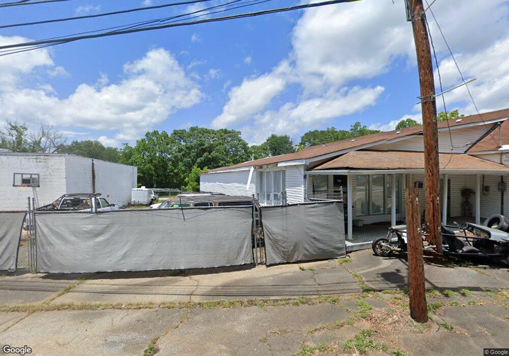
203 Anderson Dr Liberty, SC 29657
Estimated Value: $191,931
--
Bed
--
Bath
8,500
Sq Ft
$23/Sq Ft
Est. Value
About This Home
This home is located at 203 Anderson Dr, Liberty, SC 29657 and is currently estimated at $191,931, approximately $22 per square foot. 203 Anderson Dr is a home located in Pickens County with nearby schools including Liberty Primary School, Liberty Middle School, and Liberty High School.
Ownership History
Date
Name
Owned For
Owner Type
Purchase Details
Closed on
Sep 10, 2021
Sold by
Lam Mankin and Chung Jun
Bought by
Dubu Properties Llc
Current Estimated Value
Home Financials for this Owner
Home Financials are based on the most recent Mortgage that was taken out on this home.
Original Mortgage
$130,475
Outstanding Balance
$27,575
Interest Rate
2.8%
Mortgage Type
Future Advance Clause Open End Mortgage
Estimated Equity
$164,356
Purchase Details
Closed on
Apr 19, 2018
Sold by
Spearman Robert L
Bought by
Lam Mankin and Chi Jeffrey Zawchan
Create a Home Valuation Report for This Property
The Home Valuation Report is an in-depth analysis detailing your home's value as well as a comparison with similar homes in the area
Home Values in the Area
Average Home Value in this Area
Purchase History
| Date | Buyer | Sale Price | Title Company |
|---|---|---|---|
| Dubu Properties Llc | $153,500 | None Available | |
| Lam Mankin | $115,000 | None Available |
Source: Public Records
Mortgage History
| Date | Status | Borrower | Loan Amount |
|---|---|---|---|
| Open | Dubu Properties Llc | $130,475 |
Source: Public Records
Tax History Compared to Growth
Tax History
| Year | Tax Paid | Tax Assessment Tax Assessment Total Assessment is a certain percentage of the fair market value that is determined by local assessors to be the total taxable value of land and additions on the property. | Land | Improvement |
|---|---|---|---|---|
| 2024 | $2,908 | $9,220 | $2,400 | $6,820 |
| 2023 | $2,645 | $16,040 | $2,400 | $13,640 |
| 2022 | $2,592 | $16,040 | $2,400 | $13,640 |
| 2021 | $3,826 | $19,680 | $2,400 | $17,280 |
| 2020 | $3,369 | $19,680 | $2,400 | $17,280 |
| 2019 | $0 | $25,920 | $2,700 | $23,220 |
| 2018 | $3,473 | $10,920 | $2,700 | $8,220 |
| 2017 | $3,362 | $10,920 | $2,700 | $8,220 |
| 2015 | $2,879 | $10,920 | $0 | $0 |
| 2008 | -- | $9,640 | $1,800 | $7,840 |
Source: Public Records
Map
Nearby Homes
- 7 Lee St
- 9 Lee St
- 16 Lee St
- 11 Southern St
- 13 Southern St
- 17 Southern St
- 4 Hunt Ave
- 411 Anderson Dr
- 203 W Beattie St
- 7 Edgewood St
- 110 W Woodside Cir
- 108 Pineview Dr
- 00 E Main St
- 114 Bracken Ct
- 409 W Main St
- 125 Towns End Dr
- 426 N Palmetto St
- 11 Moorefield Memorial Hwy
- 10 Moorefield Memorial Hwy
- 09 Moorefield Memorial Hwy
- 207 Anderson Dr
- 207 Anderson Dr Unit A
- 207 Anderson Dr Unit B
- 208 Anderson Dr
- 204 Anderson Dr
- 00 Park Plaza
- 103 E Front St
- 200 Anderson Dr
- 215 Anderson Dr
- 300 Mills Ave
- 214 Anderson Dr
- 304 Mills Ave
- 107 E Front St
- 212 Mills Ave
- 10 Park Plaza
- 13 Lee St
- 217 Anderson Dr
- 65 Anderson Dr
- 63 Anderson Dr
- 5 E Front St