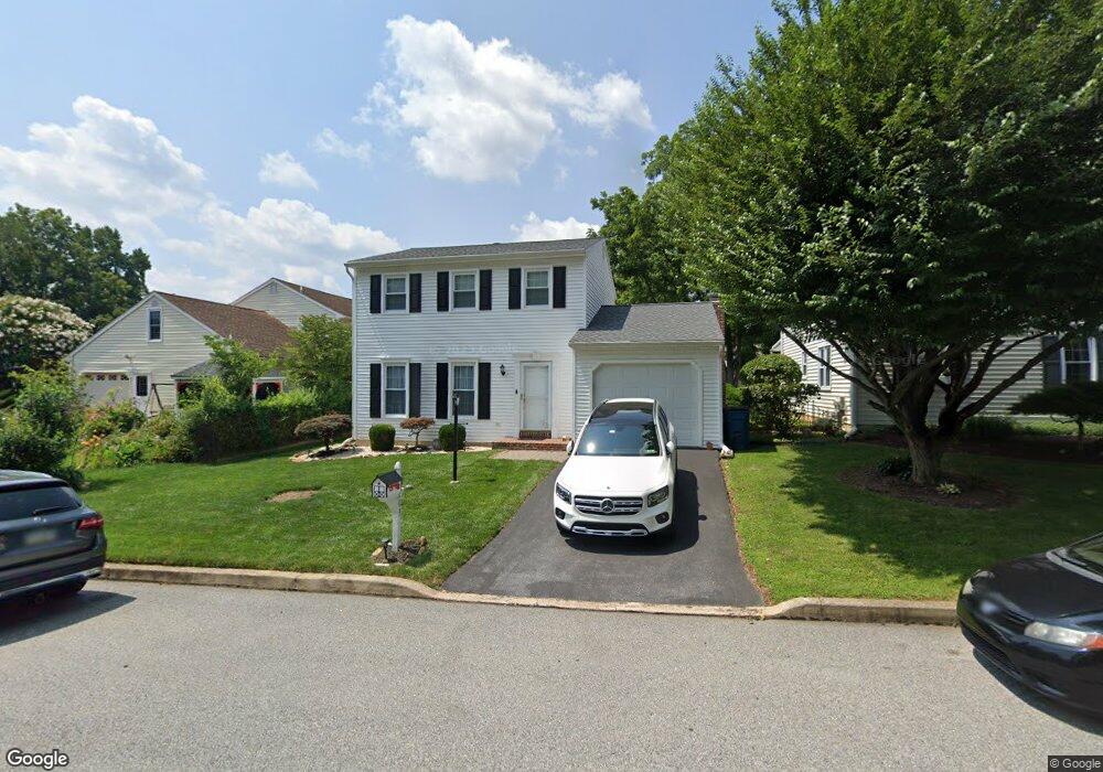
203 Armstead Ct Downingtown, PA 19335
East Caln NeighborhoodEstimated Value: $412,759 - $449,000
3
Beds
2
Baths
1,392
Sq Ft
$309/Sq Ft
Est. Value
About This Home
This home is located at 203 Armstead Ct, Downingtown, PA 19335 and is currently estimated at $430,690, approximately $309 per square foot. 203 Armstead Ct is a home located in Chester County with nearby schools including East Ward Elementary School, Lionville Middle School, and Downingtown High School East.
Ownership History
Date
Name
Owned For
Owner Type
Purchase Details
Closed on
Jan 28, 2005
Sold by
Nanni Paul J and Nanni Beth A
Bought by
Troiano Michael D and Troiano Jenna J
Current Estimated Value
Home Financials for this Owner
Home Financials are based on the most recent Mortgage that was taken out on this home.
Original Mortgage
$182,000
Outstanding Balance
$92,994
Interest Rate
5.83%
Mortgage Type
Purchase Money Mortgage
Estimated Equity
$337,696
Purchase Details
Closed on
Feb 24, 1994
Sold by
Demarsh Peter L
Bought by
Nanni Paul J and Nanni Beth A
Home Financials for this Owner
Home Financials are based on the most recent Mortgage that was taken out on this home.
Original Mortgage
$130,150
Interest Rate
6.96%
Create a Home Valuation Report for This Property
The Home Valuation Report is an in-depth analysis detailing your home's value as well as a comparison with similar homes in the area
Home Values in the Area
Average Home Value in this Area
Purchase History
| Date | Buyer | Sale Price | Title Company |
|---|---|---|---|
| Troiano Michael D | $230,000 | -- | |
| Nanni Paul J | $137,000 | -- |
Source: Public Records
Mortgage History
| Date | Status | Borrower | Loan Amount |
|---|---|---|---|
| Open | Troiano Michael D | $182,000 | |
| Previous Owner | Nanni Paul J | $130,150 |
Source: Public Records
Tax History
| Year | Tax Paid | Tax Assessment Tax Assessment Total Assessment is a certain percentage of the fair market value that is determined by local assessors to be the total taxable value of land and additions on the property. | Land | Improvement |
|---|---|---|---|---|
| 2025 | $4,681 | $132,380 | $29,360 | $103,020 |
| 2024 | $4,681 | $132,380 | $29,360 | $103,020 |
| 2023 | $4,548 | $132,380 | $29,360 | $103,020 |
| 2022 | $4,438 | $132,380 | $29,360 | $103,020 |
| 2021 | $4,366 | $132,380 | $29,360 | $103,020 |
| 2020 | $4,342 | $132,380 | $29,360 | $103,020 |
| 2019 | $4,342 | $132,380 | $29,360 | $103,020 |
| 2018 | $4,342 | $132,380 | $29,360 | $103,020 |
| 2017 | $4,342 | $132,380 | $29,360 | $103,020 |
| 2016 | $3,859 | $132,380 | $29,360 | $103,020 |
| 2015 | $3,859 | $132,380 | $29,360 | $103,020 |
| 2014 | $3,859 | $132,380 | $29,360 | $103,020 |
Source: Public Records
Map
Nearby Homes
- 1 Adams Ln
- 435 Chesterfield Dr
- 307 Kent Cir
- 419 Sunset Dr
- 149 Lake Dr
- 405 Sunset Dr
- 270 W Uwchlan Ave Unit 56
- 431 Garfield Ave
- 26 Mcilvain Dr
- 335 E Lancaster Ave Unit A-10
- 357 Jefferson Ave
- 161 Jefferson Ave
- 120 Arden Way
- 122 Brandywine Ave
- 798 Southwind Ln
- 45 W Pennsylvania Ave
- 408 Woodland Dr
- 206 Race St
- 123 W Lancaster Ave
- 137 W Lancaster Ave
- 205 Armstead Ct
- 9 Wetherburn Dr
- 7 Wetherburn Dr
- 207 Armstead Ct
- 202 Armstead Ct
- 5 Wetherburn Dr
- 204 Armstead Ct
- 11 Wetherburn Dr
- 209 Armstead Ct
- 206 Armstead Ct
- 12 Wetherburn Dr
- 14 Wetherburn Dr
- 10 Wetherburn Dr
- 3 Wetherburn Dr
- 16 Wetherburn Dr
- 8 Wetherburn Dr
- 211 Armstead Ct
- 13 Wetherburn Dr
- 208 Armstead Ct
- 18 Wetherburn Dr
Your Personal Tour Guide
Ask me questions while you tour the home.