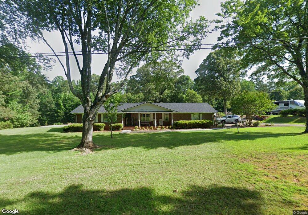
203 Austin Ave Easley, SC 29640
Estimated Value: $151,000 - $359,000
4
Beds
2
Baths
2,011
Sq Ft
$140/Sq Ft
Est. Value
About This Home
This home is located at 203 Austin Ave, Easley, SC 29640 and is currently estimated at $281,187, approximately $139 per square foot. 203 Austin Ave is a home located in Pickens County with nearby schools including East End Elementary School, Richard H. Gettys Middle School, and Easley High School.
Ownership History
Date
Name
Owned For
Owner Type
Purchase Details
Closed on
Oct 20, 2025
Sold by
Teat Elma M
Bought by
Teat Robert M and Teat Sharon B
Current Estimated Value
Purchase Details
Closed on
Oct 17, 2025
Sold by
Duncan Cathy T and Stone Beth T
Bought by
Teat Elma M
Purchase Details
Closed on
Apr 18, 2019
Sold by
Teat Elma M
Bought by
Teat Robert and Duncan Cathy T
Purchase Details
Closed on
May 11, 2017
Sold by
Teat Elma M
Bought by
Anderson Pamela A
Purchase Details
Closed on
Feb 29, 2016
Sold by
Teat Elma M
Bought by
Teat Elma M
Create a Home Valuation Report for This Property
The Home Valuation Report is an in-depth analysis detailing your home's value as well as a comparison with similar homes in the area
Home Values in the Area
Average Home Value in this Area
Purchase History
| Date | Buyer | Sale Price | Title Company |
|---|---|---|---|
| Teat Robert M | $150,000 | None Listed On Document | |
| Teat Elma M | -- | None Listed On Document | |
| Teat Robert | -- | None Available | |
| Anderson Pamela A | -- | None Available | |
| Teat Elma M | -- | None Available |
Source: Public Records
Tax History
| Year | Tax Paid | Tax Assessment Tax Assessment Total Assessment is a certain percentage of the fair market value that is determined by local assessors to be the total taxable value of land and additions on the property. | Land | Improvement |
|---|---|---|---|---|
| 2025 | $793 | $9,150 | $1,150 | $8,000 |
| 2024 | $793 | $7,960 | $1,000 | $6,960 |
| 2023 | $719 | $7,960 | $1,000 | $6,960 |
| 2022 | $722 | $7,960 | $1,000 | $6,960 |
| 2021 | $766 | $7,960 | $1,000 | $6,960 |
| 2020 | $633 | $7,960 | $1,000 | $6,960 |
| 2019 | $646 | $7,960 | $1,000 | $6,960 |
| 2018 | $583 | $7,080 | $1,000 | $6,080 |
| 2017 | $568 | $7,080 | $1,000 | $6,080 |
| 2015 | $590 | $7,080 | $0 | $0 |
| 2008 | -- | $6,330 | $960 | $5,370 |
Source: Public Records
Map
Nearby Homes
- 207 Phillips Ave
- 103 Forest Dr
- 107 S Dale Dr
- 409 Grant St
- 500 Grant St
- 101 Powell St
- 1412 Saluda Dam Rd
- 405 Hagood St
- 0 Olive St
- 129 W Compass Way
- 112 Heatherbrooke Ct
- 504 Blue Ridge St
- 109 Ashwood Ln
- 503 Laurel Rd
- 329 Prince Perry Rd
- 108 Commons Dr
- 500 Stewart Dr
- 204 Hiles St
- 205 Ashwood Ln
- 325 Lula Dr
- 109 Austin Ave
- 207 Austin Ave
- 101 Loraine Cir
- 204 Austin Ave
- 103 Loraine Cir
- 209 Austin Ave
- 103 Austin Ave
- 100 Loraine Cir
- 105 Loraine Cir
- 102 Loraine Cir
- 300 Austin Ave
- 309 Austin Ave
- 303 Austin Ave
- 101 Austin Ave
- 100 Austin Ave
- 302 Austin Ave
- 200 E Powers Dr
- 100 Lynn Cir
- 201 E Powers Dr
- 108 Powers Dr
Your Personal Tour Guide
Ask me questions while you tour the home.