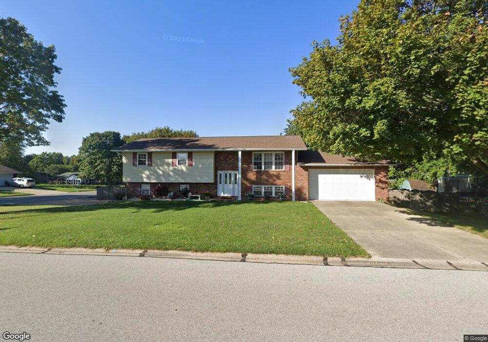
203 Bridle Ridge Rd Collinsville, IL 62234
Estimated Value: $186,752 - $231,000
3
Beds
3
Baths
1,274
Sq Ft
$171/Sq Ft
Est. Value
About This Home
This home is located at 203 Bridle Ridge Rd, Collinsville, IL 62234 and is currently estimated at $217,688, approximately $170 per square foot. 203 Bridle Ridge Rd is a home located in Madison County with nearby schools including John A Renfro Elementary School, Dorris Intermediate School, and Collinsville Middle School.
Ownership History
Date
Name
Owned For
Owner Type
Purchase Details
Closed on
Oct 15, 2013
Sold by
Weseman Jon R
Bought by
Hendel Laura M and Weseman Laura M
Current Estimated Value
Home Financials for this Owner
Home Financials are based on the most recent Mortgage that was taken out on this home.
Original Mortgage
$123,962
Interest Rate
4.62%
Mortgage Type
New Conventional
Purchase Details
Closed on
Sep 24, 2004
Sold by
Weseman Jon R
Bought by
Weseman Jon R and Weseman Laura M
Create a Home Valuation Report for This Property
The Home Valuation Report is an in-depth analysis detailing your home's value as well as a comparison with similar homes in the area
Home Values in the Area
Average Home Value in this Area
Purchase History
| Date | Buyer | Sale Price | Title Company |
|---|---|---|---|
| Hendel Laura M | -- | Nations Title Agency Of Miss | |
| Weseman Jon R | -- | -- |
Source: Public Records
Mortgage History
| Date | Status | Borrower | Loan Amount |
|---|---|---|---|
| Closed | Hendel Laura M | $123,962 |
Source: Public Records
Tax History Compared to Growth
Tax History
| Year | Tax Paid | Tax Assessment Tax Assessment Total Assessment is a certain percentage of the fair market value that is determined by local assessors to be the total taxable value of land and additions on the property. | Land | Improvement |
|---|---|---|---|---|
| 2024 | $3,646 | $63,030 | $14,650 | $48,380 |
| 2023 | $3,646 | $57,720 | $13,330 | $44,390 |
| 2022 | $3,404 | $53,380 | $12,330 | $41,050 |
| 2021 | $3,050 | $50,150 | $11,580 | $38,570 |
| 2020 | $2,921 | $47,850 | $11,050 | $36,800 |
| 2019 | $2,904 | $47,280 | $10,310 | $36,970 |
| 2018 | $2,826 | $44,790 | $9,770 | $35,020 |
| 2017 | $2,821 | $43,900 | $9,580 | $34,320 |
| 2016 | $2,962 | $43,900 | $9,580 | $34,320 |
| 2015 | $2,716 | $42,760 | $9,330 | $33,430 |
| 2014 | $2,716 | $42,760 | $9,330 | $33,430 |
| 2013 | $2,716 | $42,760 | $9,330 | $33,430 |
Source: Public Records
Map
Nearby Homes
- 414 Bunker Hill Dr
- 22 Brookwood Dr
- 0 N Keebler Ave
- 1224 Cedar Ridge Ct
- 10 White Lily Dr
- 5 Brookwood Dr
- 203 Greenfield Dr
- 1120 Williams St
- 308 Brown Ave
- 2007 Belt Line Rd
- 1210 Constance St
- 1121 Carraway Ct
- 617 N Morrison Ave
- 123 Elliot St
- 0 Strong Ave
- 123 W Wickliffe Ave
- 1059 Lafayette Ct Unit A
- 1035 Lafayette Ct Unit B
- 1051 Lafayette Ct Unit A
- 501 Spring
- 401 Chapel Dr
- 1300 Lexington Dr
- 1302 Lexington Dr
- 403 Chapel Dr
- 202 Bridle Ridge Rd
- 301 Bridle Ridge Rd
- 200 Bridle Ridge Rd
- 1304 Lexington Dr
- 216 Chapel Dr
- 405 Chapel Dr
- 303 Chapel Dr
- xx Chapel Dr
- 303 Bridle Ridge Rd
- 400 Bunker Hill Dr
- 1306 Lexington Dr
- 100 Lexington Dr
- 1303 Lexington Dr
- 302 Bridle Ridge Rd
- 407 Chapel Dr
- 112 Bridle Ridge Rd