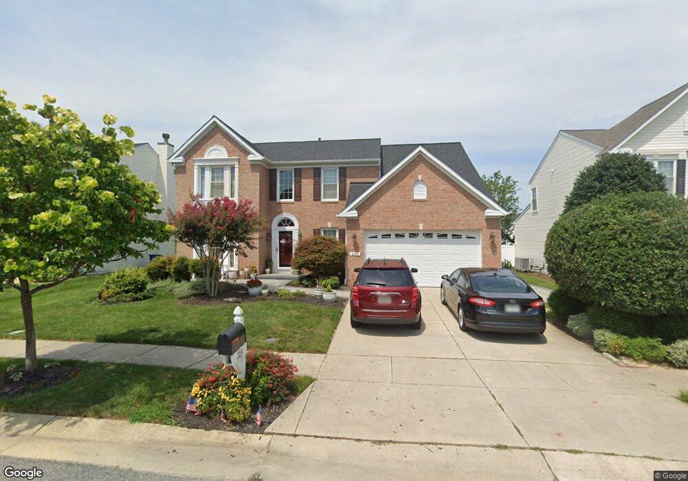
203 Creeks End Ln Stevensville, MD 21666
Estimated Value: $625,699 - $708,000
4
Beds
3
Baths
2,588
Sq Ft
$256/Sq Ft
Est. Value
About This Home
This home is located at 203 Creeks End Ln, Stevensville, MD 21666 and is currently estimated at $663,425, approximately $256 per square foot. 203 Creeks End Ln is a home located in Queen Anne's County with nearby schools including Kent Island Elementary School, Bayside Elementary School, and Matapeake Middle School.
Ownership History
Date
Name
Owned For
Owner Type
Purchase Details
Closed on
Jun 30, 2004
Sold by
Krause Todd W and Krause Kristin G
Bought by
Escherich Mark and Escherich Diane Marie
Current Estimated Value
Purchase Details
Closed on
Jan 31, 2002
Sold by
Nvr Inc
Bought by
Krause Todd W and Krause Kristin G
Purchase Details
Closed on
Nov 14, 2001
Sold by
Cox Creek Landing L C
Bought by
Nvr Inc
Create a Home Valuation Report for This Property
The Home Valuation Report is an in-depth analysis detailing your home's value as well as a comparison with similar homes in the area
Home Values in the Area
Average Home Value in this Area
Purchase History
| Date | Buyer | Sale Price | Title Company |
|---|---|---|---|
| Escherich Mark | $393,000 | -- | |
| Krause Todd W | $299,415 | -- | |
| Nvr Inc | $36,360 | -- |
Source: Public Records
Mortgage History
| Date | Status | Borrower | Loan Amount |
|---|---|---|---|
| Closed | Krause Todd W | -- |
Source: Public Records
Tax History Compared to Growth
Tax History
| Year | Tax Paid | Tax Assessment Tax Assessment Total Assessment is a certain percentage of the fair market value that is determined by local assessors to be the total taxable value of land and additions on the property. | Land | Improvement |
|---|---|---|---|---|
| 2025 | $4,938 | $524,200 | $0 | $0 |
| 2024 | $4,574 | $485,600 | $0 | $0 |
| 2023 | $4,211 | $447,000 | $165,300 | $281,700 |
| 2022 | $4,188 | $444,600 | $0 | $0 |
| 2021 | $4,218 | $442,200 | $0 | $0 |
| 2020 | $4,218 | $439,800 | $160,300 | $279,500 |
| 2019 | $4,094 | $426,867 | $0 | $0 |
| 2018 | $3,970 | $413,933 | $0 | $0 |
| 2017 | $3,846 | $401,000 | $0 | $0 |
| 2016 | -- | $397,633 | $0 | $0 |
| 2015 | $1,859 | $394,267 | $0 | $0 |
| 2014 | $1,859 | $390,900 | $0 | $0 |
Source: Public Records
Map
Nearby Homes
- 1 UNIT 2 Compass Cir
- 1839 Harbor Dr
- 1757 Harbor Dr
- 241 Jessica Lyn Ave
- 122 E Main St
- 111 Keenan Way
- 119 Keenan Way
- 1870 Harbor Dr
- 858 Moorings Cir Unit 11
- 0 Harbor Dr
- 736 Moorings Cir Unit 35
- 515 Love Point Rd
- 1906 Harbor Dr
- 349 Topside Dr
- 312 Topside Dr Unit 223
- 102 Bobbitt Ct
- 298 Moorings Cir
- 619 Love Point Rd
- 1916 Stevens Dr
- 2653 Cox Neck Rd
- 117 Creeks End Ln
- 207 Creeks End Ln
- 111 Creeks End Ln
- 319 Mainsail Dr
- 213 Creeks End Ln
- 325 Mainsail Dr
- 313 Mainsail Dr
- 518 Creeks End Ln
- 331 Mainsail Dr
- 307 Mainsail Dr
- 105 Creeks End Ln
- 219 Creeks End Ln
- 210 Creeks End Ln
- 512 Creeks End Ln
- 303 Mainsail Dr
- 216 Creeks End Ln
- 337 Mainsail Dr
- 225 Creeks End Ln
- 508 Creeks End Ln
- 346 Mainsail Dr