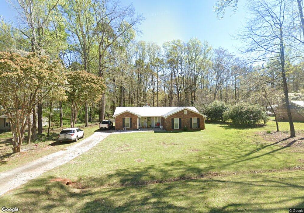
203 Cumberland Dr Lagrange, GA 30240
Estimated Value: $216,795 - $244,000
3
Beds
2
Baths
1,471
Sq Ft
$159/Sq Ft
Est. Value
About This Home
This home is located at 203 Cumberland Dr, Lagrange, GA 30240 and is currently estimated at $234,449, approximately $159 per square foot. 203 Cumberland Dr is a home located in Troup County with nearby schools including Long Cane Elementary School, Berta Weathersbee Elementary School, and Whitesville Road Elementary School.
Ownership History
Date
Name
Owned For
Owner Type
Purchase Details
Closed on
Aug 23, 2016
Sold by
Schlomer Daniel J and Schlomer Gina L
Bought by
Hopson Jessica Diane and Redden Terry Wayne
Current Estimated Value
Home Financials for this Owner
Home Financials are based on the most recent Mortgage that was taken out on this home.
Original Mortgage
$109,155
Outstanding Balance
$87,093
Interest Rate
3.48%
Mortgage Type
New Conventional
Estimated Equity
$147,356
Purchase Details
Closed on
Aug 31, 1993
Sold by
Gregory Blair Oleson
Bought by
Schlomer Daniel J and Schlomer Gina L
Purchase Details
Closed on
Jan 1, 1981
Sold by
Jack P Brown Etal
Bought by
Gregory Blair Oleson
Purchase Details
Closed on
Dec 18, 1980
Sold by
Knight Knight and Knight
Bought by
Jack P Brown Etal
Purchase Details
Closed on
Jun 26, 1977
Bought by
Knight Knight and Knight
Create a Home Valuation Report for This Property
The Home Valuation Report is an in-depth analysis detailing your home's value as well as a comparison with similar homes in the area
Home Values in the Area
Average Home Value in this Area
Purchase History
| Date | Buyer | Sale Price | Title Company |
|---|---|---|---|
| Hopson Jessica Diane | $114,900 | -- | |
| Schlomer Daniel J | $66,500 | -- | |
| Gregory Blair Oleson | $52,500 | -- | |
| Jack P Brown Etal | -- | -- | |
| Knight Knight | -- | -- |
Source: Public Records
Mortgage History
| Date | Status | Borrower | Loan Amount |
|---|---|---|---|
| Open | Hopson Jessica Diane | $109,155 |
Source: Public Records
Tax History Compared to Growth
Tax History
| Year | Tax Paid | Tax Assessment Tax Assessment Total Assessment is a certain percentage of the fair market value that is determined by local assessors to be the total taxable value of land and additions on the property. | Land | Improvement |
|---|---|---|---|---|
| 2024 | $1,860 | $68,200 | $14,000 | $54,200 |
| 2023 | $1,701 | $62,360 | $10,000 | $52,360 |
| 2022 | $1,594 | $57,120 | $8,000 | $49,120 |
| 2021 | $1,515 | $50,240 | $8,000 | $42,240 |
| 2020 | $1,515 | $50,240 | $8,000 | $42,240 |
| 2019 | $1,340 | $44,440 | $6,000 | $38,440 |
| 2018 | $1,343 | $44,520 | $6,080 | $38,440 |
| 2017 | $1,297 | $43,000 | $6,080 | $36,920 |
| 2016 | $880 | $31,157 | $6,080 | $25,077 |
| 2015 | $758 | $27,062 | $6,080 | $20,982 |
| 2014 | $726 | $25,958 | $6,080 | $19,878 |
| 2013 | -- | $27,638 | $6,080 | $21,558 |
Source: Public Records
Map
Nearby Homes
- 474 Newton Rd
- 40 River Point Dr
- 101 Ivy Springs Dr
- 119 Plymouth Dr
- 102 Franklin Place
- 108 Hidden Springs Dr
- 114 Riverbluff Dr
- 106 Landings Way
- 104 Landings Way
- 102 Landings Way
- 201 Lakeview Ct
- 135 Planters Ridge Dr
- 109 Riverbluff Dr
- 101 Riverbluff Dr
- 102 Foxdale Dr
- 266 Glass Bridge Rd
- 110 Hawthorne Cir
- 103 Hawthorne Cir
- 124 Foxdale Dr
- 0 Deming St Unit 10550189
- 201 Cumberland Dr
- 205 Cumberland Dr
- 108 Timber Ridge Dr
- 207 Cumberland Dr
- 100 Timber Ridge Dr
- 202 Cumberland Dr
- 200 Cumberland Dr
- 204 Cumberland Dr
- 110 Timber Ridge Dr
- 112 Timber Ridge Dr
- 206 Cumberland Dr
- 209 Cumberland Dr
- 442 Newton Rd
- 460 Newton Rd
- 107 Timber Ridge Dr
- 109 Timber Ridge Dr
- 105 Timber Ridge Dr
- 485 Newton Rd
- 208 Cumberland Dr
- 114 Timber Ridge Dr