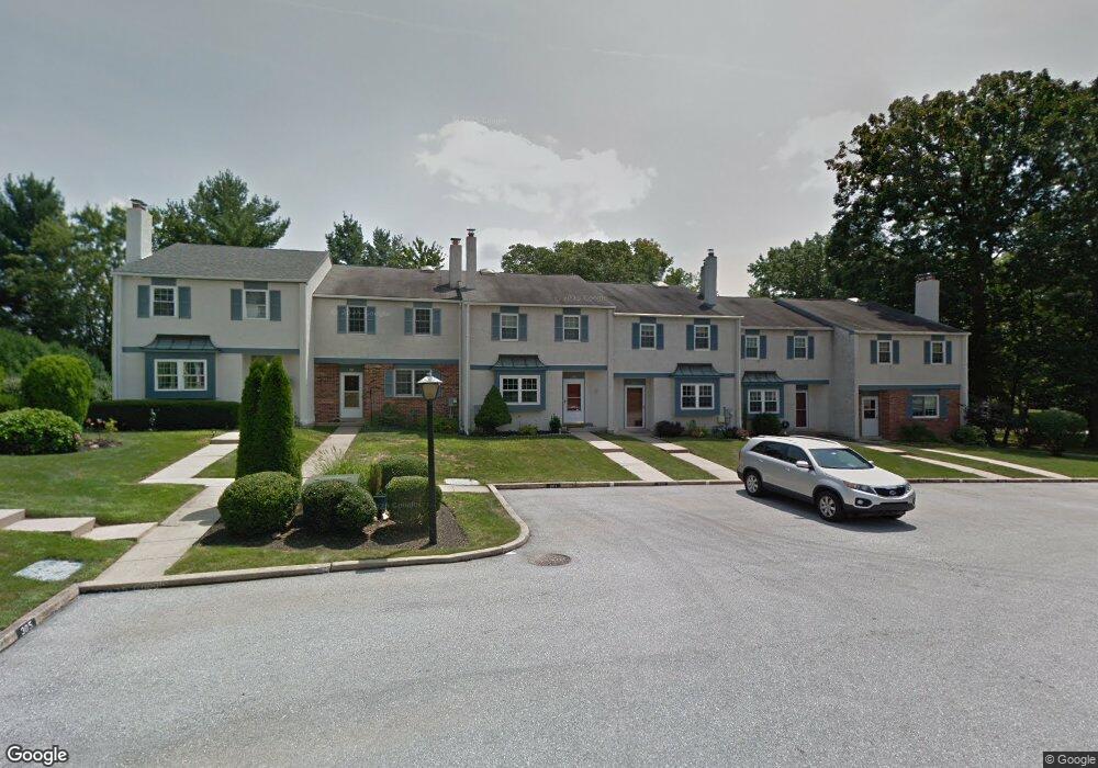
203 Debbie Ln Unit B3 Phoenixville, PA 19460
Estimated Value: $334,000 - $377,000
3
Beds
2
Baths
1,588
Sq Ft
$226/Sq Ft
Est. Value
About This Home
This home is located at 203 Debbie Ln Unit B3, Phoenixville, PA 19460 and is currently estimated at $358,291, approximately $225 per square foot. 203 Debbie Ln Unit B3 is a home located in Chester County with nearby schools including Phoenixville Area Middle School, Phoenixville Area High School, and Renaissance Academy.
Ownership History
Date
Name
Owned For
Owner Type
Purchase Details
Closed on
Sep 30, 2003
Sold by
Sullivan John and Sullivan Joan A
Bought by
Scarselle Albert C
Current Estimated Value
Home Financials for this Owner
Home Financials are based on the most recent Mortgage that was taken out on this home.
Original Mortgage
$108,800
Interest Rate
6.25%
Mortgage Type
Purchase Money Mortgage
Create a Home Valuation Report for This Property
The Home Valuation Report is an in-depth analysis detailing your home's value as well as a comparison with similar homes in the area
Home Values in the Area
Average Home Value in this Area
Purchase History
| Date | Buyer | Sale Price | Title Company |
|---|---|---|---|
| Scarselle Albert C | $136,000 | -- |
Source: Public Records
Mortgage History
| Date | Status | Borrower | Loan Amount |
|---|---|---|---|
| Closed | Scarselle Albert C | $108,800 |
Source: Public Records
Tax History Compared to Growth
Tax History
| Year | Tax Paid | Tax Assessment Tax Assessment Total Assessment is a certain percentage of the fair market value that is determined by local assessors to be the total taxable value of land and additions on the property. | Land | Improvement |
|---|---|---|---|---|
| 2025 | $3,581 | $94,890 | $21,830 | $73,060 |
| 2024 | $3,581 | $94,890 | $21,830 | $73,060 |
| 2023 | $3,544 | $94,890 | $21,830 | $73,060 |
| 2022 | $3,520 | $94,890 | $21,830 | $73,060 |
| 2021 | $3,472 | $94,890 | $21,830 | $73,060 |
| 2020 | $3,396 | $94,890 | $21,830 | $73,060 |
| 2019 | $3,331 | $94,890 | $21,830 | $73,060 |
| 2018 | $3,263 | $94,890 | $21,830 | $73,060 |
| 2017 | $3,223 | $94,890 | $21,830 | $73,060 |
| 2016 | $431 | $94,890 | $21,830 | $73,060 |
| 2015 | $431 | $94,890 | $21,830 | $73,060 |
| 2014 | $431 | $94,890 | $21,830 | $73,060 |
Source: Public Records
Map
Nearby Homes
- 2006 Diane Cir
- 1049 Mowere Rd
- 3003 Doris Ct
- 725 Reading Cir
- 1934 Revolutionary Ct Unit 94A
- 102 Elton Dr
- 3003 Spice Way
- 138 Camp Council Rd
- 2404 Northridge Ct
- 1203 Durham Ct Unit 47
- 180 Chester Ave
- 1035 Snyder Ave
- 1029 Snyder Ave
- 102 Ashley Rd
- 111 Potters Pond Dr Unit 33
- 1025 Davids Run Unit 22
- 910 Township Line Rd
- 917 Oxford Ave
- 106 Harvest Ln Unit G206
- 888 Woodlawn Ave
- 202 Debbie Ln Unit B2
- 204 Debbie Ln Unit B4
- 205 Debbie Ln Unit B5
- 201 Debbie Ln
- 206 Debbie Ln
- 305 Debbie Ln
- 304 Debbie Ln Unit O4
- 303 Debbie Ln Unit C3
- 101 Debbie Ln
- 302 Debbie Ln Unit C2
- 102 Debbie Ln
- 406 Donna Ln
- 405 Donna Ln Unit D5
- 407 Donna Ln
- 104 Debbie Ln
- 403 Donna Ln
- 402 Donna Ln Unit D2
- 105 Debbie Ln
- 401 Donna Ln Unit D1
- 106 Debbie Ln