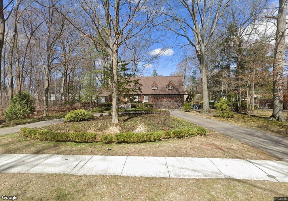
203 E Sunnybrook Dr Royal Oak, MI 48073
Estimated Value: $310,910 - $356,000
3
Beds
1
Bath
984
Sq Ft
$342/Sq Ft
Est. Value
About This Home
This home is located at 203 E Sunnybrook Dr, Royal Oak, MI 48073 and is currently estimated at $336,228, approximately $341 per square foot. 203 E Sunnybrook Dr is a home located in Oakland County with nearby schools including Oak Ridge Elementary School, Royal Oak Middle School, and Royal Oak High School.
Ownership History
Date
Name
Owned For
Owner Type
Purchase Details
Closed on
Dec 5, 2016
Sold by
Lintner Andrew and Lintner Kristen
Bought by
Bunting Lawrence and Bunting Nancy A
Current Estimated Value
Home Financials for this Owner
Home Financials are based on the most recent Mortgage that was taken out on this home.
Original Mortgage
$80,000
Outstanding Balance
$64,499
Interest Rate
3.47%
Mortgage Type
VA
Estimated Equity
$271,729
Purchase Details
Closed on
May 22, 2009
Sold by
Moloney Darren
Bought by
Lintner Andrew
Purchase Details
Closed on
Mar 25, 1998
Sold by
Popa Lidia
Bought by
Moloney Darren
Purchase Details
Closed on
Feb 23, 1995
Sold by
Hartnett William F
Bought by
Popa Lioia
Home Financials for this Owner
Home Financials are based on the most recent Mortgage that was taken out on this home.
Original Mortgage
$78,000
Interest Rate
9.13%
Mortgage Type
New Conventional
Create a Home Valuation Report for This Property
The Home Valuation Report is an in-depth analysis detailing your home's value as well as a comparison with similar homes in the area
Home Values in the Area
Average Home Value in this Area
Purchase History
| Date | Buyer | Sale Price | Title Company |
|---|---|---|---|
| Bunting Lawrence | $187,000 | Title Source Inc | |
| Lintner Andrew | $139,000 | None Available | |
| Moloney Darren | $134,000 | -- | |
| Popa Lioia | $103,000 | -- |
Source: Public Records
Mortgage History
| Date | Status | Borrower | Loan Amount |
|---|---|---|---|
| Open | Bunting Lawrence | $80,000 | |
| Previous Owner | Popa Lioia | $78,000 | |
| Closed | Moloney Darren | -- |
Source: Public Records
Tax History Compared to Growth
Tax History
| Year | Tax Paid | Tax Assessment Tax Assessment Total Assessment is a certain percentage of the fair market value that is determined by local assessors to be the total taxable value of land and additions on the property. | Land | Improvement |
|---|---|---|---|---|
| 2024 | $2,454 | $122,010 | $0 | $0 |
| 2022 | $2,900 | $110,620 | $0 | $0 |
| 2020 | $2,385 | $99,260 | $0 | $0 |
| 2018 | $2,900 | $89,340 | $0 | $0 |
| 2017 | $2,810 | $89,340 | $0 | $0 |
| 2015 | -- | $79,400 | $0 | $0 |
| 2014 | -- | $73,380 | $0 | $0 |
| 2011 | -- | $64,850 | $0 | $0 |
Source: Public Records
Map
Nearby Homes
- 3910 Bellevue Ave
- 501 E Sunnybrook Dr
- 320 W Sunnybrook Dr
- 306 Charlotte Ave
- 142 Midland Blvd
- 407 Jeffrey Ave
- 3538 Rochester Rd
- 206 E Windemere Ave
- 31 Walper Ave
- 253 Massoit St
- 625 Whitcomb Ave
- 306 W 13 Mile Rd
- 104 Charlevoix St
- 619 E Thirteen Mile Rd
- 623 E Thirteen Mile Rd
- 140 E Lawrence Ave
- 608 E Windemere Ave
- 928 Montrose Ave
- 1023 Amelia Ave
- 1108 Millard Ave
- 203 E Sunnybrook Dr
- 148 Amelia Ave
- 202 Amelia Ave
- 217 E Sunnybrook Dr
- 217 E Sunnybrook Dr
- 152 Amelia St
- 212 Amelia Ave
- 225 E Sunnybrook Dr
- 216 Amelia Ave
- 231 E Sunnybrook Dr
- 204 E Sunnybrook Dr
- 222 Amelia Ave
- 142 E Sunnybrook Dr
- 133 E Sunnybrook Dr
- 233 E Sunnybrook Dr
- 212 E Sunnybrook Dr
- 212 E Sunnybrook Dr
- 132 Amelia Ave
- 136 E Sunnybrook Dr
- 155 Amelia Ave