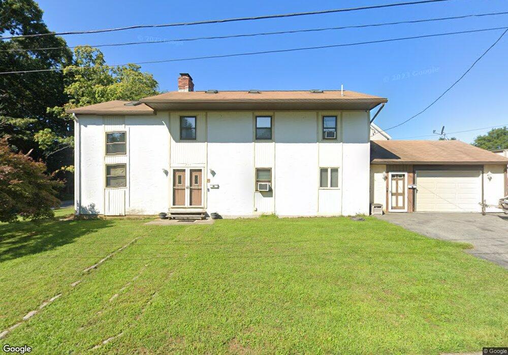
203 Earl Ave Unit 205 Riverside, RI 02915
Riverside NeighborhoodEstimated Value: $558,123 - $639,000
5
Beds
2
Baths
2,606
Sq Ft
$230/Sq Ft
Est. Value
About This Home
This home is located at 203 Earl Ave Unit 205, Riverside, RI 02915 and is currently estimated at $600,531, approximately $230 per square foot. 203 Earl Ave Unit 205 is a home located in Providence County with nearby schools including East Providence High School, St Luke Elementary School, and St Mary Academy-Bay View.
Ownership History
Date
Name
Owned For
Owner Type
Purchase Details
Closed on
Sep 21, 1994
Sold by
Ri Hospital T Nb
Bought by
King William A and King Gina
Current Estimated Value
Purchase Details
Closed on
Aug 18, 1988
Sold by
Vierra Joseph
Bought by
Miller Frank
Create a Home Valuation Report for This Property
The Home Valuation Report is an in-depth analysis detailing your home's value as well as a comparison with similar homes in the area
Home Values in the Area
Average Home Value in this Area
Purchase History
| Date | Buyer | Sale Price | Title Company |
|---|---|---|---|
| King William A | $110,000 | -- | |
| King William A | $110,000 | -- | |
| Miller Frank | $170,000 | -- | |
| Miller Frank | $170,000 | -- |
Source: Public Records
Mortgage History
| Date | Status | Borrower | Loan Amount |
|---|---|---|---|
| Open | Miller Frank | $159,120 | |
| Closed | Miller Frank | $39,000 | |
| Closed | Miller Frank | $153,146 |
Source: Public Records
Tax History Compared to Growth
Tax History
| Year | Tax Paid | Tax Assessment Tax Assessment Total Assessment is a certain percentage of the fair market value that is determined by local assessors to be the total taxable value of land and additions on the property. | Land | Improvement |
|---|---|---|---|---|
| 2025 | $8,034 | $614,700 | $111,800 | $502,900 |
| 2024 | $6,710 | $437,700 | $93,200 | $344,500 |
| 2023 | $6,460 | $437,700 | $93,200 | $344,500 |
| 2022 | $6,768 | $309,600 | $57,700 | $251,900 |
| 2021 | $6,656 | $309,600 | $57,700 | $251,900 |
| 2020 | $6,375 | $309,600 | $57,700 | $251,900 |
| 2019 | $6,198 | $309,600 | $57,700 | $251,900 |
| 2018 | $5,603 | $244,900 | $39,100 | $205,800 |
| 2017 | $5,478 | $244,900 | $39,100 | $205,800 |
| 2016 | $5,451 | $244,900 | $39,100 | $205,800 |
| 2015 | $4,888 | $213,000 | $38,700 | $174,300 |
| 2014 | $4,888 | $213,000 | $38,700 | $174,300 |
Source: Public Records
Map
Nearby Homes
- 510 Bullocks Point Ave
- 520 Bullocks Point Ave
- 200 Earl Ave
- 16 Cove St
- 502 Bullocks Point Ave
- 521 Bullocks Ave
- 151 Providence Ave
- 28 Cove St
- 15 Cove St
- 149 Providence Ave
- 502 Bullocks Point & Earl Street Ave
- 500 Bullocks Point Ave
- 535 Bullocks Point Ave
- 507 Bullocks Point Ave
- 539 Bullocks Point Ave
- 175 Providence Ave
- 145 Providence Ave
- 505 Bullocks Point Ave
- 617 Bullocks Point Ave
- 503 Bullocks Point Ave