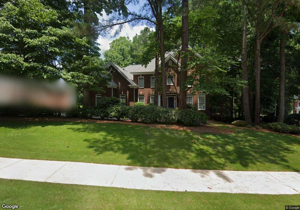
203 Farm Path Ct Unit 2A Woodstock, GA 30188
Union Hill NeighborhoodEstimated Value: $763,262 - $769,000
4
Beds
4
Baths
4,211
Sq Ft
$182/Sq Ft
Est. Value
About This Home
This home is located at 203 Farm Path Ct Unit 2A, Woodstock, GA 30188 and is currently estimated at $766,131, approximately $181 per square foot. 203 Farm Path Ct Unit 2A is a home located in Cherokee County with nearby schools including Hickory Flat Elementary School, Rusk Middle School, and Sequoyah High School.
Ownership History
Date
Name
Owned For
Owner Type
Purchase Details
Closed on
Jan 17, 2002
Sold by
Hardy Sue W
Bought by
Odum Richardson M and Odum Dawn W
Current Estimated Value
Purchase Details
Closed on
Mar 21, 1997
Sold by
Ben Nelson Contractor Inc
Bought by
Odum Richardson Dawn
Create a Home Valuation Report for This Property
The Home Valuation Report is an in-depth analysis detailing your home's value as well as a comparison with similar homes in the area
Home Values in the Area
Average Home Value in this Area
Purchase History
| Date | Buyer | Sale Price | Title Company |
|---|---|---|---|
| Odum Richardson M | -- | -- | |
| Odum Richardson Dawn | $336,500 | -- |
Source: Public Records
Mortgage History
| Date | Status | Borrower | Loan Amount |
|---|---|---|---|
| Closed | Odum Richardson Dawn | $0 |
Source: Public Records
Tax History Compared to Growth
Tax History
| Year | Tax Paid | Tax Assessment Tax Assessment Total Assessment is a certain percentage of the fair market value that is determined by local assessors to be the total taxable value of land and additions on the property. | Land | Improvement |
|---|---|---|---|---|
| 2025 | $1,729 | $301,504 | $58,000 | $243,504 |
| 2024 | $3,500 | $301,916 | $58,000 | $243,916 |
| 2023 | $3,216 | $303,808 | $58,000 | $245,808 |
| 2022 | $5,820 | $239,580 | $39,200 | $200,380 |
| 2021 | $5,452 | $202,920 | $32,000 | $170,920 |
| 2020 | $5,202 | $191,920 | $32,000 | $159,920 |
| 2019 | $5,096 | $187,360 | $30,600 | $156,760 |
| 2018 | $4,912 | $178,320 | $30,600 | $147,720 |
| 2017 | $4,771 | $426,700 | $30,600 | $140,080 |
| 2016 | $4,678 | $411,900 | $26,600 | $138,160 |
| 2015 | $4,580 | $396,600 | $26,600 | $132,040 |
| 2014 | $4,241 | $365,700 | $26,600 | $119,680 |
Source: Public Records
Map
Nearby Homes
- 1039 Avery Creek Dr
- 2065 Fairway Crossing Dr Unit IVA
- 528 Wisteria Dr
- 3015 Bradshaw Club Dr Unit 1B
- 401 Trotters Run Unit 2
- 1053 Walnut Creek Dr Unit I
- 4103 Hickory Fairway Dr
- 132 Little Brook Dr
- 802 Clubhouse Pointe
- 505 Silo View Ct
- 106 Village Ct
- 318 Heritage Overlook
- 306 Avery Creek Way
- 5020 Hickory Hills Dr
- 4592 Waters Rd
- 312 Lady Slipper Ln
- 1039 Bradshaw Estates Dr Unit 1
- 112 Glenmill Way
- 374 Heritage Overlook
- 1078 Meadow Brook Dr
- 0 Farm Path Ct Unit 7621368
- 0 Farm Path Ct
- 1024 Avery Creek Dr
- 201 Farm Path Ct
- 205 Farm Path Ct Unit 2A
- 204 Farm Path Ct Unit 2A
- 300 Farm Path Place
- 206 Farm Path Ct Unit 2A
- 1020 Avery Creek Dr
- 301 Farm Path Place Unit 2A
- 402 Farm Brook Cove Unit 2A
- 0 Avery Creek Dr Unit 8014781
- 0 Avery Creek Dr Unit 7629637
- 0 Avery Creek Dr Unit 8496518
- 0 Avery Creek Dr Unit 8028574
- 0 Avery Creek Dr Unit 8999499
- 0 Avery Creek Dr Unit 3224362
- 0 Avery Creek Dr Unit 7082816
- 0 Avery Creek Dr Unit 7185502
- 0 Avery Creek Dr Unit 7275150