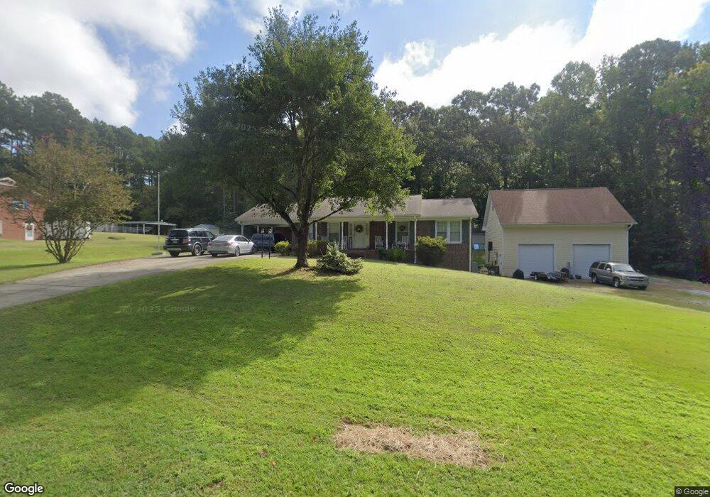
203 Hocutt Rd Durham, NC 27703
Eastern Durham NeighborhoodEstimated Value: $344,267 - $365,000
3
Beds
2
Baths
1,287
Sq Ft
$276/Sq Ft
Est. Value
About This Home
This home is located at 203 Hocutt Rd, Durham, NC 27703 and is currently estimated at $355,817, approximately $276 per square foot. 203 Hocutt Rd is a home located in Durham County with nearby schools including Oak Grove Elementary, John W Neal Middle School, and Southern School of Energy & Sustainability.
Ownership History
Date
Name
Owned For
Owner Type
Purchase Details
Closed on
Jan 23, 2004
Sold by
Turner Ronald W and Turner Tammy C
Bought by
Turner Ronald W and Turner Tammy C
Current Estimated Value
Home Financials for this Owner
Home Financials are based on the most recent Mortgage that was taken out on this home.
Original Mortgage
$110,349
Interest Rate
5.81%
Mortgage Type
FHA
Purchase Details
Closed on
Jun 30, 1999
Sold by
Frazier Edward T and Wife Carol T
Bought by
Turner Ronald W and Turner Patricia T
Home Financials for this Owner
Home Financials are based on the most recent Mortgage that was taken out on this home.
Original Mortgage
$112,450
Interest Rate
7.27%
Mortgage Type
FHA
Create a Home Valuation Report for This Property
The Home Valuation Report is an in-depth analysis detailing your home's value as well as a comparison with similar homes in the area
Home Values in the Area
Average Home Value in this Area
Purchase History
| Date | Buyer | Sale Price | Title Company |
|---|---|---|---|
| Turner Ronald W | -- | -- | |
| Turner Ronald W | -- | -- |
Source: Public Records
Mortgage History
| Date | Status | Borrower | Loan Amount |
|---|---|---|---|
| Closed | Turner Ronald W | $110,349 | |
| Closed | Turner Ronald W | $112,450 |
Source: Public Records
Tax History
| Year | Tax Paid | Tax Assessment Tax Assessment Total Assessment is a certain percentage of the fair market value that is determined by local assessors to be the total taxable value of land and additions on the property. | Land | Improvement |
|---|---|---|---|---|
| 2025 | $2,793 | $394,983 | $147,320 | $247,663 |
| 2024 | $2,205 | $210,614 | $56,531 | $154,083 |
| 2023 | $2,123 | $210,614 | $56,531 | $154,083 |
| 2022 | $2,060 | $210,614 | $56,531 | $154,083 |
| 2021 | $1,847 | $210,614 | $56,531 | $154,083 |
| 2020 | $1,805 | $210,614 | $56,531 | $154,083 |
| 2019 | $1,784 | $210,614 | $56,531 | $154,083 |
| 2018 | $1,540 | $166,810 | $35,393 | $131,417 |
| 2017 | $1,386 | $155,159 | $35,393 | $119,766 |
| 2016 | $1,343 | $155,159 | $35,393 | $119,766 |
| 2015 | $1,573 | $155,361 | $35,497 | $119,864 |
| 2014 | $1,581 | $155,361 | $35,497 | $119,864 |
Source: Public Records
Map
Nearby Homes
- 2800-2809 Napoli Dr
- 5002 Wake Forest Hwy
- 210 Stallings Rd
- 442 Gus Rd
- 208 Lick Creek Ln
- 607 Ravenstone Ln
- 107 Crosswood Dr
- 528 Plumleaf Ln
- 1056 Arbor Edge Ln
- 6 Spicewood Ct
- 13 Blackthorn Ln
- 17 Plumleaf Ln
- 1112 Blackthorn Ln
- 601 Crossing Dr
- 517 Keith St
- 1125 Arbor Edge Ln
- 110 Kindlewood Dr
- 621 Wellwater Ave
- 807 Outlaw Ave
- 1114 Blackthorn Ln
- 2800 Napoli Dr
- NAPOLI Napoli Dr
- 0 Napoli Dr
- 2802 Napoli Dr
- 113 Hocutt Rd
- 2801 Napoli Dr
- 112 Hocutt Rd
- 2804 Napoli Dr
- 2803 Napoli Dr
- 214 Hocutt Rd
- 212 Hocutt Rd
- 225 Hocutt Rd
- 2805 Napoli Dr
- 4804 Wake Forest Rd
- 2808 Napoli Dr
- 4806 Wake Forest Hwy
- 4806 Wake Forest Rd
- 4808 Wake Forest Rd
- 2809 Napoli Dr
- 218 Hocutt Rd
Your Personal Tour Guide
Ask me questions while you tour the home.