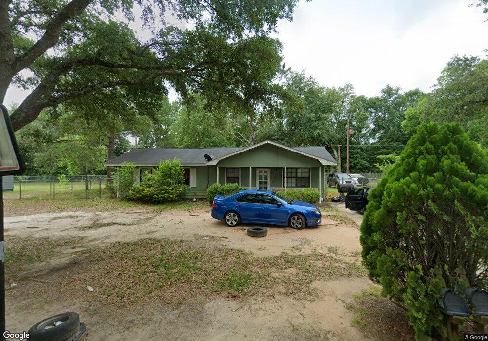
203 Independence Dr Albany, GA 31705
Estimated Value: $71,000 - $83,000
3
Beds
2
Baths
1,152
Sq Ft
$67/Sq Ft
Est. Value
About This Home
This home is located at 203 Independence Dr, Albany, GA 31705 and is currently estimated at $76,700, approximately $66 per square foot. 203 Independence Dr is a home located in Dougherty County with nearby schools including Turner Elementary School, Albany Middle School, and Radium Springs Middle School.
Ownership History
Date
Name
Owned For
Owner Type
Purchase Details
Closed on
Mar 1, 2018
Sold by
Miller Hope Patrice
Bought by
Miller Letoma Rodel
Current Estimated Value
Purchase Details
Closed on
Feb 13, 2017
Sold by
Miller Lakiesha
Bought by
Miller Hope Patrice
Purchase Details
Closed on
Oct 8, 2014
Sold by
Evans Freddrick
Bought by
Miller Lakiesha
Purchase Details
Closed on
Jan 12, 1995
Sold by
Housing & Urban Dev
Bought by
Evans Mary
Purchase Details
Closed on
Jul 5, 1994
Sold by
Williams Andrew & Virginia By Atty Fact
Bought by
Housing & Urban Dev
Purchase Details
Closed on
Sep 18, 1981
Sold by
Wiregrass Prop
Bought by
Williams Andrew
Create a Home Valuation Report for This Property
The Home Valuation Report is an in-depth analysis detailing your home's value as well as a comparison with similar homes in the area
Home Values in the Area
Average Home Value in this Area
Purchase History
| Date | Buyer | Sale Price | Title Company |
|---|---|---|---|
| Miller Letoma Rodel | -- | -- | |
| Miller Hope Patrice | -- | -- | |
| Miller Lakiesha | $5,750 | -- | |
| Evans Mary | -- | -- | |
| Housing & Urban Dev | -- | -- | |
| Williams Andrew | -- | -- |
Source: Public Records
Tax History Compared to Growth
Tax History
| Year | Tax Paid | Tax Assessment Tax Assessment Total Assessment is a certain percentage of the fair market value that is determined by local assessors to be the total taxable value of land and additions on the property. | Land | Improvement |
|---|---|---|---|---|
| 2024 | $981 | $20,560 | $2,200 | $18,360 |
| 2023 | $958 | $20,560 | $2,200 | $18,360 |
| 2022 | $961 | $20,560 | $2,200 | $18,360 |
| 2021 | $891 | $20,560 | $2,200 | $18,360 |
| 2020 | $893 | $20,560 | $2,200 | $18,360 |
| 2019 | $897 | $20,560 | $2,200 | $18,360 |
| 2018 | $0 | $20,560 | $2,200 | $18,360 |
| 2017 | $839 | $20,560 | $2,200 | $18,360 |
| 2016 | $839 | $20,560 | $2,200 | $18,360 |
| 2015 | $842 | $20,560 | $2,200 | $18,360 |
| 2014 | $831 | $20,560 | $2,200 | $18,360 |
Source: Public Records
Map
Nearby Homes
- 308 Forrestal Ln
- 2725 Yorktown Ave
- 2731 Yorktown Ave
- 148 Force Dr
- 2802 Banks Ave
- 2529 Cherokee Dr
- 2523 Cherokee Dr
- 3007 E Park Ct
- 410 Johnson Rd
- 405 Pine Bluff Rd
- 513 Johnson Rd
- 234 Cone St
- 2921 Madeline Rd
- 306 Elsom St
- 2215 E Broad Ave
- 307 Acorn St
- 309 Acorn St
- 2006 Keystone Ave
- 2004 Keystone Ave
- 119 N West Rd
- 205 Independence Dr
- 201 Independence Dr
- 202 Independence Dr
- 207 Independence Dr
- 200 Independence Dr
- 300 Enterprise Dr
- 209 Enterprise Cir
- 302 Enterprise Dr
- 2715 Sylvester Rd
- 304 Enterprise Dr
- 2711 Sylvester Rd
- 301 Enterprise Dr
- 303 Enterprise Dr
- 215 Enterprise Cir
- 211 Enterprise Cir
- 215 Enterprise Dr
- 305 Enterprise Dr
- 213 Enterprise Cir
- 213 Enterprise Dr
- 307 Enterprise Dr