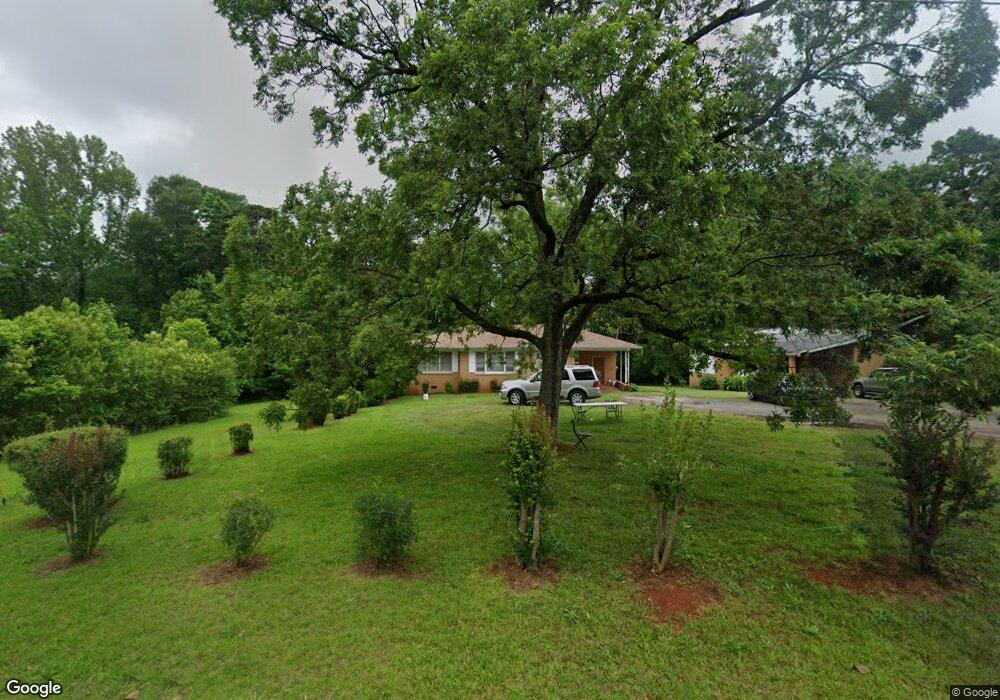
203 Johnson Ln Forsyth, GA 31029
Estimated Value: $105,000 - $266,000
--
Bed
--
Bath
1,766
Sq Ft
$97/Sq Ft
Est. Value
About This Home
This home is located at 203 Johnson Ln, Forsyth, GA 31029 and is currently estimated at $171,970, approximately $97 per square foot. 203 Johnson Ln is a home with nearby schools including Katherine B. Sutton Elementary School and Mary Persons High School.
Ownership History
Date
Name
Owned For
Owner Type
Purchase Details
Closed on
Oct 14, 2022
Sold by
Gadson Laura W
Bought by
Shri Yantra Investment Llc
Current Estimated Value
Purchase Details
Closed on
Nov 4, 2011
Sold by
Dumas Nellie Mae
Bought by
Gadson Laura W
Purchase Details
Closed on
Jul 22, 2009
Sold by
Dumas Nellie Mae Wynn
Bought by
Dumas Nellie Mae Wynn
Purchase Details
Closed on
Aug 29, 1977
Sold by
Thrash Nathaniel
Bought by
Dumas Nellie Mae Wynn
Purchase Details
Closed on
Jul 9, 1968
Sold by
Wynn Asa T
Bought by
Thrash Nellie Gray
Create a Home Valuation Report for This Property
The Home Valuation Report is an in-depth analysis detailing your home's value as well as a comparison with similar homes in the area
Home Values in the Area
Average Home Value in this Area
Purchase History
| Date | Buyer | Sale Price | Title Company |
|---|---|---|---|
| Shri Yantra Investment Llc | $105,000 | -- | |
| Gadson Laura W | -- | -- | |
| Dumas Nellie Mae Wynn | -- | -- | |
| Dumas Nellie Mae Wynn | $2,500 | -- | |
| Thrash Nellie Gray | -- | -- |
Source: Public Records
Tax History Compared to Growth
Tax History
| Year | Tax Paid | Tax Assessment Tax Assessment Total Assessment is a certain percentage of the fair market value that is determined by local assessors to be the total taxable value of land and additions on the property. | Land | Improvement |
|---|---|---|---|---|
| 2024 | $1,052 | $34,880 | $4,040 | $30,840 |
| 2023 | $908 | $29,800 | $4,040 | $25,760 |
| 2022 | $881 | $29,800 | $4,040 | $25,760 |
| 2021 | $910 | $29,800 | $4,040 | $25,760 |
| 2020 | $946 | $29,800 | $4,040 | $25,760 |
| 2019 | $952 | $29,800 | $4,040 | $25,760 |
| 2018 | $955 | $29,800 | $4,040 | $25,760 |
| 2017 | $956 | $29,800 | $4,040 | $25,760 |
| 2016 | $913 | $29,800 | $4,040 | $25,760 |
| 2015 | $870 | $29,800 | $4,040 | $25,760 |
| 2014 | $857 | $29,800 | $4,040 | $25,760 |
Source: Public Records
Map
Nearby Homes
- 4580 Capulet Ct
- 436 Magnolia Ct
- 0 Patrol Rd Unit 10473001
- Cypress Plan at Juliette Crossing
- Jackson Plan at Juliette Crossing
- Cannaberra Plan at Juliette Crossing
- Oakwood Plan at Juliette Crossing
- Delilah Plan at Juliette Crossing
- Maple Plan at Juliette Crossing
- Hawthorne Plan at Juliette Crossing
- Harrison Plan at Juliette Crossing
- Camden Plan at Juliette Crossing
- Ash II Plan at Juliette Crossing
- Belmont Plan at Juliette Crossing
- Dogwood Plan at Juliette Crossing
- Aspen Plan at Juliette Crossing
- 285 E Main St
- 0 Benson Ham Rd Unit OUTPARCEL 1 10551782
- 0 Benson Ham Rd Unit OUTPARCEL 2 10558340
- 4616 Capulet Ct
- 202 Johnson Ln
- 204 Johnson Ln
- 742 Juliette Rd
- 677 Juliette Rd
- 0 Johnson Ln Unit 3270380
- 0 Johnson Ln Unit 7091445
- 0 Beverly St Unit 7341347
- 0 Beverly St Unit M127326
- 4601 Capulet Ct Unit 323
- 4592 Capulet Ct Unit 312
- 4592 Capulet Ct
- 4580 Capulet Ct Unit 314
- 4421 Mercutio Rest Unit 351
- 4579 Capulet Ct Unit 318
- Lot 386 Tybalt Run
- 2020 Camberee Ct
- 0 Juliette Rd
- 0 Juliette Rd Unit 8031823
- 0 Juliette Rd Unit M142302
- 0 Juliette Rd Unit 8305905