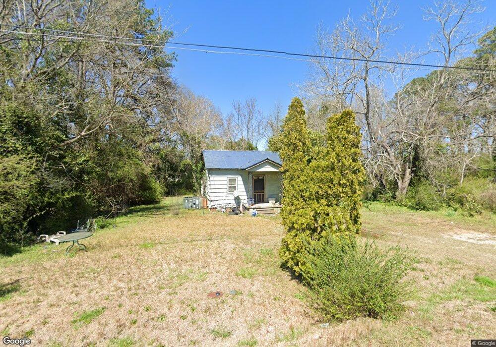
203 Marchman Dr Lagrange, GA 30241
Estimated Value: $64,248 - $134,000
2
Beds
1
Bath
1,148
Sq Ft
$88/Sq Ft
Est. Value
About This Home
This home is located at 203 Marchman Dr, Lagrange, GA 30241 and is currently estimated at $101,562, approximately $88 per square foot. 203 Marchman Dr is a home located in Troup County with nearby schools including Hollis Hand Elementary School, Franklin Forest Elementary School, and Ethel W. Kight Elementary School.
Ownership History
Date
Name
Owned For
Owner Type
Purchase Details
Closed on
Nov 18, 2004
Sold by
Cindrick Dennis
Bought by
Cindrick Dennis
Current Estimated Value
Purchase Details
Closed on
Oct 19, 2004
Sold by
Dennis Cindrick
Bought by
Cindrick Dennis
Purchase Details
Closed on
Jan 15, 2004
Sold by
Cindrick Dennis
Bought by
Dennis Cindrick
Purchase Details
Closed on
Apr 1, 1999
Sold by
Cindrick Paul
Bought by
Cindrick Dennis
Purchase Details
Closed on
May 21, 1993
Sold by
Paul Cindrics
Bought by
Cindrick Paul
Purchase Details
Closed on
Jan 1, 1954
Bought by
Paul Cindrics
Create a Home Valuation Report for This Property
The Home Valuation Report is an in-depth analysis detailing your home's value as well as a comparison with similar homes in the area
Purchase History
We collect this data history from publicly available records. To have your information removed, we recommend requesting removal directly through your county’s website.
| Date | Buyer | Sale Price | Title Company |
|---|---|---|---|
| Cindrick Dennis | -- | -- | |
| Cindrick Dennis | -- | -- | |
| Cindrick Dennis | $1,000 | -- | |
| Dennis Cindrick | -- | -- | |
| Cindrick Dennis | -- | -- | |
| Cindrick Dennis | -- | -- | |
| Cindrick Paul | -- | -- | |
| Paul Cindrics | -- | -- |
Source: Public Records
Tax History
| Year | Tax Paid | Tax Assessment Tax Assessment Total Assessment is a certain percentage of the fair market value that is determined by local assessors to be the total taxable value of land and additions on the property. | Land | Improvement |
|---|---|---|---|---|
| 2025 | $295 | $13,936 | $2,480 | $11,456 |
| 2024 | $237 | $10,696 | $2,480 | $8,216 |
| 2023 | $2 | $11,296 | $2,480 | $8,816 |
| 2022 | $246 | $10,816 | $2,480 | $8,336 |
| 2021 | $266 | $10,804 | $2,480 | $8,324 |
| 2020 | $224 | $9,404 | $2,480 | $6,924 |
| 2019 | $258 | $10,552 | $2,480 | $8,072 |
| 2018 | $237 | $9,848 | $2,496 | $7,352 |
| 2017 | $237 | $9,848 | $2,496 | $7,352 |
| 2016 | $237 | $9,840 | $2,496 | $7,344 |
| 2015 | $238 | $9,840 | $2,496 | $7,344 |
| 2014 | $226 | $9,453 | $2,496 | $6,957 |
| 2013 | -- | $15,138 | $2,496 | $12,642 |
Source: Public Records
Map
Nearby Homes
- 202 Millwood Ct
- 100 Dove Creek Ct
- 113 Pine Cir
- 302 Glenhaven Dr
- 503 Headwater Ct
- 507 Headwater Ct Unit 6
- 502 Headwater Ct
- 109 Shenandoah Ln
- 111 Shenandoah Ln
- 129 Mallory Dr
- 106 Shenandoah Ln Unit 26E
- 106 Shenandoah Ln
- 113 Shenandoah Ln
- 120 Mallory Dr
- 115 Shenandoah Ln
- 114 Shenandoah Ln
- 202 Freshwater Ct
- 204 Freshwater Ct
- 206 Freshwater Ct
- 402 Sweetwood Ct Unit LOT 2
- 204 Harmon Rd
- 207 Marchman Dr
- 204 Marchman Dr
- 200 Johnston St
- 109 Harmon Rd
- 208 Marchman Dr
- 105 Marchman Dr
- 300 Harmon Rd
- 107 Harmon Rd
- 106 Riley Rd
- 380 S Davis Rd
- 301 Harmon Rd
- 105 Harmon Rd
- 104 Riley Rd
- 1423 Lafayette Pkwy
- 203 Johnston St
- 201 Johnston St
- 103 Marchman Dr
- 1495 Lafayette Pkwy
- 105 Riley Rd
Your Personal Tour Guide
Ask me questions while you tour the home.