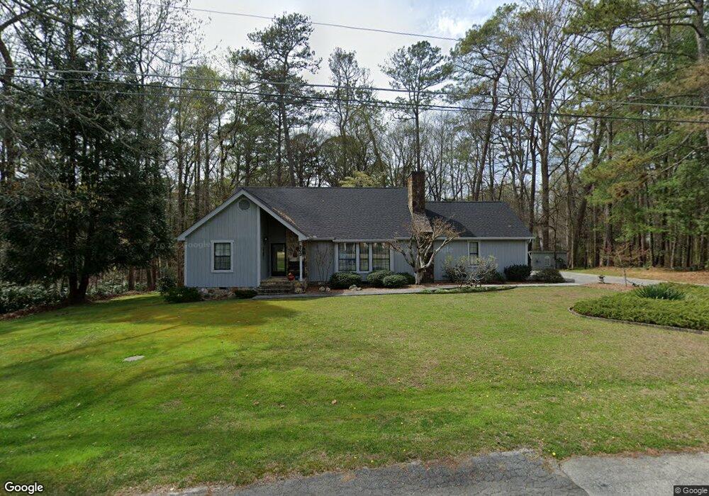
203 Meadowbrook Ln La Fayette, GA 30728
Estimated Value: $264,000 - $315,000
--
Bed
2
Baths
1,667
Sq Ft
$168/Sq Ft
Est. Value
About This Home
This home is located at 203 Meadowbrook Ln, La Fayette, GA 30728 and is currently estimated at $280,158, approximately $168 per square foot. 203 Meadowbrook Ln is a home located in Walker County with nearby schools including North Lafayette Elementary School, Lafayette Middle School, and Lafayette High School.
Ownership History
Date
Name
Owned For
Owner Type
Purchase Details
Closed on
Jul 24, 1986
Sold by
Loughridge Loughridge B and Loughridge
Bought by
King Joseph W and King Paula M
Current Estimated Value
Purchase Details
Closed on
Sep 19, 1983
Sold by
Loughridge W B
Bought by
King Joseph W and King Paula
Purchase Details
Closed on
Apr 7, 1983
Sold by
Loughridge W B
Bought by
King Jospeh W and King Paula
Purchase Details
Closed on
Jan 1, 1972
Bought by
Loughridge W B
Create a Home Valuation Report for This Property
The Home Valuation Report is an in-depth analysis detailing your home's value as well as a comparison with similar homes in the area
Home Values in the Area
Average Home Value in this Area
Purchase History
| Date | Buyer | Sale Price | Title Company |
|---|---|---|---|
| King Joseph W | $4,800 | -- | |
| King Joseph W | $4,800 | -- | |
| King Jospeh W | $4,800 | -- | |
| Loughridge W B | -- | -- |
Source: Public Records
Tax History Compared to Growth
Tax History
| Year | Tax Paid | Tax Assessment Tax Assessment Total Assessment is a certain percentage of the fair market value that is determined by local assessors to be the total taxable value of land and additions on the property. | Land | Improvement |
|---|---|---|---|---|
| 2024 | $183 | $105,448 | $21,582 | $83,866 |
| 2023 | $831 | $101,315 | $21,582 | $79,733 |
| 2022 | $504 | $90,731 | $21,582 | $69,149 |
| 2021 | $249 | $74,291 | $21,582 | $52,709 |
| 2020 | $70 | $64,048 | $21,582 | $42,466 |
| 2019 | $70 | $64,048 | $21,582 | $42,466 |
| 2018 | $1,906 | $64,048 | $21,582 | $42,466 |
| 2017 | $1,905 | $64,048 | $21,582 | $42,466 |
| 2016 | $67 | $64,048 | $21,582 | $42,466 |
| 2015 | $1,019 | $68,533 | $21,969 | $46,564 |
| 2014 | $1,493 | $55,764 | $9,200 | $46,564 |
| 2013 | -- | $55,764 | $9,200 | $46,564 |
Source: Public Records
Map
Nearby Homes
- 302 Brookwood Ln
- 7552 Us Highway 27
- 0 Georgia 136
- 21058 Georgia 193
- 0 Farris St Unit 1512317
- 0 Farris St
- 15.56 ACRES Round Pond Rd
- 214 East Ave
- 35 Sunset Dr
- 0 Center St Unit 15 11492953
- 0 Center St Unit 16 11493665
- 0 Center St Unit 1517720
- 307 Park St
- 806 N Main St
- 1 Alpine Dr
- 113 Ann St
- 5 Alpine Dr
- 114 Mallard Ln
- 406 Truman St
- 1001 N Main St
- 204 Meadowbrook Ln
- 206 Meadowbrook Ln
- 101 Meadowbrook Ln
- 301 Oakland Dr
- 0 Meadowbrook Ln
- 403 Brookwood Ln
- 104 Meadowbrook Ln
- 400 Woodlawn Dr
- 208 Meadowbrook Ln
- 405 Brookwood Ln
- 303 Oakland Dr
- 0 Oakland Dr Unit 8014837
- 406 Brookwood Ln
- 210 Meadowbrook Ln
- 402 Oakland Dr
- 406 Warthen St
- 304 Woodland Dr
- 303 Woodland Dr
- 94 Meadowbrook Ln
- 404 Brookwood Ln