Estimated Value: $155,000 - $196,000
--
Bed
--
Bath
3,765
Sq Ft
$46/Sq Ft
Est. Value
About This Home
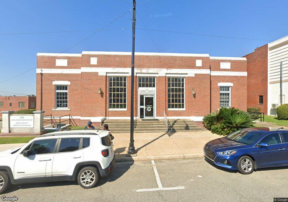
This home is located at 203 N Broad St, Cairo, GA 39828 and is currently estimated at $173,649, approximately $46 per square foot. 203 N Broad St is a home with nearby schools including Cairo High School.
Ownership History
Date
Name
Owned For
Owner Type
Purchase Details
Closed on
Sep 21, 2011
Sold by
Vanlands Llc
Bought by
Grady County Board Of Education
Current Estimated Value
Purchase Details
Closed on
Mar 31, 2011
Sold by
Farmers & Merchants Bank
Bought by
Vanlands Llc
Purchase Details
Closed on
Oct 22, 2010
Sold by
Rocuant Raymond
Bought by
Farmers & Merchants Bank
Purchase Details
Closed on
May 8, 2007
Sold by
Godwin Investments Llc
Bought by
Rocuant Raymond
Purchase Details
Closed on
May 1, 2006
Sold by
Bradwin Investments Inc
Bought by
Godwin Investments Llc
Purchase Details
Closed on
Apr 1, 2004
Sold by
Grady County Board Of
Bought by
Bradwin Investments Inc
Purchase Details
Closed on
May 15, 2000
Sold by
United States Of Am
Bought by
Grady County Board Of
Purchase Details
Closed on
Nov 5, 1934
Bought by
United States Of Am
Create a Home Valuation Report for This Property
The Home Valuation Report is an in-depth analysis detailing your home's value as well as a comparison with similar homes in the area
Home Values in the Area
Average Home Value in this Area
Purchase History
| Date | Buyer | Sale Price | Title Company |
|---|---|---|---|
| Grady County Board Of Education | -- | -- | |
| Vanlands Llc | $60,000 | -- | |
| Farmers & Merchants Bank | -- | -- | |
| Rocuant Raymond | $290,000 | -- | |
| Godwin Investments Llc | $241,000 | -- | |
| Bradwin Investments Inc | -- | -- | |
| Grady County Board Of | $58,000 | -- | |
| United States Of Am | -- | -- |
Source: Public Records
Tax History Compared to Growth
Tax History
| Year | Tax Paid | Tax Assessment Tax Assessment Total Assessment is a certain percentage of the fair market value that is determined by local assessors to be the total taxable value of land and additions on the property. | Land | Improvement |
|---|---|---|---|---|
| 2024 | -- | $59,302 | $19,466 | $39,836 |
| 2023 | $0 | $100,568 | $19,400 | $81,168 |
| 2022 | $3,603 | $100,568 | $19,400 | $81,168 |
| 2021 | $3,603 | $100,568 | $19,400 | $81,168 |
| 2020 | $3,603 | $100,568 | $19,400 | $81,168 |
| 2019 | $3,603 | $100,568 | $19,400 | $81,168 |
| 2018 | $3,603 | $100,568 | $19,400 | $81,168 |
| 2017 | $0 | $100,568 | $19,400 | $81,168 |
| 2016 | -- | $100,568 | $19,400 | $81,168 |
| 2015 | -- | $100,568 | $19,400 | $81,168 |
| 2014 | -- | $100,568 | $19,400 | $81,168 |
| 2013 | -- | $100,568 | $19,400 | $81,168 |
Source: Public Records
Map
Nearby Homes
- 4761 Hadley Ferry Rd
- X 1st St
- 00 Hwy 111 South Tract 1
- 316,322 NW 1st St + Lot
- 0 1st St
- 125 6th Ave NW
- 00 00 Hwy 111 South Tract 2
- Lot #15, 3 64 Acres Oakbend Cir
- 309 3rd St SE
- 220 8th Ave NW
- 2975 U S 84
- 000 Hwy 111 South 20 59 Acres
- 000 S Broad St
- 117 6th St SW
- 40 5th Ave SW
- 711 2nd Ave NE
- 471 4th St SE
- 481 4th St SE
- 460 2nd St SW
- 27 6th Ave SW
- 1234 N Not A Street Bend NE
- 8.98 Ac. Holton Ln
- MEADOWBR Meadow Brook Dr
- 305 N Broad St
- 112 N Broad St
- 17 1st Ave NE
- 26 3rd Ave NW
- 00 1st Ave NE
- 2 N Broad St
- 22 1st Ave NE
- 101 3rd Ave NW
- 316 1st St NW
- 4 S Broad St
- 100 3rd Ave NW
- 321 Bell Alley
- 17 4th Ave NW
- N Georgia 111
- 114 3rd Ave NW
- 206 1st St NE
- 35 4th Ave NW